Shoreacres near La Porte in Harris County, Texas — The American South (West South Central)
Site of Surrender of Santa Anna
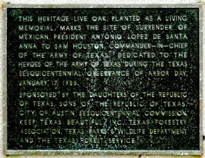
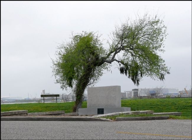
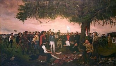
This heritage live oak, planted as a living memorial, marks the site of surrender of Mexican President Antonio Lopez de Santa Anna to Sam Houston, Commander-in-Chief of the Army of Texas. Dedicated to the heroes of the Army of Texas during the Texas Sesquicentennial observance of Arbor Day, January 17, 1986.
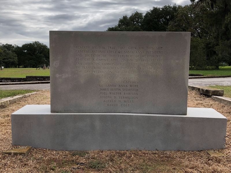
Text on Rear of Marker:
Beneath an oak tree that grew on this site General Antonio Lopez de Santa Anna President and Dictator of the Republic of Mexico was brought a captive April 22, 1836 before General Sam Houston Commander-in-Chief of the Army of Texas who had been painfully wounded on the day previous in the Battle of San Jacinto
James Austin Sylvester
Joel Walter Robison
Joseph D. Vermillion
Alfred H. Miles
David Cole
Erected 1986 by Daughters of the Republic of Texas, Sons of the Republic of Texas, City of Austin Sesquicentennial Commission, Keep Texas Beautiful, Inc., Texas Forestry Association, Texas Parks & Wildlife Department, and the Texas Forest Service. (Marker Number 20.)
Topics. This historical marker is listed in this topic list: War, Texas Independence. A significant historical date for this entry is April 22, 1836.
Location. 29° 45.214′ N, 95° 5.453′ W. Marker is near La Porte, Texas, in Harris County. It is in Shoreacres. Marker is located within the San Jacinto Battleground State Historic Site. Touch for map. Marker is at or near this postal address: 3523 Independence Parkway, La Porte TX 77571, United States of America. Touch for directions.
Other nearby markers. At least 8 other markers are within walking distance of this marker. Burleson's Camp (within shouting distance of this marker); San Jacinto Battleground Park (within shouting distance of this marker); Millard's Camp (about 300 feet away, measured in a direct line); Roster Company No. 6 (about 300 feet away); Twin Sisters (about 300 feet away); Persons Known to Have Been Buried in De Zavala Cemetery (about 300 feet away); De Zavala Plaza (about 300 feet away); David Thomas (about 300 feet away). Touch for a list and map of all markers in La Porte.
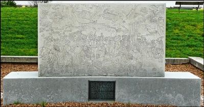
More about this marker. In 1912, the San Jacinto Chapter of the Daughters of the Republic of Texas placed a series of 20 stone markers to commemorate key points on the battlefield. Marker #20 was originally placed at this site. It was later removed to make room for the current monument. As a result, the San Jacinto Battleground State Historic Site considers the current monument to be the 20th marker in the battlefield series and lists it as such on the official park map.
Regarding Site of Surrender of Santa Anna. The surrender of Santa Anna signified the successful end of Texas' fight for independence from Mexico. This surrender is a major event to Texans -- probably the major turning point in Texas history.
Also see . . .
1. Surrender of Santa Anna. Texas State Library & Archives Commission (Submitted on March 14, 2012, by Jim Evans of Houston, Texas.)
2. Santa Anna, Antonio Lopez de - The Handbook of Texas Online. Texas State Historical Association (TSHA) (Submitted on November 7, 2018, by Brian Anderson of Humble, Texas.)
3. San Jacinto, Battle of - The Handbook of Texas Online. Texas State Historical Association (TSHA) (Submitted on November 7, 2018, by Brian Anderson of Humble, Texas.)
Credits. This page was last revised on February 1, 2023. It was originally submitted on March 14, 2012, by Jim Evans of Houston, Texas. This page has been viewed 4,135 times since then and 395 times this year. Last updated on November 7, 2018, by Brian Anderson of Humble, Texas. Photos: 1. submitted on March 14, 2012, by Jim Evans of Houston, Texas. 2. submitted on November 7, 2018, by Brian Anderson of Humble, Texas. 3, 4. submitted on March 14, 2012, by Jim Evans of Houston, Texas. 5. submitted on March 30, 2016, by J. Makali Bruton of Accra, Ghana. • Andrew Ruppenstein was the editor who published this page.
