Thira in Santorini, The Aegean, Greece — Ελλάδα (Southeastern Europe, Balkan Peninsula)
Catholic Church of Koimisi Tis Theotokou
(The Dormition of the Virgin Mary)
| — | or Panagia of Agion Theodoron | — |
Photographed by Barry Swackhamer, July 13, 2018
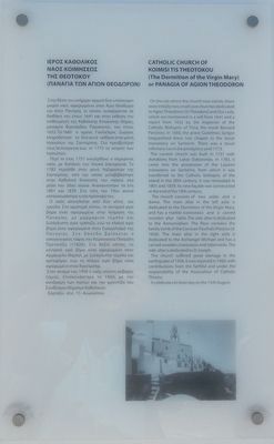
1. Catholic Church of Koimisi Tis Theotokou Marker
Greek text on the left.
The current church was built in 1757 with donations from Lukas Dakoronias. In 1783, it came into the possession of the Lazarist monastery on Santorini, from which it was transferred to the Catholic bishopric of the island in the 20th century. It was renovated in 1801 and 1839. Its new façade was constructed at the end of the 19th century.
The church consists of two aisles and a dome. The main altar in the left aisle is dedicated to the Dormition of the Virgin Mary, and has a marble iconostasis and a carved wooden altar table. The side-altar is dedicated to the Annunciation. the floor contains the family tomb of the Corsican Paschalis Presiosi (d. 1826). The main altar in the right aisle is dedicated to the Archangel Michael and has a carved wooden iconostasis and tabernacle. The side-altar is dedicated to St. Joseph.
The church suffered great damage in the earthquake of 1956. It was repaired in 1960, with contributions from the faithful and under the responsibility of the Association of Catholic Thirans.
It celebrates its feast day on the 15th August.
Topics. This historical marker is listed in this topic list: Religion & Religious Structures.
Location. 36° 25.398′ N, 25° 25.694′ E. Marker is in Thira, The Aegean, in Santorini. It is on Nomikou M, on the right when traveling south. Touch for map. Marker
this page online

Regionally, it is in Europe, the European Union, the Schengen Area, a coastal Mediterranean country, and the Western World. Historically, it finds itself in what was once the Byzantine Empire, the Ottoman Empire, and specifically the Roman Empire.
Other nearby markers. At least 2 other markers are within walking distance of this marker: Catholic Church of Saint Stylianos (approx. 0.3 kilometers away); Santorini Cable Car (approx. 0.4 kilometers away).
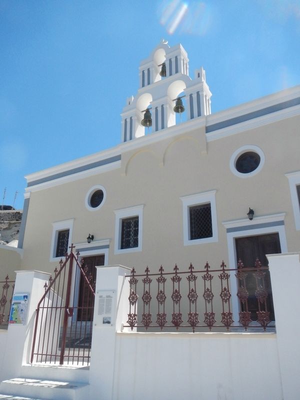
More about this marker. The Catholic Church of Koimisi Tis Theotokou (aka the Virgin Mary Catholic Church or Three Bells of Fira) is located on the footpath which parallels the cliff forming the caldera of Santorini.
Photographed by Barry Swackhamer, July 13, 2018
2. Catholic Church of Koimisi Tis Theotokou and Marker

Photographed by Barry Swackhamer, July 13, 2018
3. Catholic Church of Koimisi Tis Theotokou
Photographed by Barry Swackhamer, July 13, 2018
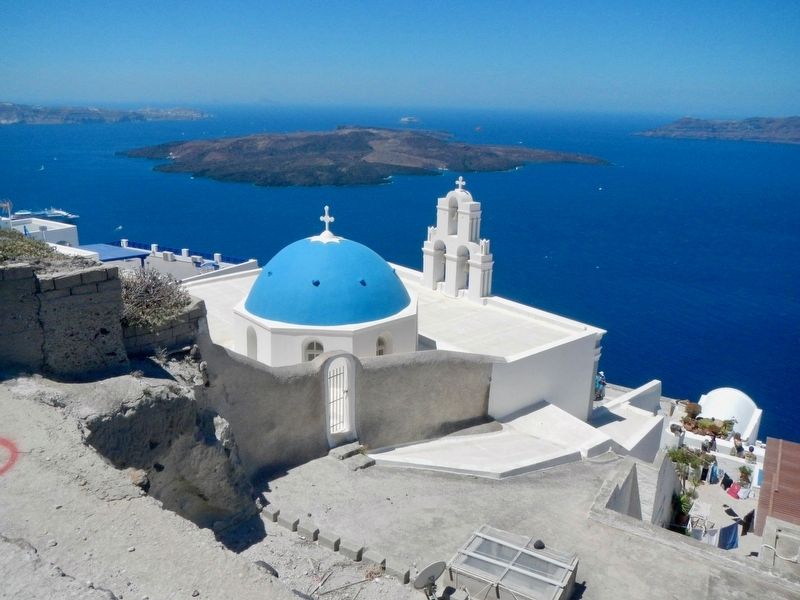
4. Catholic Church of Koimisi Tis Theotokou Marker
Note the famous blue domes of Santorini.
Credits. This page was last revised on June 28, 2023. It was originally submitted on November 8, 2018, by Barry Swackhamer of Brentwood, California. This page has been viewed 587 times since then and 57 times this year. Photos: 1, 2, 3, 4. submitted on November 8, 2018, by Barry Swackhamer of Brentwood, California.
