Sutter Creek in Amador County, California — The American West (Pacific Coastal)
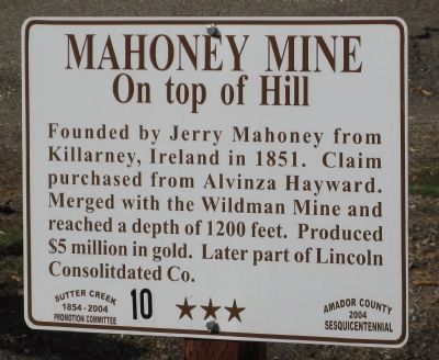
Mahoney Mine
On top of the Hill
Founded by Jerry Mahoney from Killarney, Ireland in 1851. Claim purchased from Alvinza Hayward. Merged with the Wildman Mine and reached a depth of 1200 feet. Produced $5 million in gold. Later part of Lincoln Consolidated Co.
Erected 2004 by Amador County 2004 Sesquicentennial, Sutter Creek 1854 – 2004 Promotion Committee.
Topics. This historical marker is listed in these topic lists: Industry & Commerce • Natural Resources • Notable Events • Notable Places • Settlements & Settlers. A significant historical year for this entry is 1851.
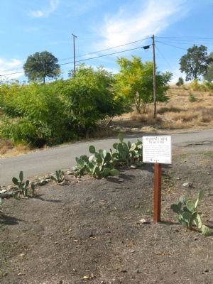
Location. 38° 23.755′ N, 120° 48.156′ W. Marker is in Sutter Creek, California, in Amador County. Marker can be reached from Gopher Flat Road. Marker is located at the north end of the parking lot on Gopher Hill Road next to the Wildman Mine Powder House. Touch for map. Marker is in this post office area: Sutter Creek CA 95685, United States of America. Touch for directions.
Other nearby markers. At least 8 other markers are within walking distance of this marker. Wildman Mine (here, next to this marker); Leland Stanford, Sr. (within shouting distance of this marker); 134 Broad Street (within shouting distance of this marker); Sutter Creek Jail (about 300 feet away, measured in a direct line); C. Soracco Company (about 600 feet away); Sutter Creek Grammar School (about 600 feet away); J. Monteverde General Store Museum (about 600 feet away); Sutter Creek Sanitarium (about 700 feet away). Touch for a list and map of all markers in Sutter Creek.
Regarding Mahoney Mine. Also see: Wildman Mine and Emerson Shaft markers for additional information.
Additional keywords. Gold Rush
Credits. This page was last revised on November 22, 2023. It was originally submitted on October 17, 2008, by Syd Whittle of Mesa, Arizona. This page has been viewed 2,087 times since then and 20 times this year. Photos: 1, 2. submitted on October 17, 2008, by Syd Whittle of Mesa, Arizona.

