Tynemouth in Tyne and Wear, England, United Kingdom — Northwestern Europe (the British Isles)
The Shrine Area
| — | Tynemouth Priory and Castle | — |
Photographed by Michael Herrick, August 19, 2018
1. The Shrine Area Marker
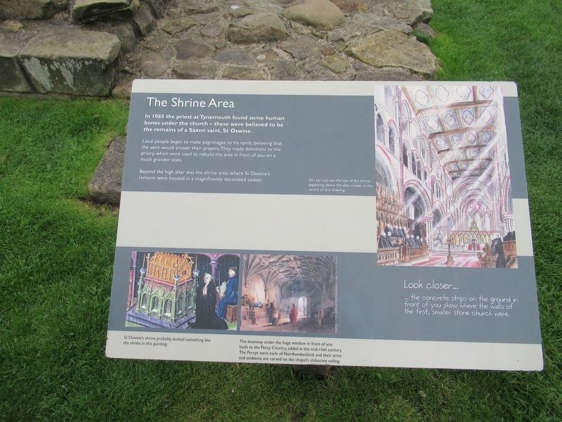
The Shrine Area
In 1065 the priest at Tynemouth found some human bones under the church – these were believed to be the remains of a Saxon saint, St Oswine.
Local people began to make pilgrimages to his tomb, believing that the saint would answer their prayers. They made donations to the priory, which were used to rebuild the area in front of you much grander scale.
Beyond the high altar was the shrine area, where St Oswine’s remains were housed in a magnificently decorated casket.
Look closer ...
the concrete strips on the ground in front of you show where the walls of the first, smaller stone church were.
( photo captions )
You can just see the top of the shrine appearing above the altar screen in the centre of this drawing.
St. Oswine’s shrine probably looked something like the shrine in this painting.
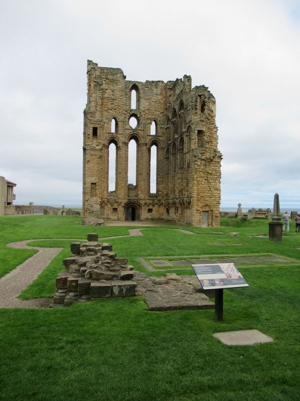
The doorway under the huge window in front of you leads to the Percy Chantry, added in the mid-15th century. The Percys were earls of Northumberland, and their arms and emblems are carved on the chapel's elaborate ceiling.
Topics. This historical marker is listed in these topic lists:
this page online
Location. 55° 1.067′ N, 1° 25.069′ W. Marker is in Tynemouth, England, in Tyne and Wear. It can be reached from the intersection of Front Street and Pier Road, on the right when traveling east. Located at Tynemouth Priory and Castle. Touch for map. Marker is in this post office area: Tynemouth, England NE30 4BZ, United Kingdom. Touch for directions.

Regionally, this marker is in North East England. Globally, it is on the Atlantic Ocean, in the North Atlantic Region, in Europe, in Atlantic Europe, on one of the British Isles, in the Western World, and in the Anglosphere. Historically, it finds itself in what was once the Roman Empire.
Other nearby markers. At least 8 other markers are within walking distance of this marker: The Cloister (a few steps from this marker); Lost Buildings (a few steps from this marker); The Priory Church (within shouting distance of this marker); Site of Tynemouth Lighthouse (within shouting distance of this marker); Stone Detectives (within shouting distance of this marker); The Gatehouse
Photographed by Michael Herrick, August 19, 2018
2. The Shrine Area Marker
Also see . . . Tynemouth Priory and Castle on Wikipedia. (Submitted on November 10, 2018, by Michael Herrick of Southbury, Connecticut.)
Credits. This page was last revised on May 26, 2022. It was originally submitted on November 10, 2018, by Michael Herrick of Southbury, Connecticut. This page has been viewed 228 times since then and 8 times this year. Photos: 1, 2. submitted on November 10, 2018, by Michael Herrick of Southbury, Connecticut.
