Tynemouth in Tyne and Wear, England, United Kingdom — Northwestern Europe (the British Isles)
Lost Buildings
Photographed by Michael Herrick, August 19, 2018
1. Lost Buildings Marker
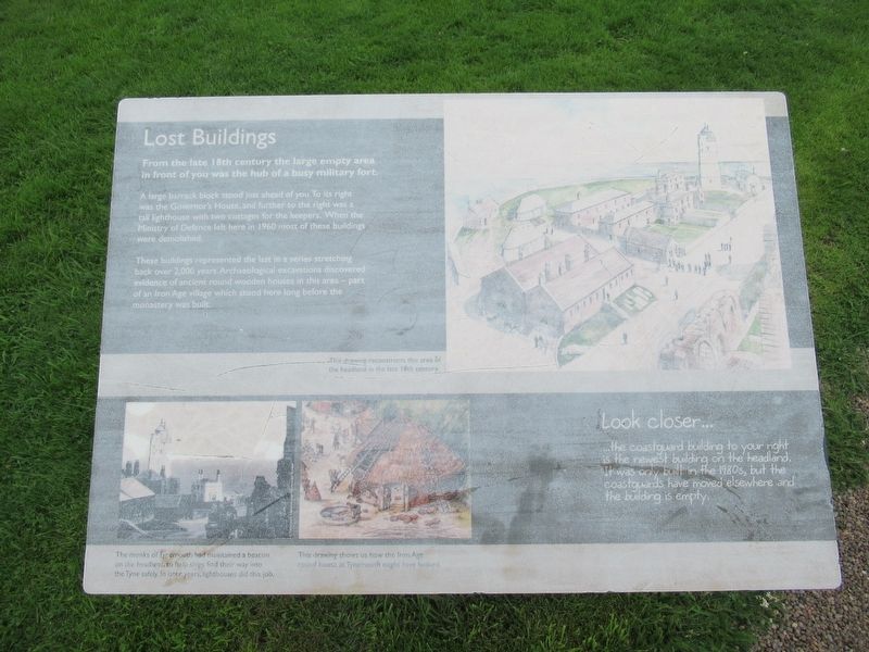
Lost Buildings
From the late 18th century the large empty area in front of you was the hub of a busy military fort.
A large barrack block stood just ahead of you. To its right was the Governor's House, and further to the right was a tall lighthouse with two cottages for the keepers. When the Ministry of Defence left here in 1960 most of these buildings were demolished.
These buildings represented the last in a series stretching back over 2,000 years. Archaeological excavations discovered evidence of ancient round wooden houses in this area – part of an Iron Age village which stood here long before the monastery was built.
Look closer …
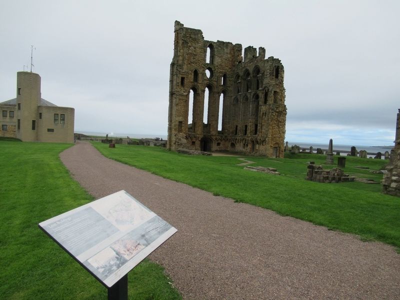
the coastguard building to your right is the newest building on the headland. It was only built in the 1980s, but the coastguards have moved elsewhere and the building is empty.
( photo captions )
The monks of Tynemouth had maintained a beacon on the headland, to help ships find their way into the Tynesafely. In later years, lighthouses did this job.
This drawing shws us how the Iron Age round house at Tynemouth might have looked.
Topics. This historical
this page online
Location. 55° 1.077′ N, 1° 25.079′ W. Marker is in Tynemouth, England, in Tyne and Wear. It can be reached from the intersection of Front Street and Pier Road, on the right when traveling east. Located at Tynemouth Priory and Castle. Touch for map. Marker is in this post office area: Tynemouth, England NE30 4BZ, United Kingdom. Touch for directions.

Regionally, this marker is in North East England. Globally, it is on the Atlantic Ocean, in the North Atlantic Region, in Europe, in Atlantic Europe, on one of the British Isles, in the Western World, and in the Anglosphere. Historically, it finds itself in what was once the Roman Empire.
Other nearby markers. At least 8 other markers are within walking distance of this marker: The Shrine Area (a few steps from this marker); The Cloister (within shouting distance of this marker); The Priory Church (within shouting distance of this marker); Site of Tynemouth Lighthouse (within shouting distance of this marker); The Gatehouse (within
Photographed by Michael Herrick, August 19, 2018
2. The Coastguard Building and Priory Ruins beyond the Marker
Also see . . .
1. English Heritage - Tynemouth Priory and Castle. (Submitted on November 11, 2018, by Michael Herrick of Southbury, Connecticut.)
2. Tynemouth Priory and Castle on Wikipedia. (Submitted on November 11, 2018, by Michael Herrick of Southbury, Connecticut.)
Credits. This page was last revised on January 27, 2022. It was originally submitted on November 11, 2018, by Michael Herrick of Southbury, Connecticut. This page has been viewed 187 times since then and 12 times this year. Photos: 1, 2. submitted on November 11, 2018, by Michael Herrick of Southbury, Connecticut.
