Barnhart in Irion County, Texas — The American South (West South Central)
Barnhart
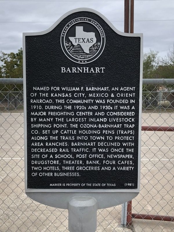
Photographed by Brian Anderson, November 10, 2018
1. Barnhart Marker
Erected 1981 by Texas Historical Commission. (Marker Number 262.)
Topics. This historical marker is listed in these topic lists: Railroads & Streetcars • Settlements & Settlers. A significant historical year for this entry is 1910.
Location. 31° 7.751′ N, 101° 10.302′ W. Marker is in Barnhart, Texas, in Irion County. It is at the intersection of Main Street (State Highway 163) and Irion Street, on the right when traveling north on Main Street. Marker is located in the parking lot of the Barnhart Volunteer Fire Department. Touch for map. Marker is at
this page online

Regionally, this marker is in West Texas. Globally, it is in North America, a Gulf of Mexico state, the Western Hemisphere, the Western World, and the Anglosphere. Historically, it finds itself in what was once New Spain, the Republic of Texas, and one of the Confederate States of America.
Other nearby markers. At least one other marker is within walking distance of this marker: Barnhart Cowboy Church (about 800 feet away, measured in a direct line).
Also see . . . Barnhart, TX - The Handbook of Texas Online. Texas State Historical Association (TSHA) (Submitted on November 11, 2018, by Brian Anderson of New Albany, Ohio.)
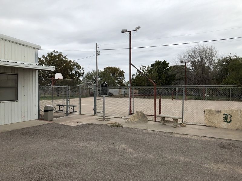
Photographed by Brian Anderson, November 10, 2018
2. Barnhart Marker
Credits. This page was last revised on November 15, 2018. It was originally submitted on November 11, 2018, by Brian Anderson of New Albany, Ohio. This page has been viewed 430 times since then and 37 times this year. Photos: 1, 2. submitted on November 11, 2018, by Brian Anderson of New Albany, Ohio. • Andrew Ruppenstein was the editor who published this page.
