Fort Mifflin in Philadelphia in Philadelphia County, Pennsylvania — The American Northeast (Mid-Atlantic)
Torpedo Casemate
1875
Report from the Fort
20 May 1807 • Lieutenant Jonathan Williams, Inspector of Fortifications
Casemate No. 11 is situated in the second redan [point] from the Gate and is in length 27 feet, in breadth 7 feet, in height 7 feet.
National Archives
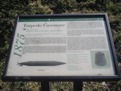
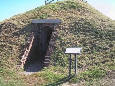
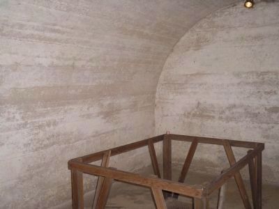
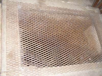
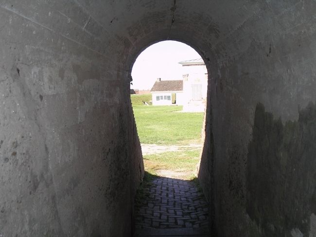
Between 1807 and 1875 little mention of this brick casemate is made or shown on maps. In 1875, however, a Torpedo storage and firing tank was built into the original casemate, closing off an end containing a fireplace. The top of the chimney for this fireplace still peeks out of the sod on the rampart as the one remaining identification of the hidden casemate. The new torpedo building inside the earlier brick structure is a barrel vault of poured concrete approximately six feet thick with dead air space above. The casemate is designed with a zig-zag entranceway in order to off-set a direct attack from the door.
The use of torpedos in 1875 was relatively experimental, for they had only been developed as a weapon in 1866. Torpedos were typically self-propelled underwater missiles that detonated upon contact with an object, usually a ship. Various types evolved, but generally torpedos are described as cigar-shaped with a propeller at the end. The Lay Torpedo also had a rudder and was controlled electronically by two cables running from the control station to start, stop, or steer the torpedo. Documents referencing a cable gallery in this casemate imply that experiments with a small Lay torpedo were carried out at Fort Mifflin.
The torpedo was apparently fired from a pool in the floor of the casemates. The projectile went through a tunnel under the ramparts, into the moat and through a tube in the river bank to meet the target in the river. The torpedo channel in the moat has a small bridge crossing it outside the wall. Lay torpedos were fired by the thrust of carbon dioxide vented to the rear of the weapon. The gas resulted from the creation of carbonic acid by mixing baking soda and vinegar. The electricity to start and stop the reaction and control the rudder was sent to the torpedo through wires attached to a miner’s battery.
Corps of Engineers records indicate that by 1883 submarine mines were stored in this casemate. These were floating or ground mines that would have been placed in the river in specific locations in time of war. Their explosive charge would have been controlled electronically by wires from a battery in the command station to blow up an advancing ship. When the fort was deactivated as a military unit in 1904 all mines, wires, and earlier torpedo equipment were removed.
Floating mines on the Delaware River had been used as early as the Revolution and
were not a new concept. By 1775, a young Yale student, David Bushnell, had invented floating kegs filled with gunpowder that would explode on contact with a vessel. Upon a light shock, a flintlock detonator inside the top of the barrel fired the gunpowder. The episode of Bushnell’s plot against Howe’s British ships in the Delaware became known as the Battle of the Kegs. A flotilla of powder kegs was sent down the river in late December 1777, but the kegs became jammed in the ice. More unfortunately, two youths who found one were killed when they attempted to rescue a barrel. The British quickly learned the explosive nature of these kegs and by January 5, 1778, had destroyed all those that remained. The legend of the Battle of the Kegs was memorialized by Francis Hopkinson, a Philadelphia statesman, musician, and signer of the Declaration of Independence who set his text describing the saga of the floating kegs to the tune of “Yankee Doodle.”
The Battle of the Kegs (verse three)
These kegs, must hold the Rebel bold, packed up like pickled herring.
And they’ve come down to take the town, in this new way of ferrying.
The soldier flew, the sailor too, and scared almost to death, Sirs.
Wore out their shoes to spread the news and ran till out of breath, Sirs.
Yankee Doodle keep it up, Yankee Doodle Dandy.
Mind the music and the step,
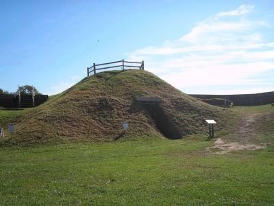
Photographed By Bill Coughlin, October 11, 2008
3. Torpedo Casemate
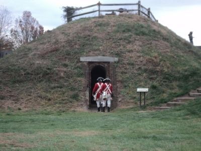
To the right of this photo can be seen the entrance to Casemate #11, buried during construction of the Torpedo Casemate. Discovered in 2006, this casemate dates back to before the American Revolution and is one of the oldest British structures still standing in the United States.
Erected by Fort Mifflin Historic Site.
Topics. This historical marker is listed in these topic lists: Forts and Castles • Notable Buildings. A significant historical month for this entry is January 1919.
Location. 39° 52.503′ N, 75° 12.77′ W. Marker is in Philadelphia, Pennsylvania, in Philadelphia County. It is in Fort Mifflin. Marker can be reached from W Fort Mifflin Road, on the right when traveling east. Marker is along the walking tour of Fort Mifflin. Touch for map. Marker is at or near this postal address: 6400 Hog Island Rd, Philadelphia PA 19153, United States of America. Touch for directions.
Other nearby markers. At least 8 other markers are within walking distance of this marker. Citadel - 1796 (within shouting distance of this marker); Arsenal (within shouting distance of this marker); Expert Fishers of Fort Mifflin (within shouting distance of this marker); Artillery Shed (within shouting distance of this marker); Quartermaster’s Store (within shouting distance of this marker); Blacksmith Shop (within shouting distance of this marker); Soldiers’ Barracks (within shouting distance of this marker); Casemates or Bombproofs (within shouting distance of this marker). Touch for a list and map of all markers in Philadelphia.
More about this marker. The bottom left of the marker contains a picture of a Lay Torpedo Design. The lower right of the marker features a picture of “A keg mine from Philadelphia, attributed ca. 1793.”
Related markers. Click here for a list of markers that are related to this marker. This series of markers follow the walking tour of Fort Mifflin.
Also see . . .
1. The Fort that saved America. The Official Website of Fort Mifflin on the Delaware. (Submitted on October 18, 2008, by Bill Coughlin of Woodland Park, New Jersey.)
2. Fort Mifflin Groundplan. Layout of Fort Mifflin, the Fort that saved America. (Submitted on October 18, 2008, by Bill Coughlin of Woodland Park, New Jersey.)
Credits. This page was last revised on February 2, 2023. It was originally submitted on October 18, 2008, by Bill Coughlin of Woodland Park, New Jersey. This page has been viewed 1,644 times since then and 31 times this year. Photos: 1, 2, 3. submitted on October 18, 2008, by Bill Coughlin of Woodland Park, New Jersey. 4. submitted on November 17, 2013, by Bill Coughlin of Woodland Park, New Jersey. 5, 6, 7. submitted on October 18, 2008, by Bill Coughlin of Woodland Park, New Jersey.
