Corfu, Peloponnese, Western Greece and the Ionian, Greece — Ελλάδα (Southeastern Europe, Balkan Peninsula)
Old Fortress
ΠAΛAIO ΦPOYPIO
English:
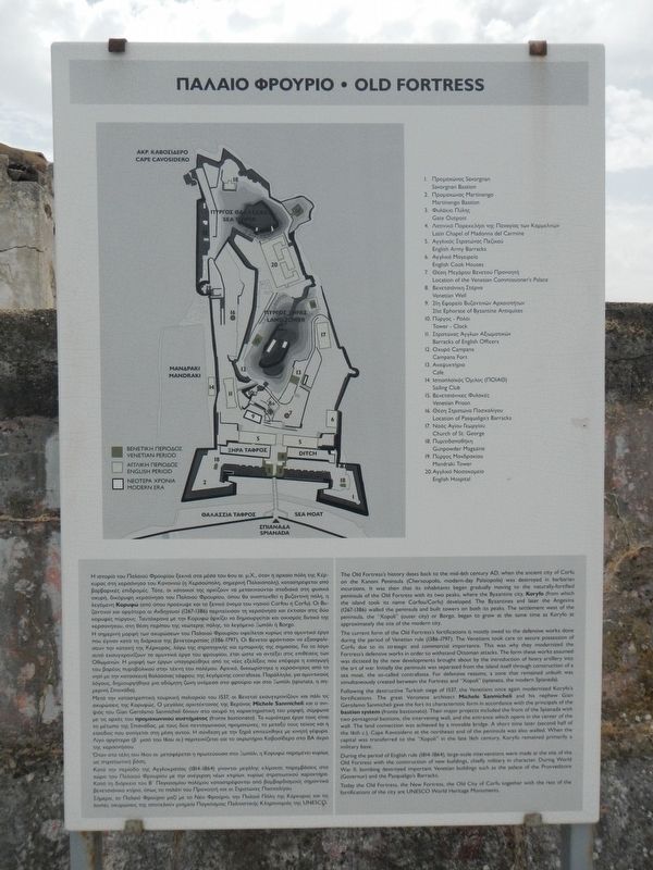
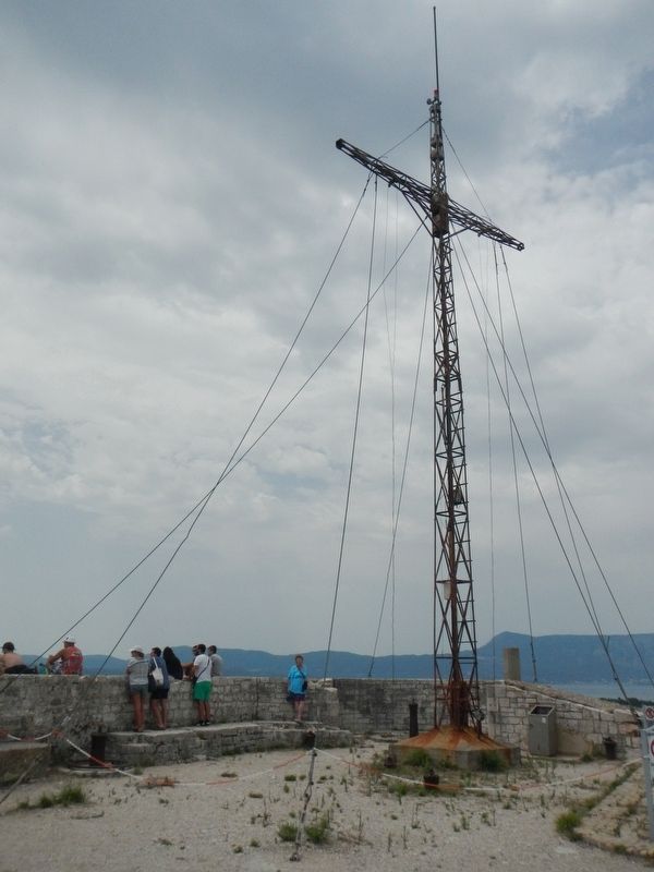
The Old Fortress's history dates back to the mid-6th century AD, when the ancient city of Corfu on the Kanoni Peninsula (Chersoupolis, modern-day Palaiopolis) was destroyed in barbarian invasions. It was then that its inhabitants began gradually moving to the naturally-fortified peninsula of the Old Fortress with its two peaks where the Byzantine city, Koryfo (from which the island took its name Corfou/Corfu) developed. The Byzantines and later the Angevins (1267-1386) walled the peninsula and built towers on both peaks. The settlement west of the peninsula, the "Xopoli" (outer city) or Borgo, began to grow at the same time as Koryfo at approximately the site of the modern city.
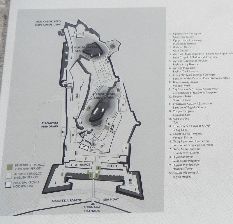
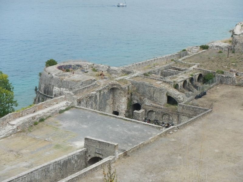
The current form of the Old Fortress's fortifications is mostly owed to the defensive works done during the period of Venetian rule (1386-1797). The Venetians took care to secure possession of Corfu, due to its strategic and commercial importance. This was why they modernized the Fortress's defensive works in order to withstand Ottoman attacks. The form these works assumed was dictated by the new developments brought about by the introduction of heavy artillery into the art of war. Initially the peninsula was separated from the island itself through construction of a sea moat, the so-called contra fossa. For defensive reasons, a zone that remained unbuilt was simultaneously created between the Fortress and "Xopoli"(spianata, the modern Spianada). Following the destructive Turkish siege of 1537, the Venetians once again modernized Koryfo's fortifications. The great Veronese architect Michele Sanmicheli and his nephew Gian Gerolamo Sanmicheli gave the fort its characteristic form in accordance with the principals of the bastion system (fronte basitionato). Their major projects included the front of the Spianada with two pentagonal bastions, the intervening wall, and the entrance which opens in the center of the wall. The land connections was achieved by a movable bridge. A short time later (second half of the 16th c.) Cape Kavosidero at the northeast end of the peninsula was also walled. When the capital was transferred to the "Xopoli" in the late 16th century, Koryfo remained primarily a military base.
During the period of English rule (1814-1864), large-scale interventions were made at the site of the Old Fortress with the construction of new buildings, chiefly military in character. During World War II, bombing destroyed important Venetian buildings such as the palace of the Provveditore (Governor) and the Pasqualigo's Barracks. Today the Old Fortress, the New Fortress, the Old City of Corfu together with the rest of the fortifications of the city are UNESCO World Heritage Monuments.
Topics. This historical marker is listed in these topic lists: Architecture • Forts and Castles.
Location. 39° 37.397′ N, 19° 55.749′ E. Marker is in Corfu, Peloponnese, Western Greece and the Ionian. Marker can be reached from the intersection of Agoniston Politechniou and 39.623286, 19.929149, on the left when traveling north. Touch for map. Marker is in this post office area: Corfu, Peloponnese, Western Greece and the Ionian 491 00, Greece. Touch for directions.
Other nearby markers. At least 8 other markers are within 8 kilometers of this marker, measured as the crow flies. Church of Saint George (within shouting distance of this marker); Barracks of Pasqualigo/Barracks of British Officiers (about 90 meters away, measured in a direct line); Palace of the Venetian Commissioner (about 120 meters away); Latin Chapel of Madonna del Carmine/British Army Barracks (about 180 meters away); Count Matthais von der Schulenburg (approx. 0.3 kilometers away); a different marker also named Old Fortress (approx. 0.3 kilometers away); Pendant La Guerre Continentale 1914-1918 (approx. 7.1 kilometers away); Achillion Museum Corfu (approx. 7.1 kilometers away). Touch for a list and map of all markers in Corfu.
