Anthon in Woodbury County, Iowa — The American Midwest (Upper Plains)
Woodbury County Freedom Rock Veterans Memorial
Ray "Bubba" Sorensen painted this rock in June 2017.
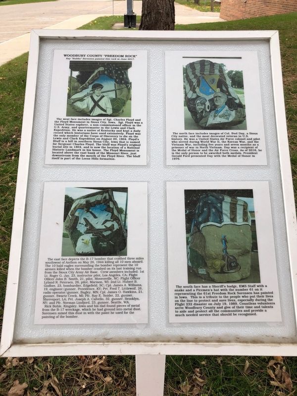
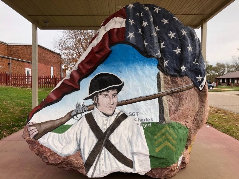
The west face includes images of Sgt. Charles Floyd and the Floyd Monument in Sioux City, Iowa.
Sgt. Floyd was a United States explorer, a non-commissioned officer in the U.S. Army and quartermaster in the Lewis and Clear Expedition. He was a native of Kentucky and kept a daily record which historians have used extensively. Floyd was the only member of the Corps of Discovery to die on the Lewis and Clark Expedition on August 20, 1804. Floyd's Bluff is a hill in southern Sioux City, Iowa that is named for Sergeant Charles Floyd. The bluff was Floyd's original burial site in 1804, and is now the location of a National Historic Landmark in his honor. The Floyd Monument is located above the east bank of the Missouri River, just downstream from the mouth of the Floyd River. The bluff itself is part of the Loess Hills formation.
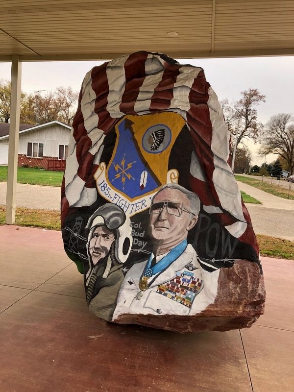
The north face includes images of Col. Bud Day, a Sioux City native, and the most decorated veteran in U.S. history. He was a United States Air Force colonel and pilot who served during World War II, the Korean War, and the Vietnam War, including five years and seven months as a prisoner of war in North Vietnam. Day was a recipient of the Medal of Honor and the Air Force Cross. As of 2016, he is the only person to be awarded both medals. President Gerald Ford presented Day with the Medal of Honor in 1976.
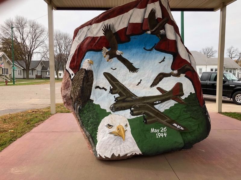
The east face depicts the B-17 bomber that crashed three miles southwest of Anthon on May 26, 1944 killing all 10 med aboard. The 10 bald eagles surrounding the bomber represent the 10 airmen killed when the bomber crashed on its last training run from the Sioux City Army Air Base. Crew members included: 1st Lt. Roger G. Jay, 23, instructor pilot, Los Angeles, CA; Flight Officer John B. Smith, 21 pilot, Mooresville, NC; Flight Officer Lyland R. Petersen, 26, pilot, Marison, WI; 2nd Lt. Hubert B. Godbee, 23, bombardier, Edgefield, SC; Cpt. James a. Williams, 19, engineer/gunner, Providence, KY; Pvt. Fred T. Littlewold, 26, radio operator/gunner, Bagley, MN; Cpl. James O. Hawkins, 21, gunner, Swartz Creek, MI; Pfc. Ray E. Snider, 22, gunner, Shreveport, LA; Pvt. Joseph A. Calvello, 32 gunner, Brooklyn, NY; and Pfc. Norman Lindjord, 23 gunner, Seattle, WA.
Rick Bohle, Kingsley, Iowa and his boy found pieces of metal from the B-17 wreckage, which he had ground into metal dust. Sorensen mixed this dust in with the paint he used for the painting of the bomber.
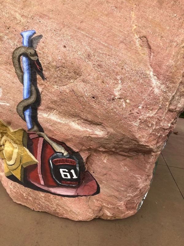
The south face has a Sheriff's badge, EMS Staff with a snake and a Fireman's hat with the number 61 on it representing the 61st Freedom Rock Sorensen has painted in Iowa. This is a tribute to the people who put their lives on the line to protect and save lives, especially during the Flight 232 disaster on July 19, 1989. Countless volunteers serve Woodbury County and give of their time and talents to aide and protect all the communities and provide a much needed service that should be recognized.
Topics and series. This memorial is listed in these topic lists: Exploration • Patriots & Patriotism • War, Vietnam • War, World II. In addition, it is included in the Former U.S. Presidents: #38 Gerald R. Ford, Jr., the Freedom Rock Memorials, the Lewis & Clark Expedition, and the Medal of Honor Recipients series lists.
Location. 42° 23.307′ N, 95° 51.741′ W. Marker is in Anthon, Iowa, in Woodbury County. Memorial is at the intersection of N. 5th Ave and E. Main St, on the right when traveling north on N. 5th Ave. Touch for map. Marker is at or near this postal address: 110 N 5th Ave, Anthon IA 51004, United States of America. Touch for directions.
Other nearby markers. At least 7 other markers are within 15 miles of this marker, measured as the crow flies. Theobald Subwatershed (approx. 4 miles away); Strong, Simple and Economical (approx. 6˝ miles away); Correctionville's Engine for Growth (approx. 6˝ miles away); Veteran's Memorial (approx. 7 miles away); Built for a Lifetime of Service (approx. 7 miles away); How Correctionville Got Its Name! (approx. 7.1 miles away); Kingsley Freedom Rock Veterans Memorial (approx. 14.7 miles away).
Credits. This page was last revised on November 29, 2018. It was originally submitted on November 2, 2018, by Ruth VanSteenwyk of Aberdeen, South Dakota. This page has been viewed 290 times since then and 31 times this year. Last updated on November 29, 2018, by Ruth VanSteenwyk of Aberdeen, South Dakota. Photos: 1, 2, 3, 4, 5. submitted on November 2, 2018, by Ruth VanSteenwyk of Aberdeen, South Dakota. • Andrew Ruppenstein was the editor who published this page.
