Charlton in Saratoga County, New York — The American Northeast (Mid-Atlantic)
Slab Troy
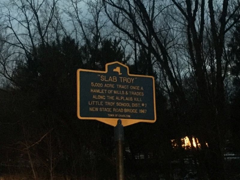
Photographed by Steve Stoessel, November 29, 2018
1. Slab Troy Marker
Erected by Town of Charlton.
Topics. This historical marker is listed in this topic list: Settlements & Settlers.
Location. 42° 55.022′ N, 73° 56.664′ W. Marker is in Charlton, New York, in Saratoga County. It is on Stage Road, on the right when traveling south. Touch for map. Marker is in this post office area: Ballston Lake NY 12019, United States of America. Touch for directions.

Regionally, this marker is in Upstate New York, in the Capital District, and in the Albany Metropolitan Area. It is also in the American Northeast and in the Mid-Atlantic. Globally, it is in North America, the Great North Woods, the Western Hemisphere, the Western World, and the Anglosphere. Historically, it finds itself in what was once New Netherland and also one of the original Thirteen Colonies.
Other nearby markers. At least 8 other markers are within 2 miles of this marker, measured as the crow flies: The Charlton School (approx. 0.6
this page online
Also see . . . Tour of Charlton. (Submitted on November 29, 2018, by Steve Stoessel of Niskayuna, New York.)
Credits. This page was last revised on November 29, 2018. It was originally submitted on November 29, 2018, by Steve Stoessel of Niskayuna, New York. This page has been viewed 601 times since then and 37 times this year. Photo 1. submitted on November 29, 2018, by Steve Stoessel of Niskayuna, New York. • Andrew Ruppenstein was the editor who published this page.
