Near Three Forks in Gallatin County, Montana — The American West (Mountains)
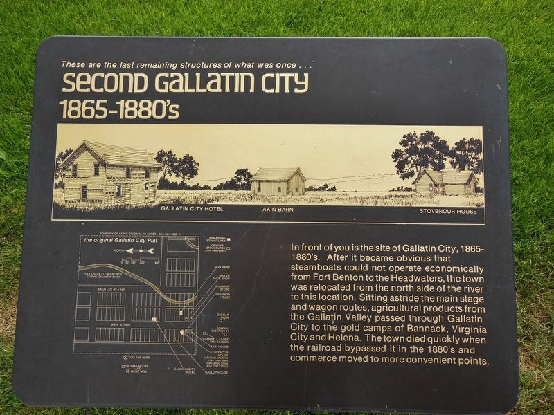
Second Gallatin City
1865-1880's
Topics. This historical marker is listed in this topic list: Settlements & Settlers.
Location. 45° 55.211′ N, 111° 29.925′ W. Marker is near Three Forks, Montana, in Gallatin County. Marker is on Trident Road (State Highway 286) 1˝ miles north of Interstate 90, on the right when traveling north. Marker is located on the east side of the Headwaters of the Missouri picnic area parking lot, overlooking the Second Gallatin City site. Touch for map. Marker is in this post office area: Three Forks MT 59752, United States of America. Touch for directions.
Other nearby markers. At least 8 other markers are within 2 miles of this marker, measured as the crow flies. Colter’s Run (within shouting distance of this marker); Gallatin City Hotel - 1868 (about 300 feet away, measured in a direct line); The Log Cabin (about 400 feet away); Thomas-Frederick Flour Mill (about 500 feet away); Jefferson’s Instructions to Lewis and Clark (approx. half a mile away); The Naming of a River (approx. half a mile away); Lewis and Clark reach the Headwaters (approx. half a mile away); The Upper Missouri (approx. 1.4 miles away). Touch for a list and map of all markers in Three Forks.
Related markers. Click here for a list of markers that are related to this marker. Gallatin City, Missouri Headwaters State Park, Montana
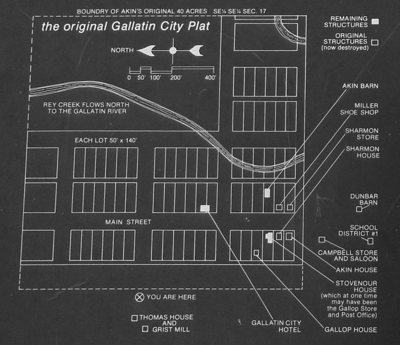
Also see . . . Gallatin City (Three Forks). In 1863 a settlement named Gallatin City (the first of three) sprang to life opposite the mouth of the Gallatin River under the hands of twenty-five pioneers, including James Gallaher and Major J. B. Campbell, by authorization of the first Territorial legislature. All were inspired by the prospect that river commerce would be extended to the Three Forks valley as soon as a government-chartered shortline railroad was built around the Great Falls. They expected that their market area would include all the gold camps from Virginia City to the south and Helena to the north, as well as the Yellowstone Valley via Clark's "high dry firm road" between the Big Bend and the head of the Gallatin River. Second thoughts dictated the moving of the first Gallatin City's legal domain to a new location on the bank of the Madison River about two miles south, on the stage route. Hope survived in Gallatin City (No. 2) until the Northern Pacific Railroad laid its main line several miles to the south, and new options—the foundations of another phase of Western history—emerged. A third Gallatin City briefly came to mind, but no farther. (Submitted on December 3, 2018, by Cosmos Mariner of Cape Canaveral, Florida.)
Credits. This page was last revised on December 4, 2018. It was originally submitted on December 1, 2018, by Cosmos Mariner of Cape Canaveral, Florida. This page has been viewed 181 times since then and 20 times this year. Photos: 1, 2, 3. submitted on December 3, 2018, by Cosmos Mariner of Cape Canaveral, Florida. • Andrew Ruppenstein was the editor who published this page.


