Naples in Collier County, Florida — The American South (South Atlantic)
The Naples Depot
Photographed by Tim Fillmon, October 2, 2018
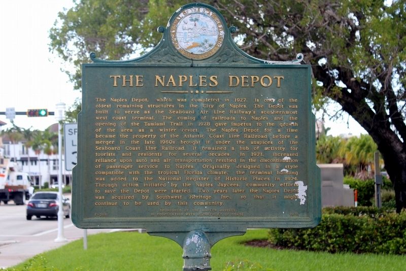
1. The Naples Depot Marker
Inscription.
The Naples Depot, which was completed in 1927, is one of the oldest remaining structures in the City of Naples. The Depot was built to serve as the Seaboard Air Line Railway's southern-most west coast terminal. The coming of railroads to Naples and the opening of the Tamiami Trail in 1928 gave impetus to the growth of the area as a winter resort. The Naples Depot for a time became the property of the Atlantic Coast Line Railroad before a merger in the late 1960s brought it under the auspices of the Seaboard Coast Line Railroad. It remained a hub of activity for tourists and residents for several decades. In 1971, increased reliance upon auto and air transportation resulted in the discontinuation of passenger service to Naples. Originally designed in a style compatible with the tropical Florida climate, the terminal building was added to the National Register of Historic places in 1974. Through action initiated by the Naples Jaycees, community efforts to save the Depot were started. Two years later the Naples Depot was acquired by Southwest Heritage, Inc., so that it might continue to be used by this community.
Erected 1972
Click or scan to see this page online
by The Naples Jaycees in Cooperation with Department of State. (Marker Number F-268.)
Topics. This historical marker is listed in this topic list: Railroads & Streetcars. A significant historical year for this entry is 1927.
Location. 26° 8.538′ N, 81° 47.58′ W. Marker is in Naples, Florida, in Collier County. It is at the intersection of 5th Avenue South (U.S. 41) and 10th Street South, on the right when traveling west on 5th Avenue South. Touch for map. Marker is at or near this postal address: 1051 5th Aveune South, Naples FL 34102, United States of America. Touch for directions.
Regionally, this marker is on Florida’s Gulf Coast. It is also in the American South and on the Gulf Coast. Globally, it is in the North Atlantic Region, North America, a Gulf of Mexico state, the Western Hemisphere, the Western World, and the Anglosphere. Historically, it finds itself in what was once New Spain, the territory of the Mississippian Culture, one of the Confederate States of America, and the Antebellum South.
Other nearby markers. At least 8 other markers are within one mile of this marker, measured as the crow flies:
Credits. This page was last revised on December 23, 2018. It was originally submitted on December 22, 2018, by Tim Fillmon of Webster, Florida. This page has been viewed 667 times since then and 33 times this year. Photos:1, 2. submitted on December 22, 2018, by Tim Fillmon of Webster, Florida. • Andrew Ruppenstein was the editor who published this page.