National Harbor in Fort Washington in Prince George's County, Maryland — The American Northeast (Mid-Atlantic)
Laurel
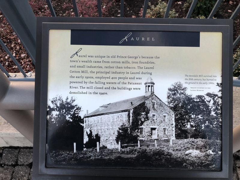
Laurel was unique in old Prince George's because the town's wealth came from cotton mills, iron foundries, and small industries, rather than tobacco. The Laurel Cotton Mill, the principal industry in Laurel during the early 1900s, employed 400 people and was powered by the falling waters of the Patuxent River. The mill closed and the buildings were demolished in the 1940s.
[Caption:]
The Avondale Mill survived into the 20th century, but burned to the ground in the early 1990s.
Topics. This historical marker is listed in this topic list: Industry & Commerce.
Location. 38° 47.557′ N, 77° 1.456′ W. Marker is in Fort Washington, Maryland, in Prince George's County. It is in the National Harbor. It can be reached from Capital Beltway (Interstate 95) west of National Harbor Boulevard, on the right when traveling east. Touch for map. Marker is in this post office area: Oxon Hill MD 20745, United States of America. Touch for directions.

Regionally, this marker is in the Washington Metropolitan Area. It is also in the American South, specifically in the Upper South,
this page online
Other nearby markers. At least 8 other markers are within walking distance of this marker: Clinton (here, next to this marker); Upper Marlboro (here, next to this marker); Andrews Air Force Base (here, next to this marker); Hyattsville (here, next to this marker); College Park (here, next to this marker); The Growth of the Black Middle Class (here, next to this marker); Bladensburg (here, next to this marker); The Founding of Maryland (here, next to this marker). Touch for a list and map of all markers in Fort Washington.
Credits. This page was last revised on March 3, 2023. It was originally submitted on December 23, 2018, by Devry Becker Jones of Washington, District of Columbia. This page has been viewed 271 times since then and 23 times this year. Photos: 1, 2. submitted on December 23, 2018, by Devry Becker Jones of Washington, District of Columbia. • Andrew Ruppenstein was the editor who published this page.
