South Queensferry in Edinburgh, Scotland, United Kingdom — Northwestern Europe (the British Isles)
The Royal Navy in the Forth
Photographed by Michael Herrick, August 25, 2018
1. The Royal Navy in the Forth Marker
In The Forth
During World War I
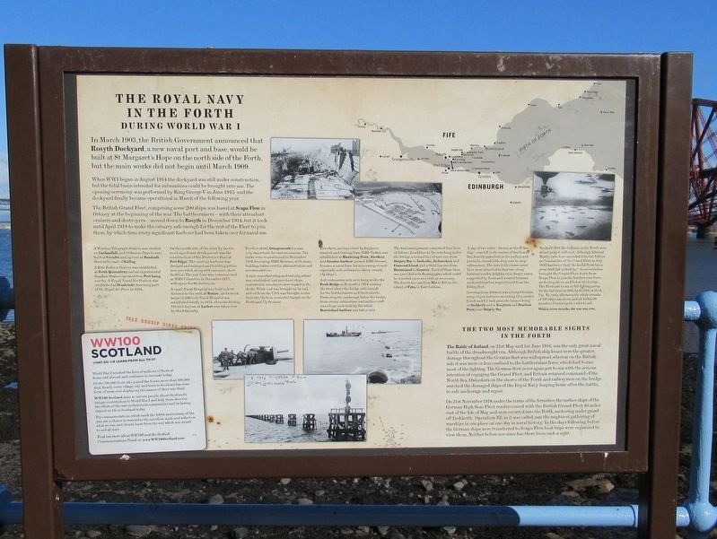
When WWI began in August 1914 the dockyard was still under construction, but the tidal basin intended for submarines could be brought into use. The opening ceremony was performed by King George V in June 1915 and the dockyard finally became operational in March of the following year.
The British Grand Fleet, comprising some 200 ships, was based at Scapa Flow in Orkney at the beginning of the war. The battlecruisers – with their attendant cruisers and destroyers – moved down to Rosyth in December 1914, but it took until April 1918 to make the estuary safe enough for the rest of the Fleet to join them, by which time every significant harbour had been taken over for naval use.
A Wireless Telegraph Station was erected on Castlandhill, and Ordnance Depots were built at Crombie and upriver at Bandeath three miles east of Stirling.
A Kite Balloon
this page online
On the south side of the river, by far the most significant development was the construction of the Destroyer Base at Port Edgar. The existing harbour was dredged and enlarged and berthing jetties were provided, along with extensive shore facilities. The new base was commissioned as HMS Columbine in December 1917, with space for 66 destroyers.
A small Naval Hospital was built a short distance to the west, at Butlaw, and a much larger (1,200 bed) Naval Hospital was established briefly in 1918, when the Stirling District Asylum at Larbert was taken over by the Admiralty.
Further afield, Grangemouth became very important, for various reasons. The docks were requisitioned in November 1914, becoming HMS Rameses, with many buildings taken over for administration and accommodation.
A mine manufacturing and training school was established and merchant ships converted to minelayers were loaded in the docks. Welsh coal
Photographed by Michael Herrick, August 25, 2018
2. The Royal Navy in the Forth Marker
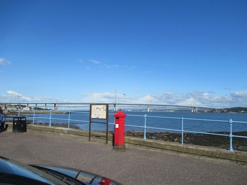
Behind the marker are the Forth Road Bridges over the Firth of Forth.
Elsewhere, an important hydrophone research and training base, HMS Tarlair, was established at Hawkcraig Point, Aberdour, and Granton harbour, named HMS Gunner, became a naval base for minesweepers and especially anti-submarine decoy vessels ('Q-ships').
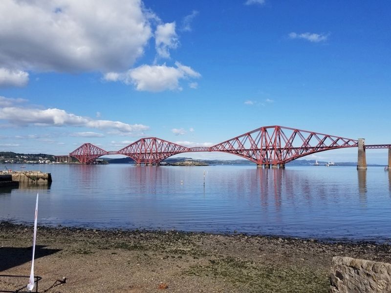
Anti-submarine nets were hung under the Forth Bridge in November 1914, making the river above the bridge safe enough for the battlecruisers and their escorts. Protecting the anchorage below the bridge from enemy submarines and surface craft was a huge undertaking, for which Burntisland harbour was taken over.
The final arrangement comprised four lines of defence. In addition to the nets hung under the bridge, a second line of nets ran from Dalgety Bay to Inchcolm, Inchmickery and Cramond Island, and a third line ran from Burntisland to Granton. Each of these lines was provided with floating gates which could be winched open and shut as necessary The fourth line ran from Elie in Fife to the island of Fidra in East Lothian.
A gap of two miles —
Photographed by Michael Herrick, September 4, 2018
3. The Forth Rail Bridge
Covering these defences was a comprehensive array of gun batteries mounting 12-pounder, 6-inch and 9.2-inch guns, the largest being on Inchkeith and at Kinghorn and Braefoot Point, near Dalgety Bay.
By April 1918 the facilities in the Forth were at last judged sufficient. Although Admiral Beatty (who had succeeded Admiral Jellicoe as Commander of the Grand Fleet in July 1916) had never liked ”the horid Forth like a great ditch full of thick fog”, he nevertheless brought the Grand Fleet down from Scapa Flow to join the battlecruiser force, anchoring above and below the bridge. The Fleet put to sea in full fighting array for the last time on 24th April 1918, in a thick fog. By early afternoon the whole armada of 193 ships was at sea, and all within 90 minutes of receiving the order to sail.
Within seven months, the war was over.
On 21st November 1918 under the terms of the Armistice, the surface ships of the German High Seas Fleet rendezvoused with the British Grand Fleet 40 miles east of the Isle of May and were escorted into the Forth, anchoring under guard off Inchkeith. Operation ZZ, as it was called, saw the mightiest gathering of warships in one place on one day in naval history. In the days following, before the German ships were transferred to Scapa Flow, boat trips were organised to view them. Neither before nor since has there been such a sight.
WW100 Scotland
What Do We Learn From All This?
World War I touched the lives of millions of Scots at home and abroad, and continues to resonate today.
Of the 700,000 Scots who joined the forces, more than 100,000 died. Nearly every village, city and town in Scotland has some form of memorial displaying the names of their war dead.
WW100 Scotland aims to inform people about Scotland's unique contribution to World War I and help them discover the effects of the war on their local communities and its lasting impact on life in Scotland today.
The commemorations, which mark the 100th anniversary of the war, are a chance to remember the sacrifices made and reflect on what we can, and should, learn from the war which was meant to end all wars. Find out more about WW100 and the Scottish Commemorations Panel at: www.WW100Scotland.com
Topics. This historical marker is listed in this topic list: War, World I. A significant historical month for this entry is March 1903.
Location. 55° 59.406′ N, 3° 23.279′ W. Marker is in South Queensferry, Scotland, in Edinburgh. It is at the intersection of Newhalls Road and Longcraig Road, on the left when traveling east on Newhalls Road. Touch for map. Marker is in this post office area: South Queensferry, Scotland EH30 9TA, United Kingdom. Touch for directions.

Regionally, this marker is in Edinburgh & the Lothians. Globally, it is on the Atlantic Ocean, in the North Atlantic Region, in Europe, on the Celtic Fringe, in Atlantic Europe, on one of the British Isles, in the Western World, and in the Anglosphere.
Other nearby markers. At least 8 other markers are within 6 kilometers of this marker, measured as the crow flies: A Rough Ride (about 90 meters away, measured in a direct line); Briggers Memorial (about 120 meters away); The Forth Rail Bridge (approx. 0.3 kilometers away); Forth Bridge (approx. half a kilometer away); John Reid (approx. half a kilometer away); In Gratitude (approx. 0.6 kilometers away); Queensbury War Memorial (approx. 0.6 kilometers away); 603 (City of Edinburgh) Squadron (approx. 5.3 kilometers away). Touch for a list and map of all markers in South Queensferry.
Credits. This page was last revised on January 27, 2022. It was originally submitted on December 4, 2018, by Michael Herrick of Southbury, Connecticut. This page has been viewed 2,026 times since then and 265 times this year. Last updated on December 26, 2018, by T. Patton of Jefferson, Georgia. Photos: 1, 2, 3. submitted on December 4, 2018, by Michael Herrick of Southbury, Connecticut.
