Lairg in Highland, Scotland, United Kingdom — Northwestern Europe (the British Isles)
Glacier detectives
Inscription.
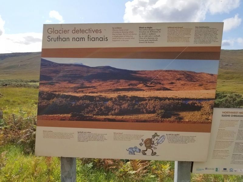
Glacier detectives
Sruthan nam fianais
Icy evidence
Glaciers leave a trail of evidence showing where they've been. But it's not always a simple piece of detective work to find out exactly what happened in the past.
Dileab na deighe
Tha sruthan-deighe a' fagail shreathan de dh'fhianais às an dèidh a' sealltainn far an robh iad a' sruthadh. Chan eil e daonnan cho furasta ge-tà dearbhadh dìreach dè thachair.
Bulldozed and dumped
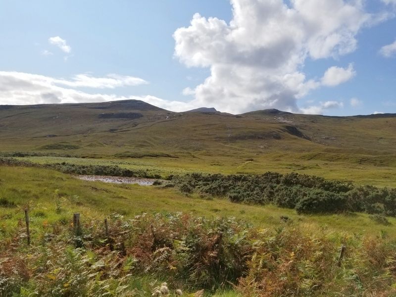
The mounds on the far side of the River Ioanan are 'moraines'. These are heaps of rock and that a glacier scraped up on its journey down the glen when the ice melted around 15,000 years ago. But were they left by one glacier or two at different times? Were the horseshoeshaped moraine ridges which lie beyond those in the foreground bulldozed up at the front of a later glacier that occupied the hollow in the far hillside?
Càrn chuimhneachan
'S iad na torran air taobh thall Abhainn Iaonan rudan ris an canar 'moraine'. Is iad seo nan torran mòra de chloich is poll air sgròbadh le sruth-deighe agus air fhàgail nuair a leagh an deigh bho chionn 15,000 bliadhna. Ach an deach am fàgail le aon sruth-deighe no a dhà aig amannan eadordhealaichte? An deach na torran air a bheil coltas cruidhe fhàgail nas fhaide shuas a’ bheinn le sruth-deighe eile a bha a' ruith anns an lag air leathad ud fada thall? Glacier scratches
Glociers pluck out rocks and grind them up as they move downhill. These rocks and stones freeze to the bottom of the ice, creating a formidable rock scourer. Look out for shallow scratches-on rock surfaces produced by harder stones embedded in the moving ice. They can tell us the direction in which the ice was flowing.
Sgròbadh nan sruthan
Tha sruthan-deighe a' spionadh chlachan agus am pronnadh sa ghluasad. Tha na clachan mòra is beaga a' dol an sás ann am bonn na deighe, agus tha seo a' sgùradh a’ ghrunnd. Feuch is gum faic sibh sgrìoban air uachdar nan clachan a rinneadh le clachan cruaidh aig bonn nan sruthan-deighe. Innsidh na sgrìoban seo dè an taobh a bha na sruthan-deighe a' dol.
Did you know?
Glaciers can tell us a lot about how our climate has changed, which is useful when we want to know what might happen in the future. Large ice sheets have covered Scotland at least six times in the last 750,000 years — and there are almost certainly more to come! An robh fios agaibh?
Tha na sruthan-deighe a' toirt dhuinne mòran fiosrachaidh mu atharraichean san aimsir thar nan linntean, rud a tha feumail dhuinne ann a bhith coimhead air adhart. Chaidh Alba a chòmhdachadh co-dhiù sia tursan anns na 750,000 bliadhna fa dheireadh — agus chan eil rian nach tachair an aon rud a-rithist!
Topics. This historical marker is listed in this topic list: Natural Features.
Location. 58° 8.065′ N, 4° 58.629′ W. Marker is in Lairg, Scotland, in Highland. Marker is on Scotland Route A837, 5 kilometers south of Scotland Route A894, on the right when traveling south. Touch for map. Marker is in this post office area: Lairg, Scotland IV27 4HN, United Kingdom. Touch for directions.
Other nearby markers. At least 8 other markers are within 19 kilometers of this marker, measured as the crow flies. Calda House (approx. 3.3 kilometers away); Cultural Landscape (approx. 3.6 kilometers away); Ardvreck Castle (approx. 3.6 kilometers away); Green and pleasant land (approx. 10.1 kilometers away); A geological sandwich (approx. 12.1 kilometers away); Kylesku Bridge (approx. 14 kilometers away); X Craft Memorial (approx. 14 kilometers away); Deep freeze mountains (approx. 18.8 kilometers away). Touch for a list and map of all markers in Lairg.
Credits. This page was last revised on January 27, 2022. It was originally submitted on December 29, 2018, by Michael Herrick of Southbury, Connecticut. This page has been viewed 237 times since then and 18 times this year. Photos: 1, 2, 3. submitted on December 29, 2018, by Michael Herrick of Southbury, Connecticut.


