
Butte in Silver Bow County, Montana — The American West (Mountains)
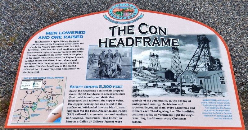
The Con Headframe
Photographed by Cosmos Mariner, July 18, 2016
1. The Con Headframe Marker
Men Lowered and Ore Raised
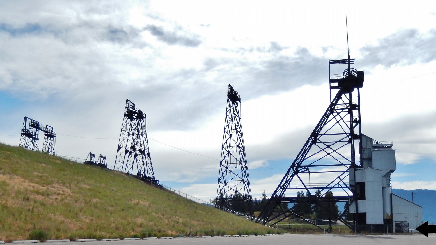
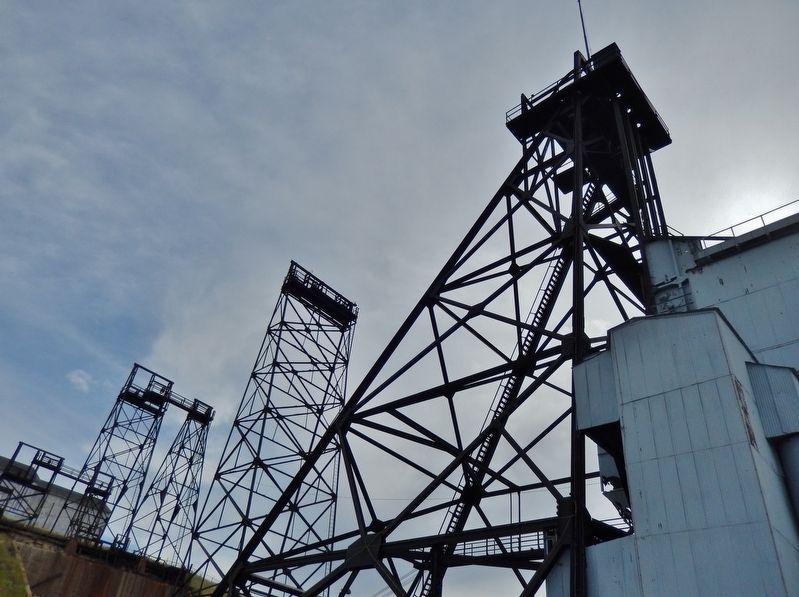
The Anaconda Copper Mining Company (ACM) erected the Mountain Consolidated (or simply the "Con") mine headframe in 1928. Towering 129-1/2 feet, the steel headframe and five idlers towers replaced smaller wooden structures (the steel structures are easily seen in the photo at tar right). The Hoist House (or Engine Room), located on the hill above, lowered men and equipment into the mine and raised ore from the mine. The Con headframe is the second tallest of the 12 surviving steel headframes on the Butte Hill.
Shaft Drops 5,300 Feet
Below the headframe a mineshaft dropped almost 5,300 feet down to access crosscuts (horizontal tunnels) and drifts that intersected and followed the copper veins. The copper-bearing ore was raised to the surface and off-loaded into ore bins to await shipment via the Butte, Anaconda and Pacific (BA&P) railroad to concentrators and smelters in Anaconda. Headframes (also known in Butte as a Gallus or Gallows Frame) were symbols of the community. In the heyday of underground mining, electricians and ropemen decorated them every Christmas and lit them each Thanksgiving
this page online
Topics. This historical marker is listed in these topic lists: Industry & Commerce • Landmarks. A significant historical year for this entry is 1928.
Location. 46° 1.379′ N, 112° 31.951′ W. Marker is in Butte, Montana, in Silver Bow County. It can be reached from Little Minah Street 0.2 miles east of North Main Street when traveling east. Marker is located at the east end of the Mountain Consolidated Mine parking lot, overlooking the "Con" headframe from just outside the fencing that surrounds the headframe. Touch for map. Marker is in this post office area: Butte MT 59701, United States of America. Touch for directions.

Regionally, this marker is in andspecifically outhwest Montana, in Gold West Country, in Mining Country. It is also in the American Mountain West and in the Lewis & Clark Corridor. Globally, it is in North America, the Rocky Mountains, the Western Hemisphere, the Western World, and the Anglosphere. Historically, it finds itself in what was once Rupert’s Land and also the Louisiana Purchase.
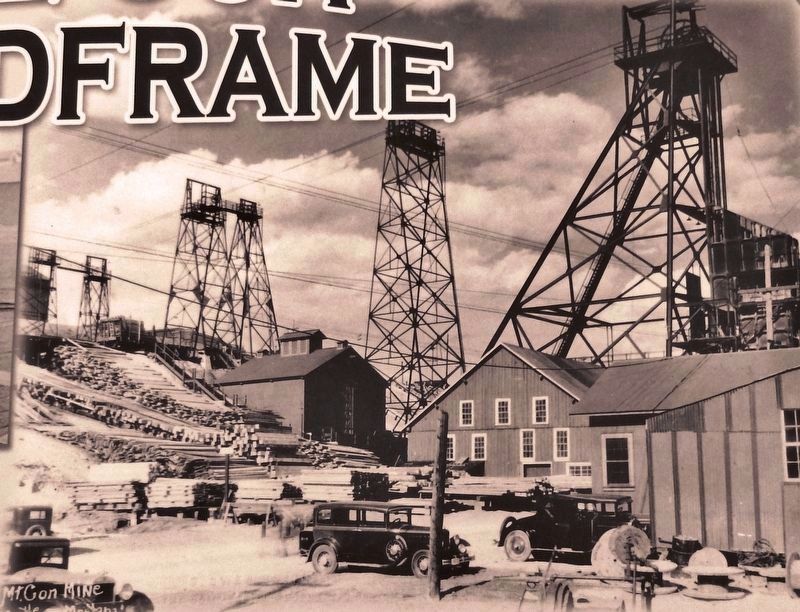
2. Marker detail: Mountain Consolidated Headframe, ca. 1935.
Large Steel cables looped over the massive sheave wheels (pulleys) on top of the Mount Con headframe (the largest structure to the right above), connecting the hoist to the man cages and ore skips suspended over the mineshaft.
Other nearby markers. At least 8 other markers are within walking distance of this marker: Welcome! To the Top of the World (within shouting distance of this marker); The Steward (approx. 0.4 miles away); 611 North Main Street (approx. 0.4 miles away); Corby Residence (approx. 0.4 miles away); St. Mary's Church (approx. 0.4 miles away); Anaconda Road (approx. half a mile away); From The Ashes (approx. half a mile away); The Original (Mine) (approx. half a mile away). Touch for a list and map of all markers in Butte.
More about this marker. Marker is a large composite plaque, mounted horizontally on a waist-high post.
Related markers. Click here for a list of markers that are related to this marker. Butte-Anaconda National Historic Landmark District
Also see . . .
1. Mountain Consolidated Mine. The Mountain Con, or simply the "Con", is located in uptown Butte. It possesses the deepest shaft on the Butte Hill at 5380 feet. The headframe still stands. (Submitted on January 1, 2019, by Cosmos Mariner of Cape Canaveral, Florida.)
2. Mountain Consolidated Mine. This high-quality video features many exterior,
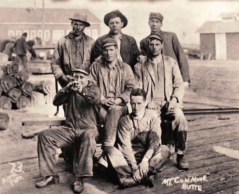
3. Marker detail: Miners
Photographed by Cosmos Mariner, July 18, 2016
4. The Con Headframe Marker (wide view; marker located beside fence, at far right)
Photographed by Cosmos Mariner, July 18, 2016
5. The Con Headframe (view looking up from marker)
Photographed by Cosmos Mariner, July 18, 2016
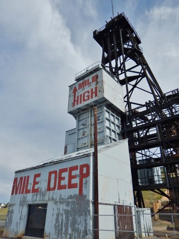
6. "One Mile High - One Mile Deep"
Credits. This page was last revised on December 20, 2020. It was originally submitted on January 1, 2019, by Cosmos Mariner of Cape Canaveral, Florida. This page has been viewed 976 times since then and 48 times this year. Photos: 1, 2, 3, 4, 5, 6. submitted on January 1, 2019, by Cosmos Mariner of Cape Canaveral, Florida. • Andrew Ruppenstein was the editor who published this page.
