
Bowling Green in Warren County, Kentucky — The American South (East South Central)
McFadin's Station
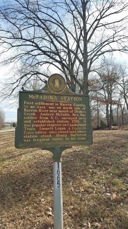
Photographed by Dave, January 7, 2019
1. McFadin's Station Marker
Erected 1979 by Kentucky Historical Society, Kentucky Department of Highways. (Marker Number 1665.)
Topics and series. This historical marker is listed in these topic lists: Settlements & Settlers • War, US Revolutionary. In addition, it is included in the Kentucky Historical Society series list. A significant historical year for this entry is 1785.
Location. 36° 59.685′ N, 86° 21.434′ W. Marker is in Bowling Green, Kentucky, in Warren County. It is on Porter Pike (Kentucky Route 1402). Touch for map. Marker is in this post office area: Bowling Green KY 42103, United States of America. Touch for directions.

Regionally, this marker is in Kentucky’s Pennyroyal Region. It is also in the American Midwest, in the South, and specifically in the Upper South. Globally, it is in North America, the Western Hemisphere, the Western World, and the Anglosphere. Historically, it finds itself in what was once the territory of the Mississippian Culture and also the Antebellum South.
Other nearby markers. At least 8 other markers are within 4 miles of this marker, measured as the crow flies: National Corvette Museum Sinkhole Rock (approx. 1.1 miles away); Home/Office of Duncan Hines 1941-1959 (approx. 2.4 miles away); Confederate Monument of Bowling Green (approx. 3.4 miles away); The Confederate Monument (approx. 3.4 miles away); Home of Thomas Hines (approx. 3½ miles away); Baker Hill (approx. 3.6 miles away); College Street Bridge
this page online
Credits. This page was last revised on January 8, 2019. It was originally submitted on January 4, 2019, by Dave of Spence, Kentucky. This page has been viewed 824 times since then and 63 times this year. Photo 1. submitted on January 7, 2019, by Dave of Spence, Kentucky. • Bill Pfingsten was the editor who published this page.
