Twin Bridges in Madison County, Montana — The American West (Mountains)
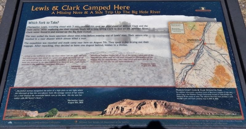
Lewis & Clark Camped Here
A Missing Note & A Side Trip Up the Big Hole River
Photographed by Cosmos Mariner, July 17, 2016
1. Lewis & Clark Camped Here Marker
Which Fork to Take?
Meriwether Lewis, traveling ahead with 3 men, reached this spot two days ahead of William Clark and the main parry. After exploring the river courses, Lewis left a note telling Clark to stay on the Jefferson River. Clark never found it and starred up the Big Hole instead.
The men pulled the boats upstream about nine miles before meeting one of Lewis’ men. Their return trip resulted in a near disaster which almost killed a man.
The expedition was reunited and made camp near here on August 7th. They spent a day drying out their baggage. After repacking, they decided to leave one dugout behind, hidden in a thicket.
”…arrived at the confluence of the two rivers where I left the note. this note had unfortunately been placed on a green pole which the beaver had cut and carried off together with the note; the possibility of such an occurrence never once occurred to me when I placed it on the green pole… Capt. Clark… ascended it (Big Hole River) with much difficulty…”
Meriwether Lewis
August 5th, 1805
”Whitehouse had been thrown out of one of the canoes… a great part of our most valuable
this page online
Meriwether Lewis
August 6th, 1805
”…the Indian woman recognized the point of a high plain to our right which she informed us was not very distant from the summer retreat of her nation on a river beyond the mountains which runs to the west, this she says here nation calls the beaver’s head…”
Meriwether Lewis
August 8th, 1805
marker background picture caption:
One of the most famous landmarks in Southwest Montana, named for its resemblance to the head of a swimming beaver.
Erected by Montana Lewis & Clark Bicentennial Commission and National Park Service, U.S. Department of the Interior.
Topics and series. This historical marker is listed in this topic list: Exploration. In addition, it is included in the Lewis & Clark Expedition series list. A significant historical date for this entry is August 7, 1805.
Location. 45° 35.737′ N, 112° 19.041′ W. Marker is in Twin Bridges, Montana, in Madison County. It is on State Highway 41 3.6 miles north
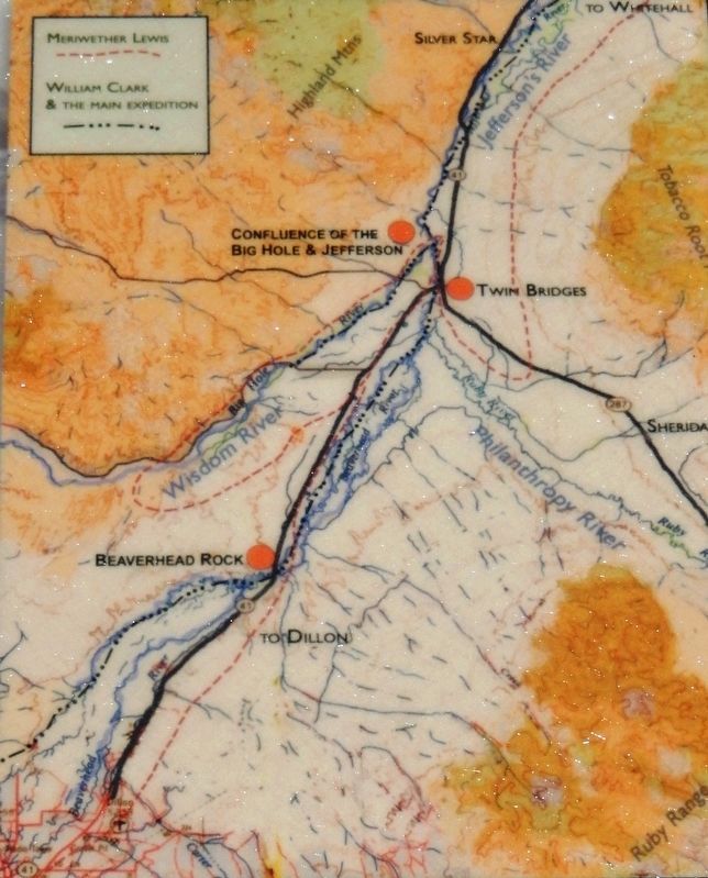
2. Marker detail: Madison County Lewis & Clark Interpretive Park
For additional information regarding Corps of Discovery activities in this area please stop at the Madison County Fairgrounds located in Twin Bridges on Highway 41 just south of town. The adjacent Riverside Park provides a walk through Lewis & Clark camping areas in 1805 & 1806.

Regionally, this marker is in Southwest Montana, in Gold West Country, in Mining Country and in Greater Bozeman. It is also in the American Mountain West and in the Lewis & Clark Corridor. Globally, it is in North America, the Rocky Mountains, the Western Hemisphere, the Western World, and the Anglosphere. Historically, it finds itself in what was once Rupert’s Land and also the Louisiana Purchase.
Other nearby markers. At least 8 other markers are within 4 miles of this marker, measured as the crow flies: The Jefferson Valley (here, next to this marker); The Trail of Lewis & Clark (approx. 3½ miles away); Road Agent Trail (approx. 3.6 miles away); Sacajawea, "Pomp" and Seaman (approx. 3.7 miles away); Jefferson River - Beaverhead River (approx. 3.7 miles away); Which way did they go? (approx. 3.7 miles away); Recognizing her people's land
Photographed by Cosmos Mariner, July 17, 2016
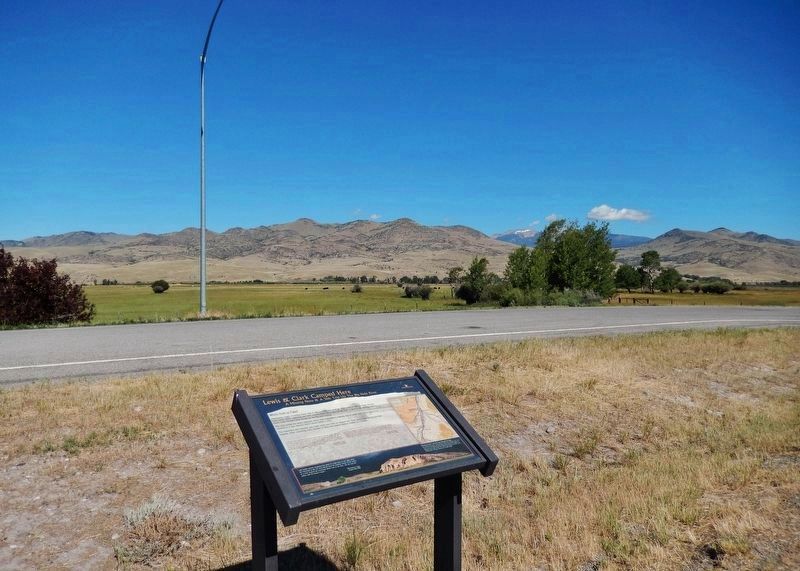
3. Lewis & Clark Camped Here Marker (wide view; looking east across Montana Highway 41)
Tobacco Root Mountain Range in distant background.
More about this marker. Marker is a large, framed composite plaque, mounted horizontally on waist-high metal posts.
Also see . . . Beaverhead Rock - Sacagawea's landmark. On August 8, 1805, near today's town of Twin Bridges, Montana, the men were tediously poling their canoes up the river they called Jefferson's, which was becoming ever more "crooked with Short bends a fiew Islands and maney gravelly Sholes." That evening, Sacagawea shed the light of hope on the prospect of finally meeting her people, and securing horses for the portage over the mountains to the headwaters of the Columbia... (Submitted on January 8, 2019, by Cosmos Mariner of Cape Canaveral, Florida.)
Credits. This page was last revised on January 11, 2019. It was originally submitted on January 8, 2019, by Cosmos Mariner of Cape Canaveral, Florida. This page has been viewed 1,810 times since then and 198 times this year. Photos: 1, 2, 3. submitted on January 8, 2019, by Cosmos Mariner of Cape Canaveral, Florida. • Bill Pfingsten was the editor who published this page.
