St Katharine's & Wapping in Tower Hamlets in Greater London, England, United Kingdom — Northwestern Europe (the British Isles)
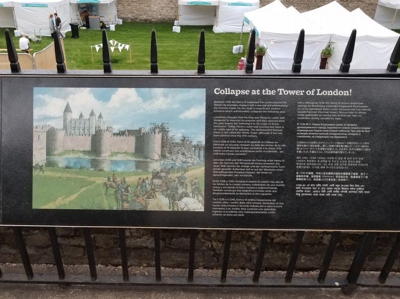
Collapse at the Tower of London!
Photographed by Michael Herrick, September 6, 2018
1. Collapse at the Tower of London! Marker
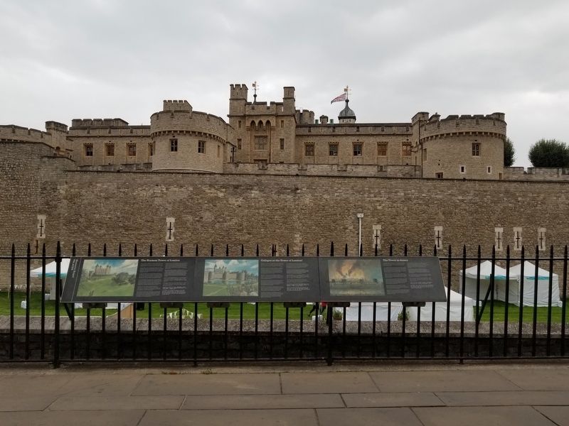
Between 1238-40 Henry III expanded the castle beyond the Roman city boundary, ringing it with a new wall and whitewashing the Norman tower. He also built a magnificent western entrance which unfortunately collapsed the following year.
Londoners thought that the king was filling his castle with dungeons to imprison his enemies and they rejoiced when the gate-towers fell, believing it to be a sign of divine retribution. Today, Henry's outer wall survives but there is no visible sign of his gateway. The whitewashed Norman tower is still called the White Tower' although it has not been painted since the 17th century.
Topics. This historical marker is listed in this topic list: Forts and Castles. A significant historical year for this entry is 1238.
Location. Marker has been permanently removed. It was located near 51° 30.562′ N, 0° 4.553′ W. Marker was in Tower Hamlets, England, in Greater London. It was in St Katharine's & Wapping. It could be reached from the intersection of Tower Hill and Trinity Square, on the left when traveling west. The marker stands at the Tower of London. Touch for map. Marker was in this post
this page online
We have been informed that this marker is no longer there and will not be replaced. This page is an archival view of what was.
Regionally, this marker was in the Greater South East. Globally, it was on the Atlantic Ocean, in the North Atlantic Region, in Europe, in Atlantic Europe, on one of the British Isles, in the Western World, and in the Anglosphere. Historically, it found itself in what was once the Roman Empire.

Other nearby markers. At least 8 other markers are within walking distance of this location: London Wall (within shouting distance of this marker); The Origins of the Tower (within shouting distance of this marker); A Place of Execution (within shouting distance of this marker); Wakefield Gardens (within shouting distance of this marker); The Tower Liberty (within shouting distance of this marker); Captured Cannon (about 90 meters away, measured in a direct line); The Waterloo Battery (about 90 meters away); On Guard (about 90 meters away). Touch for a list and map of all markers in Tower Hamlets.
Other markers no longer nearby. The Tower in flames
Photographed by Michael Herrick, September 6, 2018
2. Collapse at the Tower of London! Marker
Credits. This page was last revised on September 23, 2026. It was originally submitted on January 9, 2019, by Michael Herrick of Southbury, Connecticut. This page has been viewed 628 times since then and 35 times this year. Last updated on September 23, 2026, by Ian Lefkowitz of New York, New York. Photos: 1, 2. submitted on January 9, 2019, by Michael Herrick of Southbury, Connecticut. • Devry Becker Jones was the editor who published this page.
