Pleasant Hill in Pike County, Illinois — The American Midwest (Great Lakes)
Site of First Building in Pleasant Hill
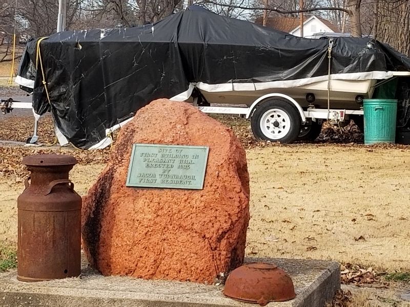
Photographed by Emily Pursley, December 30, 2018
1. Site of First Building in Pleasant Hill Marker
Topics. This historical marker is listed in this topic list: Settlements & Settlers. A significant historical year for this entry is 1836.
Location. 39° 26.783′ N, 90° 52.333′ W. Marker is in Pleasant Hill, Illinois, in Pike County. It is at the intersection of West Bluff Street and Harman Street, on the right when traveling north on West Bluff Street. This is at the corner of a private residence's lawn and there is not a good place to pull over or park to view, but it is easily seen from the road. Touch for map. Marker is in this post office area: Pleasant Hill IL 62366, United States of America. Touch for directions.

Regionally, this marker is in the Illinois River Valley. It is also in the American Midwest, in the Corn Belt, and in the Great River Road Region. Globally, it is in North America, the Western Hemisphere, the Western World, and the Anglosphere. Historically, it finds itself in what was once the territory of the Mississippian Culture and also the Northwest Territory.
Other nearby markers. At least 8 other
this page online
Photographed by Unknown, circa unknown
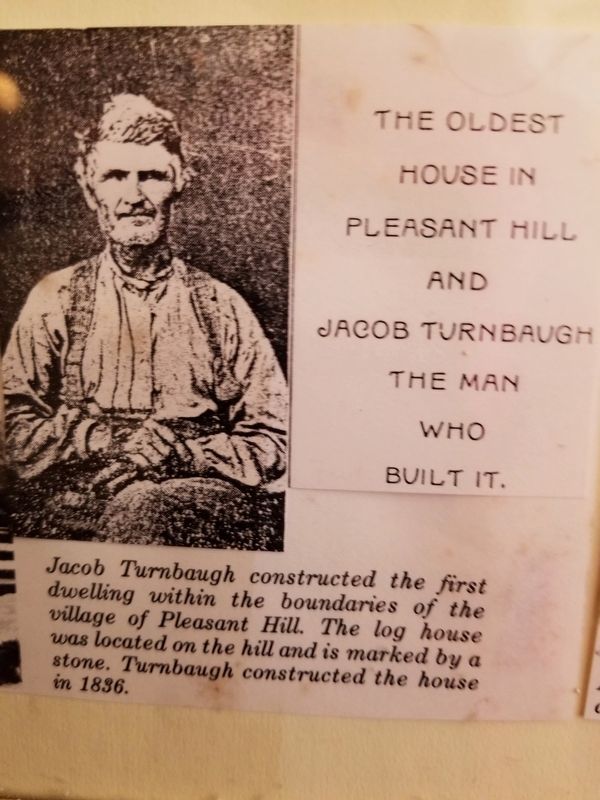
2. Jacob Turnbaugh
Photo courtesy of Pike County Historical Society.
Photographed by Unknown, circa unknown
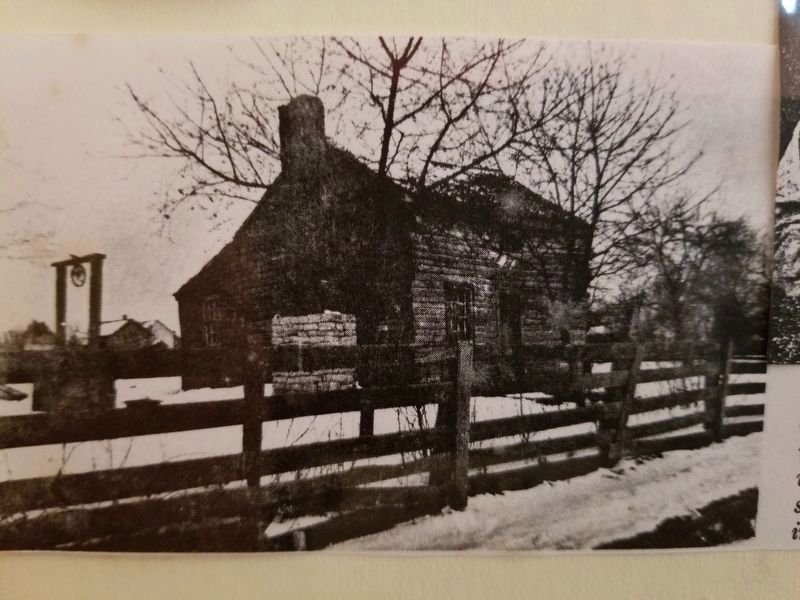
3. First Building in Pleasant Hill
Photo courtesy of Pike County Historical Society.
Credits. This page was last revised on August 10, 2019. It was originally submitted on January 14, 2019, by Emily Pursley of Pittsfield, Illinois. This page has been viewed 592 times since then and 53 times this year. Photos: 1. submitted on January 14, 2019, by Emily Pursley of Pittsfield, Illinois. 2, 3. submitted on July 30, 2019, by Emily Pursley of Pittsfield, Illinois. • Bill Pfingsten was the editor who published this page.
