Poipu in Kauai County, Hawaii — Hawaiian Island Archipelago (Pacific Ocean)
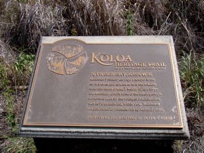
Pu‘uwanawana Volcanic Cone
Kōloa Heritage Trail — Ka Ala Hele Waiwai Ho‘olina o Kōloa
— Preserving the Heritage of Po‘ipū & Kōloa —
Erected by Po‘ipū Beach Foundation. (Marker Number 9.)
Topics. This historical marker is listed in these topic lists: Natural Features • Natural Resources.
Location. 21° 52.896′ N, 159° 26.94′ W. Marker is near Poipu, Hawaii, in Kauai County. Marker is on Ala Kinolike Highway north of Poipu Road, on the right when traveling north. Touch for map. Marker is in this post office area: Koloa HI 96756, United States of America. Touch for directions.
Other nearby markers. At least 8 other markers are within 2 miles of this marker, measured as the crow flies. Hapa Road (approx. 0.6 miles away); Po‘ipū Beach Park (approx. 0.6 miles away); Kihāhouna Heiau (approx. ¾ mile away); Keoneloa Bay (approx. ¾ mile away); Sacred Fishing Grounds (approx. ¾ mile away); Pā‘ū a Laka (Moir Gardens) (approx. 0.8 miles away); Makawehi & Pā‘ā Dunes (approx. 0.9 miles away); Hanaka‘ape Bay & Kōloa Landing (approx. 1.3 miles away). Touch for a list and map of all markers in Poipu.
Related marker. Click here for another marker that is related to this marker. It is the first of the Kōloa Heritage Trail markers, and has a link to a list of all Kōloa Heritage Trail markers.

Photographed By J. J. Prats, October 18, 2008
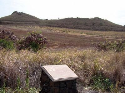
2. The Pu‘uwanawana Volcanic Cone
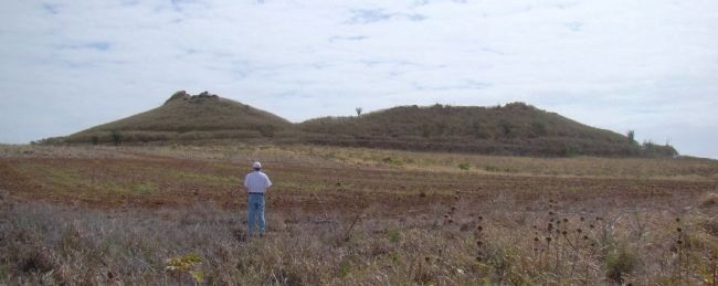
The circular ridge in the distance is the remains of the edge of the cone. The ground drops down inside the ridge into the caldera. Examine its size by using the map link on this page and then switching to the satellite view. The cone and its caldera is covered in tall scrub and cactus.
Credits. This page was last revised on February 10, 2023. It was originally submitted on October 23, 2008, by J. J. Prats of Powell, Ohio. This page has been viewed 2,341 times since then and 96 times this year. Photos: 1, 2, 3. submitted on October 23, 2008, by J. J. Prats of Powell, Ohio.

