South Columbus in Grove City in Franklin County, Ohio — The American Midwest (Great Lakes)
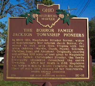
The Borror Family
Jackson Township Pioneers
⎯⎯⎯
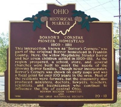
Borror's Corners
Pioneer Homestead 1809 - 1811
Photographed by William Fischer, Jr., October 23, 2008
1. The Borror Family, Jackson Township Pioneers Marker
The Borror Family. Jackson Township Pioneers. In 1809-1811, Magdalene Strader Borror, widow of Revolutionary War veteran Jacob Borror, Jr., moved to this area from Virginia with her seven children (Martin, Jacob, Myomi, Solomon, Christine, Issac, and Absalom). Originally clearing and settling 400 acres of land given to Magdalene by her father, Christopher Strader, the family eventually prospered throughout the entire township. After her death in 1838, Magdalene was buried in nearby Scioto Cemetery, the resting place of more than seventy of her descendants.
Borror's Corners. Pioneer Homestead 1809-1811. This intersection, known as "Borror's Corners," was part of the original Borror homestead in Franklin County. Here, the widow Magdalene Strader Borror and her seven children settled in 1809-1811. As the region prospered, a school, store, and several churches were built to meet the needs of the growing Borror families. Though never incorporated, Borror's Corners was shown on early maps and was a focal point for over 100 years in the area. Most of the residents were farmers, but the community also produced ministers, doctors,
this page online
Erected 1996 by Borror Reunion Committee and The Ohio Historical Society. (Marker Number 20-25.)
Topics and series. This historical marker is listed in these topic lists: Settlements & Settlers • War, US Revolutionary. In addition, it is included in the Ohio Historical Society / The Ohio History Connection series list. A significant historical year for this entry is 1838.
Location. 39° 49.525′ N, 83° 1.938′ W. Marker is in Grove City, Ohio, in Franklin County. It is in South Columbus. It is at the intersection of London-Groveport Road (Ohio Route 665) and Jackson Pike ( Route 104), on the left when traveling east on London-Groveport Road. Touch for map. Marker is in this post office area: Grove City OH 43123, United States of America. Touch for directions.

Regionally, this marker is in the Scioto Valley and in the Columbus Metropolitan Area. It is also in the American Midwest and in the Corn Belt. Globally, it is in North America, the Western Hemisphere, the Western World, and the Anglosphere. Historically, it finds
Photographed by William Fischer, Jr., October 23, 2008
2. Borror's Corners Pioneer Homestead 1809 - 1811 Marker
Other nearby markers. At least 8 other markers are within 4 miles of this marker, measured as the crow flies: Archaeological Site (approx. 2.9 miles away); Ohio & Erie Canal (approx. 3.4 miles away); Ohio-Erie Canal and Locks / The Columbus Feeder Canal (approx. 3.4 miles away); a different marker also named Ohio-Erie Canal and Locks / The Columbus Feeder Canal (approx. 3.4 miles away); a different marker also named Lockbourne Veterans Memorial (approx. 3.6 miles away); Laura Mae Ross (approx. 3.6 miles away); Historic Lockbourne (approx. 3.6 miles away); Wray (approx. 3.7 miles away). Touch for a list and map of all markers in Grove City.
Another marker is no longer nearby. Lockbourne Veterans' Memorial (was approx. 3.4 miles away but has been permanently removed).
More about this marker. Marker number reads "20-18" in error. Marker # 20-18 is for The Berea Triangle Marker in Berea, Ohio, over 130 miles away.
Photographed by William Fischer, Jr., October 23, 2008
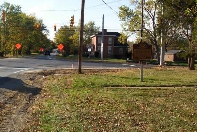
3. The Borror Family / Borror's Corners Marker
Looking west.
Photographed by Craig Doda, April 3, 2026
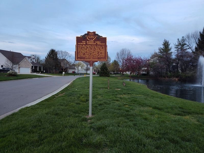
4. The Borror Family / Borror's Corners Marker
Credits. This page was last revised on April 8, 2026. It was originally submitted on October 23, 2008, by William Fischer, Jr. of Reynoldsburg, Ohio. This page has been viewed 4,378 times since then and 194 times this year. Photos: 1, 2, 3. submitted on October 23, 2008, by William Fischer, Jr. of Reynoldsburg, Ohio. 4. submitted on April 4, 2026, by Craig Doda of Napoleon, Ohio. • Kevin W. was the editor who published this page.
