Battle in East Sussex, England, United Kingdom — Northwestern Europe (the British Isles)
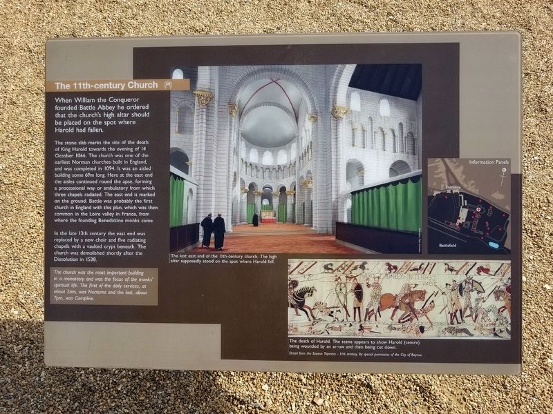
The 11th-century Church
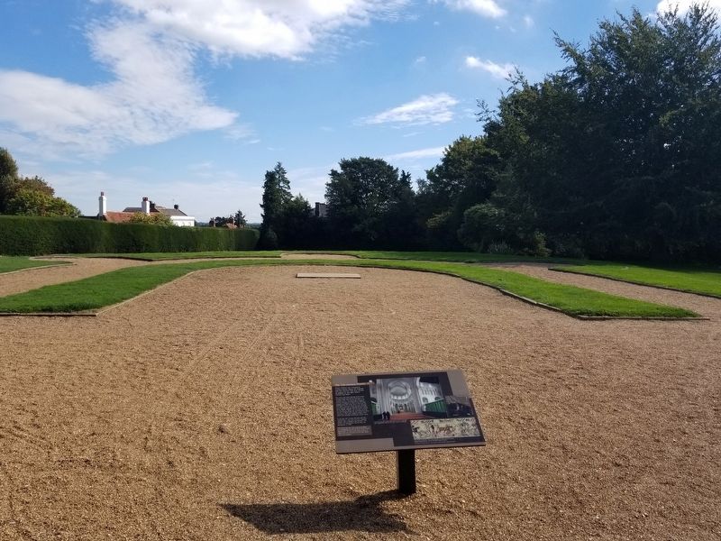
The stone slab marks the site of the death of King Harold towards the evening of 14 October 1066. The church was one of the earliest Norman churches built in England, and was completed in 1094. It was an aisled building some 69m long. Here at the east end the aisles continued round the apse, forming a processional way or ambulatory from which three chapels radiated. The east end is marked on the ground. Battle was probably the first church in England with this plan, which was then common in the Loire valley in France, from where the founding Benedictine monks came.
In the late 13th century the east end was replaced by a new choir and five radiating chapels with a vaulted crypt beneath. The church was demolished shortly after the Dissolution in 1538.
The church was the most important building in a monastery and was the focus of the monks' spiritual life. The first of the daily services, at about 2am, was Nocturns and the last, about 7pm, was Compline.
( photo captions )
- The lost east end of the 11th-century church. The high altar supposedly stood on the spot where Harold fell.
- The death of Harold. The scene appears to show Harold (centre) being wounded by an arrow and the being cut down.
Detail from the Bayeux Tapestry - 11th century. By special permission of the City of Bayeux.
Topics. This historical marker is listed in these topic lists: Churches & Religion • Notable Events. A significant day of the year for for this entry is October 14.
Location. 50° 54.871′ N, 0° 29.254′ E. Marker is in Battle, England, in East Sussex. Marker can be reached from the intersection of High Street and Park Lane, on the right when traveling south. Located next to Battle Abbey along the battlefield path at the Battle of Hastings Battlefield. Touch for map. Marker is in this post office area: Battle, England TN33 0AD, United Kingdom. Touch for directions.
Other nearby markers. At least 8 other markers are within walking distance of this marker. The High Altar of Battle Abbey (a few steps from this marker); The Cloister (a few steps from this marker); The Chapter House (within shouting distance of this marker); Parlour (within shouting distance of this marker); The Dormitory (within shouting distance of this marker); The Refectory (within shouting distance of this marker); Rebuilding the Abbey Church (within shouting distance of this marker); Dairy and Icehouse (within shouting distance of this marker). Touch for a list and map of all markers in Battle.
Also see . . . English Heritage - 1066 Battle of Hastings, Abbey and Battlefield. (Submitted on January 30, 2019, by Michael Herrick of Southbury, Connecticut.)
Credits. This page was last revised on January 27, 2022. It was originally submitted on January 30, 2019, by Michael Herrick of Southbury, Connecticut. This page has been viewed 270 times since then and 8 times this year. Photos: 1, 2. submitted on January 30, 2019, by Michael Herrick of Southbury, Connecticut.

