St. Ignace in Mackinac County, Michigan — The American Midwest (Great Lakes)
The Chief Dock
St. Ignace Downtown History
Inscription.
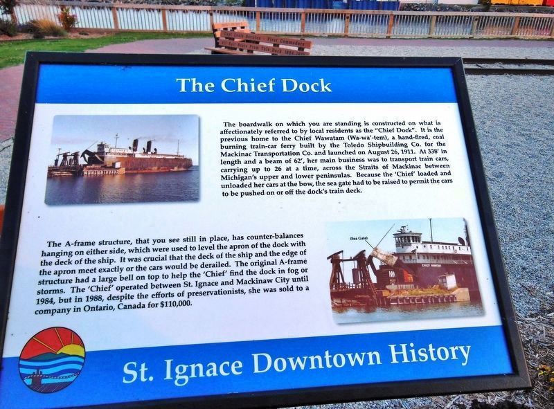
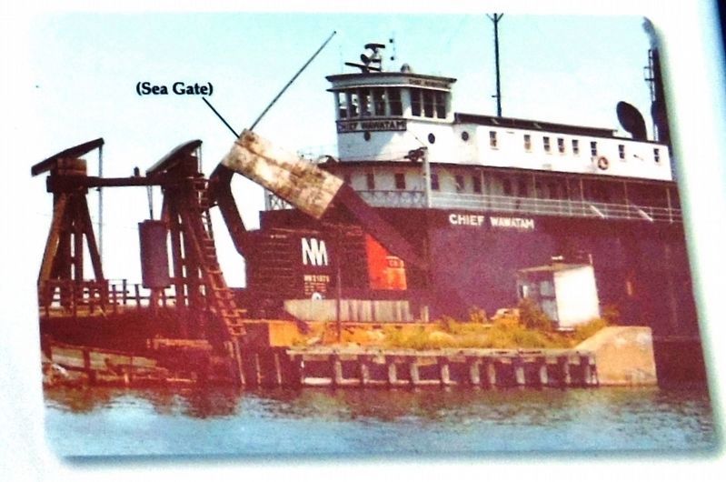
The boardwalk on which you are standing is constructed on what is affectionately referred to by local residents as the "Chief Dock". It is the previous home to the Chief Wawatam (Wa-wa'-tem), a hand-fired, coal burning train-car ferry built by the Toledo Shipbuilding Co. for the Mackinac Transportation Co. and launched on August 26, 1911. At 338’ in length and a beam of 62', her main business was to transport train cars, carrying up to 26 at a time, across the Straits of Mackinac between Michigan's upper and lower peninsulas. Because the “Chief” loaded and unloaded her cars at the bow, the sea gate had to be raised to permit the cars to be pushed on or off the dock's train deck.
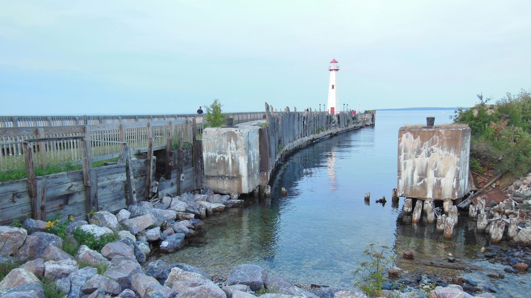
The A-frame structure, that you see still in place, has counter-balances hanging on either side, which were used to level the apron of the dock with the deck of the ship. It was crucial that the deck of the ship and the edge of the apron meet exactly or the cars would be derailed. The original A-frame structure had a large bell on top to help the “Chief” find the dock in fog or storms. The “Chief” operated between St. Ignace and Mackinaw City until 1984, but in 1988, despite the efforts of preservationists, she was sold to a company in Ontario, Canada for $110,000.
Topics. This historical marker is listed in these topic lists: Industry & Commerce • Railroads & Streetcars • Waterways & Vessels. A significant historical date for this entry is August 26, 1911.
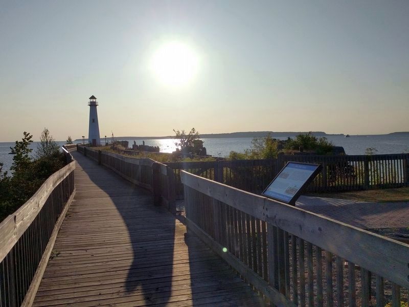
Location. 45° 51.934′ N, 84° 43.013′ W. Marker is in St. Ignace, Michigan, in Mackinac County. Marker can be reached from the intersection of North State Street (Business Interstate 75) and McCann Street, on the right when traveling north. Marker is located along the boardwalk, near the east end of Wawatam Park. Touch for map. Marker is in this post office area: Saint Ignace MI 49781, United States of America. Touch for directions.
Other nearby markers. At least 8 other markers are within walking distance of this marker. Antique Railroad Bell (a few steps from this marker); Mooring Facilities (a few steps from this marker); The Chief Dock Kiosk (within shouting distance of this marker); France at Mackinac (about 700 feet away, measured in a direct line); Heritage of Fishermen in this Area (about 800 feet away); Great Lakes Shipwrecks and Michigan's Underwater Preserves (about 800 feet away); State Ferries, 1923-1957 (approx. 0.2 miles away); Veterans Memorial (approx. 0.2 miles away). Touch for a list and map of all markers in St. Ignace.
More about this marker. Marker is a framed composite plaque, mounted horizontally on a waist-high metal post.
Also see . . . Chief Wawatam. The Chief was one of the last coal-fired ships on the lakes, and she was the last "hand-bomber" (i.e., hand-fired boiler) to sail. In 1965, the Chief's boilers had deteriorated to the point the tug John Purves was chartered to push the ferry back and forth across the straits. Only enough steam pressure to operate the winches and sea gate was produced. In August of 1984, the dock at St. Ignace collapsed and was not repaired, and the Chief had sailed for the last time. (Submitted on February 20, 2019, by Cosmos Mariner of Cape Canaveral, Florida.)
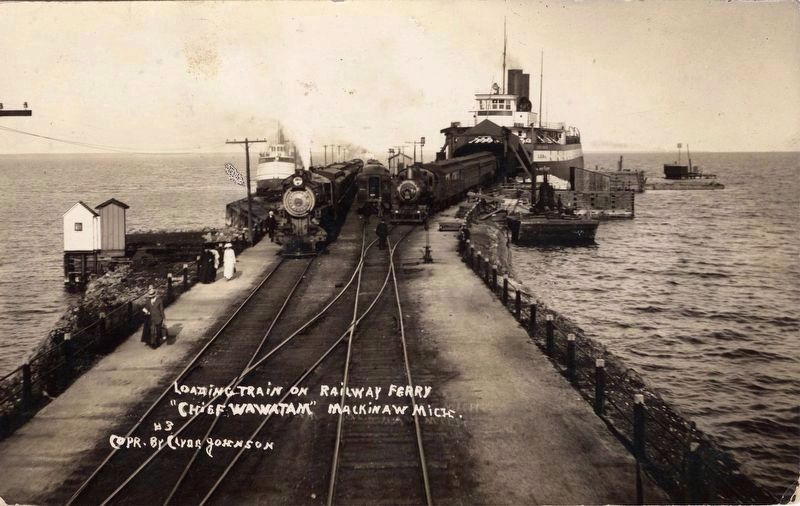
Clyde Johnson (courtesy of the Bentley Historical Library, University of Michigan), 1925
5. Loading train on "Chief Wawatam"
Note that the dock here is not the same as in the previous picture. Instead it is the counterpart of that one, located in Mackinaw, on the other side of the strait. However it is the subject ship, and it does illustrate the train loading process as described on the marker.
Credits. This page was last revised on September 25, 2019. It was originally submitted on February 19, 2019, by Cosmos Mariner of Cape Canaveral, Florida. This page has been viewed 179 times since then and 14 times this year. Photos: 1, 2. submitted on February 20, 2019, by Cosmos Mariner of Cape Canaveral, Florida. 3. submitted on September 24, 2019, by Joel Seewald of Madison Heights, Michigan. 4. submitted on February 20, 2019, by Cosmos Mariner of Cape Canaveral, Florida. 5. submitted on February 22, 2019. • Andrew Ruppenstein was the editor who published this page.
