St. Ignace in Mackinac County, Michigan — The American Midwest (Great Lakes)
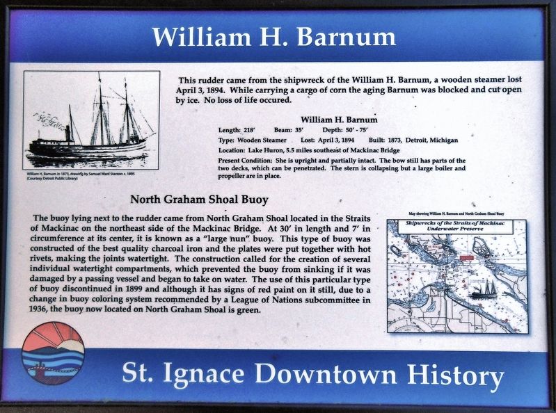
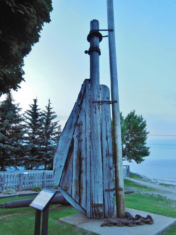
William H. Barnum
St. Ignace Downtown History
Length: 218' • Beam: 35’ • Depth: 50' - 75'
Type: Wooden Steamer • Lost: April 3, 1894
Built: 1873, Detroit, Michigan
Location: Lake Huron, 5.5 miles southeast of Mackinac Bridge
Present Condition: She is upright and partially intact. The bow still has parts of the two decks, which can be penetrated. The stern is collapsing but a large boiler and propeller are in place.
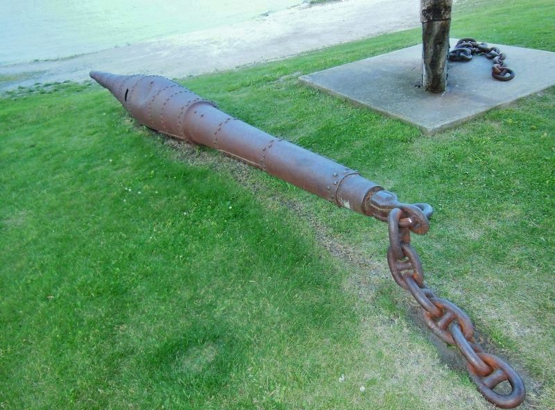
North Graham Shoal Buoy
The buoy lying next to the rudder came from North Graham Shoal located in the Straits of Mackinac on the northeast side of the Mackinac Bridge. At 30' in length and 7' in circumference at its center, it is known as a "large nun" buoy. This type of buoy was constructed of the best quality charcoal iron and the plates were put together with hot rivets, making the joints watertight. The construction called for the creation of several individual watertight compartments, which prevented the buoy from sinking if it was damaged by a passing vessel and began to take on water. The use of this particular type of buoy discontinued in 1899 and although it has signs of red paint on it still, due to a change in buoy coloring system recommended by a League of Nations subcommittee in 1936, the buoy now located on North Graham Shoal is green.
(inset captions)
• William H. Barnum in 1873, drawing by Samuel Ward Stanton c. 1895 (Courtesy Detroit Public Library)
• Map showing William H. Barnum and North Graham Shoal Buoy, Shipwrecks of the Straits of Mackinac Underwater Preserve
Topics. This historical marker is listed in this topic list: Waterways & Vessels. A significant historical date for this entry is April 3, 1894.
Location. 45° 52.028′ N, 84° 43.288′ W. Marker is in St. Ignace, Michigan, in Mackinac County. Marker is on North State Street (Business Interstate 75) south of East Truckey Street, on the right when traveling north. Marker is located in a small roadside park on the north side of the St. Ignace Marina, adjacent to the subject William H. Barnum rudder exhibit. Touch for map. Marker is at or near this postal address: 7 North State Street, Saint Ignace MI 49781, United States of America. Touch for directions.
Other nearby markers. At least 8 other markers are within walking distance of this marker. People and the Great Lakes (about 300 feet away, measured in a direct line); State Ferry Service (about 500 feet away); State Ferries, 1923-1957 (about 500 feet away); Heritage of Fishermen in this Area (about 600 feet away); St. Ignace (about 700 feet away); Michigan State Ferry (about 700 feet away); Diving into History (about 800 feet away); France at Mackinac (approx. 0.2 miles away). Touch for a list and map of all markers in St. Ignace.
More about this marker. Marker is a framed composite plaque, mounted horizontally on waist-high metal posts.
Related markers. Click here for a list of markers that are related to this marker. William H. Barnum Shipwreck
Also see . . . William H. Barnum Shipwreck. The heavy weather and grinding ice in the Straits proved to be to much for the Barnum and she started taking on water. The tug Crusader came to her rescue and tried to move her into shallow water, but her efforts were also halted by the ice. The Crusader took the crew of the Barnum and they watched her vanish beneath the ice and waves on the morning of April 3, 1894. Her propeller is still visible through the wreckage. (Submitted on February 20, 2019, by Cosmos Mariner of Cape Canaveral, Florida.)
Credits. This page was last revised on August 17, 2020. It was originally submitted on February 20, 2019, by Cosmos Mariner of Cape Canaveral, Florida. This page has been viewed 257 times since then and 10 times this year. Photos: 1, 2, 3. submitted on February 20, 2019, by Cosmos Mariner of Cape Canaveral, Florida. • Andrew Ruppenstein was the editor who published this page.


