New Oxford in Adams County, Pennsylvania — The American Northeast (Mid-Atlantic)
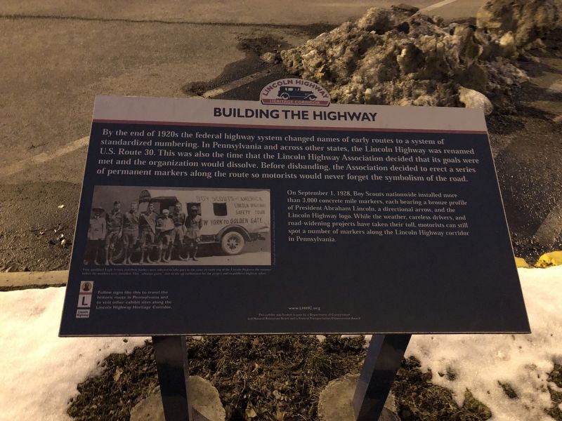
Building the Highway
Lincoln Highway Heritage Corridor
On September 1, 1928, Boy Scouts nationwide installed more than 3,000 concrete mile markers, each bearing a bronze profile of President Abraham Lincoln, a directional arrow, and the Lincoln Highway logo. While the weather, careless drivers, and road-widening projects have taken their toll, motorists can still spot a number of markers along the Lincoln Highway corridor in Pennsylvania.
Topics and series. This historical marker is listed in these topic lists: Charity & Public Work • Roads & Vehicles. In addition, it is included in the Lincoln Highway series list. A significant historical date for this entry is September 1, 1928.
Location. 39° 51.817′ N, 77° 3.376′ W. Marker is in New Oxford, Pennsylvania, in Adams County. Marker is at the intersection of Center Square (U.S. 30) and Lincoln Way West (U.S. 30), on the right when traveling east on Center Square. Touch for map. Marker is at or near this postal address: 19 Center Square, New Oxford PA 17350, United States of America. Touch for directions.
Other nearby markers. At least 8 other markers are within walking distance of this marker. World War II Veterans of New Oxford (within shouting distance of this marker); Theo. Pfeiffer (within shouting distance of this marker); New Oxford Veterans Memorial (within shouting distance of this marker); Kuhn Tavern (within shouting distance of this marker); Gettysburg Campaign (approx. 0.2 miles away); Road Versus Rail (approx. 0.2 miles away); Fill 'Er Up (approx. 0.4 miles away); New Oxford (approx. 0.4 miles away). Touch for a list and map of all markers in New Oxford.
Credits. This page was last revised on February 26, 2019. It was originally submitted on February 24, 2019, by Devry Becker Jones of Washington, District of Columbia. This page has been viewed 181 times since then and 15 times this year. Photo 1. submitted on February 24, 2019, by Devry Becker Jones of Washington, District of Columbia. • Andrew Ruppenstein was the editor who published this page.
Editor’s want-list for this marker. Clear, daylight photos of the marker and its context. • Can you help?
