Alton in Kane County, Utah — The American Mountains (Southwest)
Town of Alton
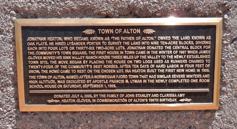
The town of Alton, named after a Norwegian fjord town that had similar severe winters and high altitude, was dedicated by Apostle Francis M. Lyman in the newly completed one room school house on Saturday, September 1, 1908.
Heaton Glover, in commemoration of Alton’s 100th birthday.
Erected 2008 by The family of John Stanley and Clarissa Amy Heaton Glover.
Topics. This historical marker is listed in this topic list: Settlements & Settlers. A significant historical date for this entry is September 1, 1908.
Location. 37° 26.744′ N, 112° 29.259′ W. Marker is in Alton, Utah, in Kane County. Marker is on Alton Road (County Road 10) 3.3 miles east of U.S. 89, on the right when traveling east. Marker is located in a pull-out on the south side of the highway, as you approach Alton from the east. Touch for map. Marker is in this post office area: Alton UT 84710, United States of America. Touch for directions.
Other nearby markers. At least 8 other markers are within 15 miles of this marker, measured as the crow flies. United Order Woolen Mill (approx. 9.7 miles away); Asay Settlement (approx. 9.9 miles away); Glendale Orientation Center (approx. 10.6 miles away); Millstones (approx. 10.6 miles away); The Berry Family (approx. 10.7 miles away); Glendale (approx. 10.8 miles away); People of the Land (approx. 14.2 miles away); Orderville Bell (approx. 14.3 miles away).
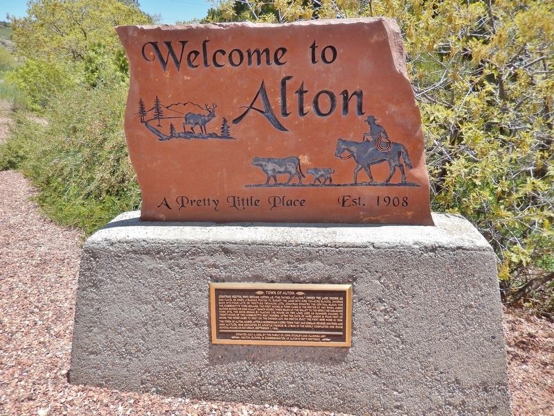
More about this marker. Marker is a rectangular, embossed metal tablet, mounted at ankle-level on a concrete pedestal, below the "Welcome to Alton" sign.
Also see . . . History of Alton, Utah. Alton's earliest name was Roundys Station after Lorenzo Wesley Roundy and his family. Roundy built two log cabins there but was forced to abandon his ranch site because he was having trouble with the Indians. He drowned in 1876 while ferrying supplies across the Colorado River. The site was later named Graham for Graham Duncan MacDonald, a pioneer of nearby Ranch. MacDonald was a bookkeeper for an adjacent sawmill; he also helped haul lumber for the construction of the St. George Mormon temple. As time passed, various names were discussed, but none were accepted until a drawing was held at a community social in 1912. Among the names put into a hat for the drawing was one suggested by Charles R. Pugh who had been reading a book about the Alton Fjord in Norway, known for the height of its surrounding mountains. A two-year-old child drew the name from the hat. (Submitted on March 5, 2019, by Cosmos Mariner of Cape Canaveral, Florida.)
Credits. This page was last revised on March 6, 2019. It was originally submitted on March 5, 2019, by Cosmos Mariner of Cape Canaveral, Florida. This page has been viewed 264 times since then and 39 times this year. Photos: 1, 2. submitted on March 5, 2019, by Cosmos Mariner of Cape Canaveral, Florida. • Andrew Ruppenstein was the editor who published this page.

