Fillmore in Ventura County, California — The American West (Pacific Coastal)
317 Central Avenue
Stephen's Grocery Store
Photographed by James King, October 9, 2014
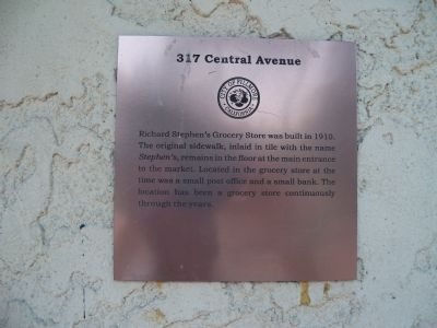
1. 317 Central Avenue Marker
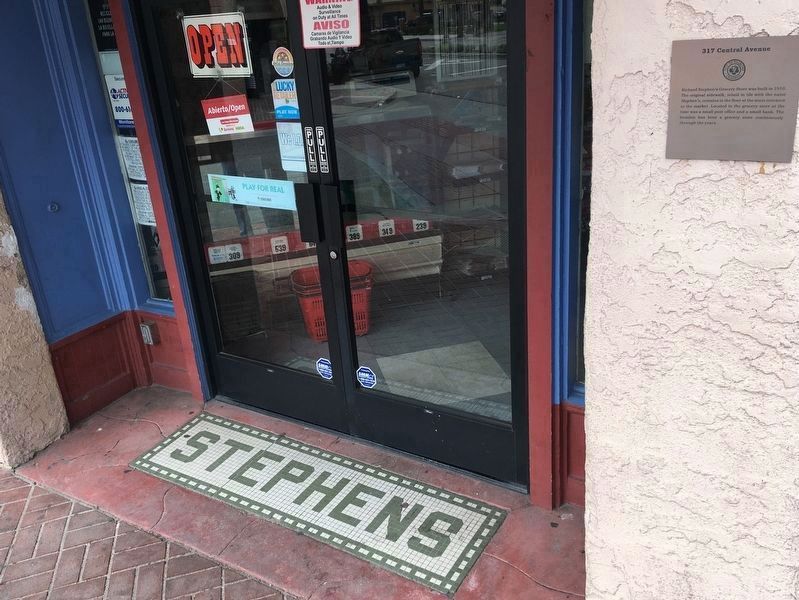
Richard Stephen's Grocery Store was built in 1910. The original sidewalk, inlaid in tile with the name Stephen's remains in the floor at the main entrance to the market. Located in the grocery store at the time was a small post office and a small bank. The location has been a grocery store continuously through the years.
Erected by City of Fillmore.
Topics. This historical marker is listed in this topic list: Industry & Commerce. A significant historical year for this entry is 1910.
Location. 34° 23.953′ N, 118° 54.82′ W. Marker is in Fillmore, California, in Ventura County. It is at the intersection of Central Avenue and Main Street, on the left when traveling north on Central Avenue. Touch for map. Marker is at or near this postal address: 317 Central Avenue, Fillmore CA 93015, United States of America. Touch for directions.

Regionally, this marker is in Greater Los Angeles, on the Central Coast, and in the Transverse Ranges. It is also on the American Pacific Coast. Globally, it is in North America, on the Ring of Fire, in the Pacific Rim, in the Western Hemisphere, in the Western World, and in the
this page online
Other nearby markers. At least 8 other markers are within walking distance of this marker: Fillmore State Bank (a few steps from this marker); 320 Central Avenue (within shouting distance of this marker); 328 Central Avenue (within shouting distance of this marker); 338 Central Avenue (within shouting distance of this marker); 340 Central Avenue (within shouting distance of this marker); Fillmore's First Bank & Masonic Hall (about 400 feet away); 362 Central Avenue (about 500 feet away); 364 Central Avenue (about 500 feet away). Touch for a list and map of all markers in Fillmore.
Another marker is no longer nearby. 348 Central Avenue (was about 300 feet away, measured in a direct line but has been confirmed missing).
Photographed by Craig Baker, March 23, 2019
2. Marker and Original Sidewalk - 2019

Photographed by Craig Baker, January 20, 2024
3. Original Sidewalk Destroyed
The historic tile floor has been vandalized by a new owner.
Photographed by James King, October 9, 2014
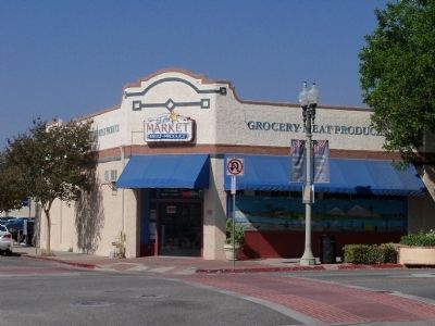
4. Stephen's Market Building
Credits. This page was last revised on October 14, 2024. It was originally submitted on October 12, 2014, by James King of San Miguel, California. This page has been viewed 631 times since then and 19 times this year. Last updated on March 24, 2019, by Craig Baker of Sylmar, California. Photos: 1. submitted on October 12, 2014, by James King of San Miguel, California. 2. submitted on March 24, 2019, by Craig Baker of Sylmar, California. 3. submitted on October 14, 2024, by Craig Baker of Sylmar, California. 4. submitted on October 12, 2014, by James King of San Miguel, California. • Andrew Ruppenstein was the editor who published this page.
