Near Gate in Beaver County, Oklahoma — The American South (West South Central)
No Man's Land
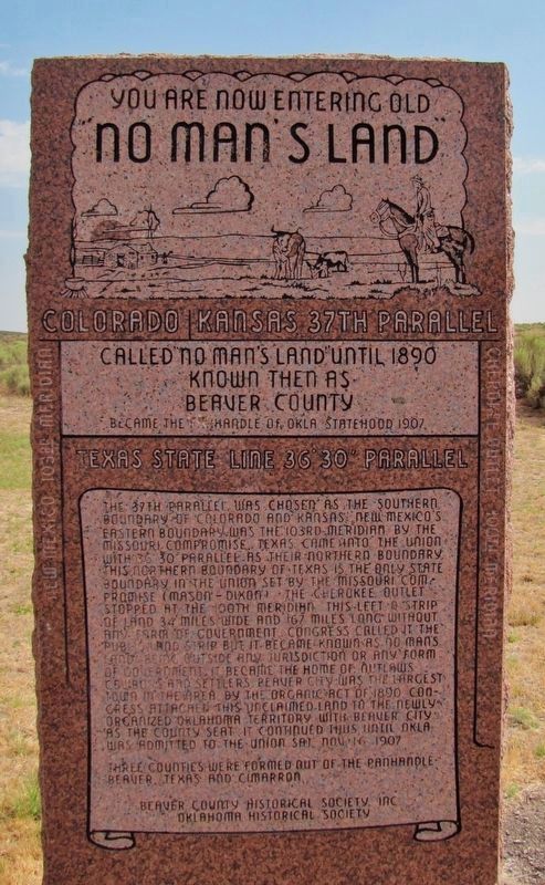
”No Man’s Land”
Colorado/Kansas • 37th Parallel
Texas State Line • 36° 30’ parallel
New Mexico • 103rd Meridian
Cherokee Outlet • 100th Meridian
Called “No Man’s Land” until 1890
Known then as
Beaver County
Became the Panhandle of Okla • Statehood 1907
The 37th parallel was chosen as the southern boundary of Colorado and Kansas. New Mexico's eastern boundary was the 103rd meridian by the Missouri Compromise. Texas came into the Union with 36° 30' parallel as their northern boundary. This northern boundary of Texas is the only state boundary in the Union set by the Missouri Compromise (Mason-Dixon). The Cherokee Outlet stopped at the 100th meridian. This left a strip of land, 34 miles wide and 167 miles long without any form of government. Congress called it the Public Land Strip but it became known as No Man's Land, being outside any jurisdiction or any form of government. It became the home of outlaws, cowboys and settlers. Beaver City was the largest town in the area. By the Organic Act of 1890, Congress attached this unclaimed land to the newly organized Oklahoma Territory with Beaver City as the County Seat. It continued thus until Oklahoma was admitted to the Union, Sat. Nov. 16, 1907.
Three counties were formed out of the Panhandle: Beaver, Texas, and Cimarron.
Oklahoma Historical Society
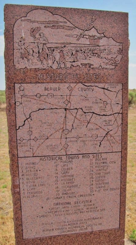
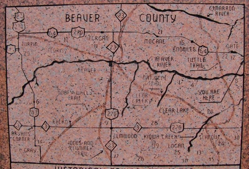
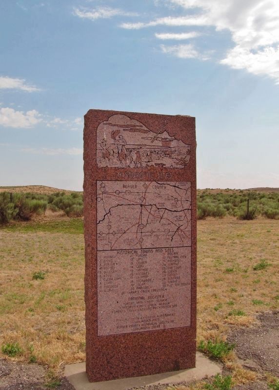
No Man’s Land • Historical Towns and Sites (nearby supplemental marker)
1. Alpine • 2. Balko • 3. Beaver • 4. Benton • 5. Bluegrass • 6. Boyd • 7. Clear Lake
8. Cline • 9. Elmwood • 10. Floris • 11. Forgan • 12. Gate • 13. Golden • 14. Gray • 15. Ivanhoe
16. Knowles • 17. La Kemp • 18. Lockwood • 19. Logan • 20 • Madison • 21. Mocane
22. Neutral City • 23. Rothwell • 24. Slapout • 25. Sod Town • 26. Sophia • 27. Sunset • 28. Surprise
29. Turpin • 30. Flat Top Mound • 31. Sharp’s Creek Crossing
National Register
• James Lane Cabin – Beaver
• Presbyterian Church – Beaver
• Sharp’s Creek Crossing Archeology Site
Beaver County Extension Homemakers (Organized 1917)
Beaver County Historical Society, Inc. (Organized 1969)
Erected by Beaver County Historical Society, Inc., and Oklahoma Historical Society.
Topics and series. This historical marker is listed in this topic list: Political Subdivisions. In addition, it is included in the Oklahoma Historical Society series list.
Location. 36° 50.282′ N,
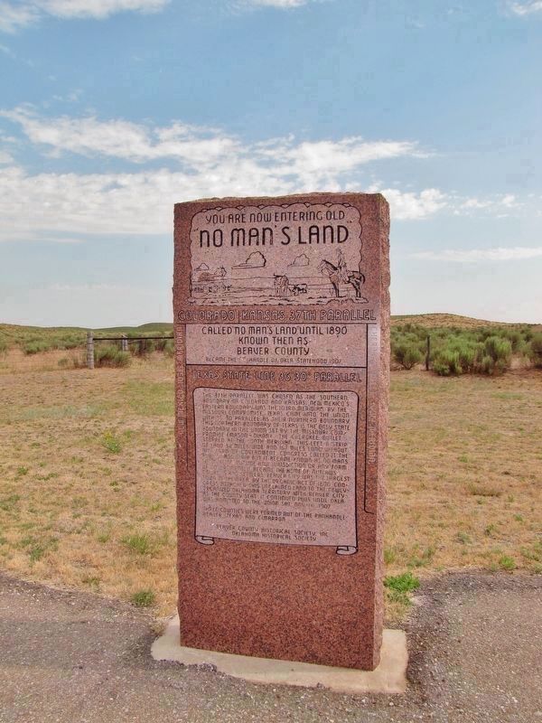
100° 0.225′ W. Marker is near Gate, Oklahoma, in Beaver County. Marker is at the intersection of U.S. 64 and N1680 Road, on the right when traveling east on U.S. 64. Marker and supplemental Historical Sites marker are located in a large pull-out on the south side of the highway, at the Beaver County/Harper County line. Touch for map. Marker is in this post office area: Gate OK 73844, United States of America. Touch for directions.
Also see . . .
1. The Secret History of the Oklahoma Panhandle. When the United States annexed Texas in 1845, the future Lone Star State was even larger than it is today, stretching all the way north into modern Wyoming. But the Missouri Compromise of 1820 had forbidden slavery north of the 36½th parallel, so Texas got its top chopped off. But the Kansas-Nebraska Act that created Kansas in 1854 used a different border: the 37th parallel, which had previously divided the Osage and Cherokee reservations in Indian Territory. There was a pesky 34-mile gap left over between Kansas and Texas. (Submitted on March 25, 2019, by Cosmos Mariner of Cape Canaveral, Florida.)
2. Oklahoma Panhandle: Badmen in No Man’s Land. To the east, the western line of the Cherokee Outlet was drawn at the 100th meridian, leaving a gap of just under 170 miles before you reached the New Mexico Territory line. In time, Congress officially referred to the area as the ‘Public Land Strip.’ Out West, though, men seldom called it anything but No Man’s Land. The first Anglo occupiers were mostly cattlemen, tough, adventurous types willing to fight anybody for free grass and water. (Submitted on March 25, 2019, by Cosmos Mariner of Cape Canaveral, Florida.)
Credits. This page was last revised on October 23, 2021. It was originally submitted on March 25, 2019, by Cosmos Mariner of Cape Canaveral, Florida. This page has been viewed 1,182 times since then and 223 times this year. Photos: 1, 2, 3, 4, 5. submitted on March 25, 2019, by Cosmos Mariner of Cape Canaveral, Florida.
