
San Luis Potosí, Mexico — The Northeast (and Central Highlands)
Pitman House
Photographed by J. Makali Bruton, March 16, 2019
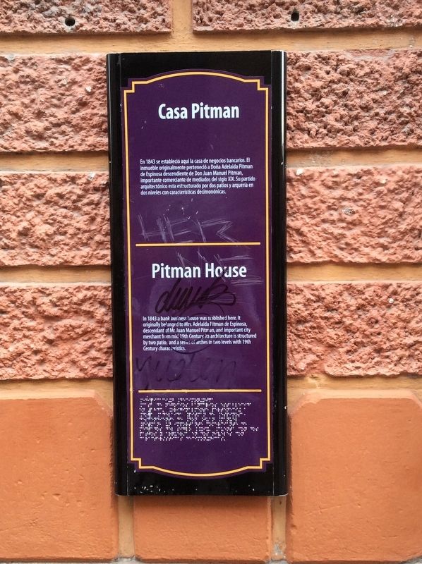
1. Pitman House Marker

En 1843 se estableció la casa de negocios bancarios. El inmueble originalmente perteneció a Doña Adelaida Pitman de Espinosa descendiente a Don Juan Manuel Pitman, importante comerciante de mediados del siglo XIX. Su partido arquitectónico esta estructurado por dos patios y arquería en dos niveles con características decimonónicas.
Pitman House
In 1843 a bank business house was established here. It originally belonged to Mrs. Adelaida Pitman de Espinosa, descendant of Mr. Juan Pitman, and important city merchant from mid 19th Century. Its architecture is structured by two patios, and a series of arches in two levels with 19th Century characteristics.
Topics. This historical marker is listed in these topic lists: Architecture • Industry & Commerce. A significant historical year for this entry is 1843.
Location. 22° 9.084′ N, 100° 58.535′ W. Marker is in San Luis Potosí. It is on Manuel José Othón just west of José María Morelos y Pavón, on the left when traveling west. Manuel José Othón is pedestrian-only in front of the Casa Pitman. Touch for map. Marker is in this post office area: San Luis Potosí
this page online

Regionally, this marker is in Northern Mexico, in the Bajío, and in the Sierra Madre. Globally, it is in North America and the Western Hemisphere. Historically, it finds itself in what was once New Spain and also a Spanish colony.
Other nearby markers. At least 8 other markers are within walking distance of this marker: Española Bookstore (a few steps from this marker); General Ignacio Zaragoza (within shouting distance of this marker); The San Luis Potosí Cathedral (within shouting distance of this marker); House of Don Félix María Calleja (within shouting distance of this marker); Al Libro Mayor (within shouting distance of this marker); Metropolitan Cathedral / Vicereine's Balcony (within shouting distance of this marker); Municipal Palace (within shouting distance of this marker); Arms Square / City Hall (about 90 meters away, measured in a direct line). Touch for a list and map of all markers in San Luis Potosí.
Photographed by J. Makali Bruton, March 16, 2019
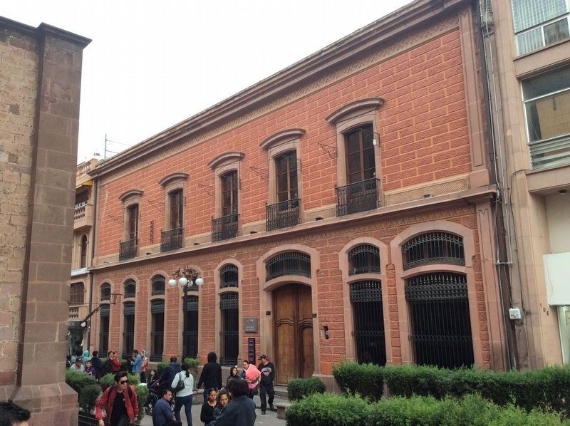
2. Pitman House and Marker
The marker, which also includes Braille text, is to the left of the entrance to the Casa Pitman, now the San Luis Potosí Secretaría de Turismo (Tourism Commission).
Credits. This page was last revised on November 9, 2025. It was originally submitted on March 29, 2019, by J. Makali Bruton of Washington, District of Columbia. This page has been viewed 436 times since then and 14 times this year. Photos: 1, 2. submitted on March 29, 2019, by J. Makali Bruton of Washington, District of Columbia.
