Near Indian Head in Charles County, Maryland — The American Northeast (Mid-Atlantic)
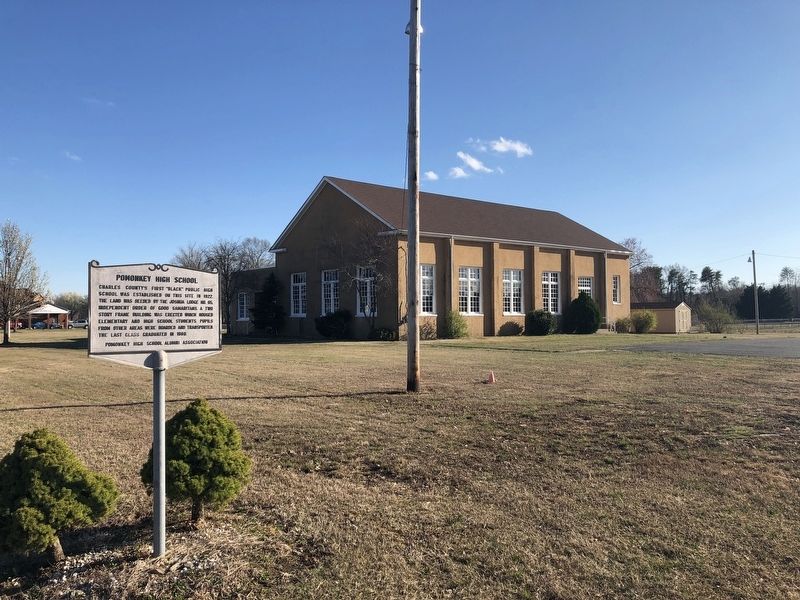
Pomonkey High School
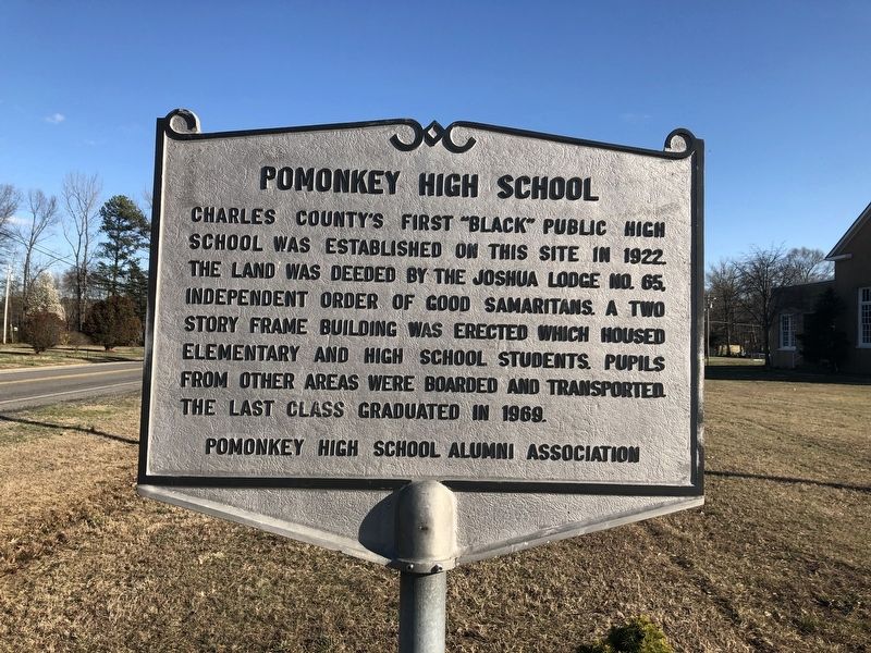
Erected by Pomonkey High School Alumni Association.
Topics. This historical marker is listed in these topic lists: African Americans • Education. A significant historical year for this entry is 1922.
Location. 38° 37.137′ N, 77° 4.581′ W. Marker is near Indian Head, Maryland, in Charles County. It is on Metropolitan Church Road east of Laurel Acres Drive, on the right when traveling east. Touch for map. Marker is at or near this postal address: 3395 Metropolitan Church Road, Indian Head MD 20640, United States of America. Touch for directions.

Regionally, this marker is in the Washington Metropolitan Area and in Southern Maryland. It is also in the American South, specifically in the Upper South, in the Mid-Atlantic, in the Tidewater, and on the Eastern Seaboard.
this page online
Other nearby markers. At least 8 other markers are within 5 miles of this marker, measured as the crow flies: The Village of Pomonkey (here, next to this marker); The Story (approx. 2.8 miles away); "Eutaw" (approx. 2.9 miles away); Araby (approx. 3.4 miles away); Saint Charles of Cornwallis Neck (approx. 3.4 miles away); Church of St. Joseph (approx. 3.7 miles away); First People of the Potomac (approx. 4.2 miles away); First Alarm System (approx. 4½ miles away). Touch for a list and map of all markers in Indian Head.
Credits. This page was last revised on May 15, 2023. It was originally submitted on March 31, 2019, by Devry Becker Jones of Washington, District of Columbia. This page has been viewed 1,557 times since then and 95 times this year. Photos: 1, 2. submitted on March 31, 2019, by Devry Becker Jones of Washington, District of Columbia.
