Moorpark in Ventura County, California — The American West (Pacific Coastal)
Moorpark’s Community Church
Photographed by Craig Baker, March 25, 2019
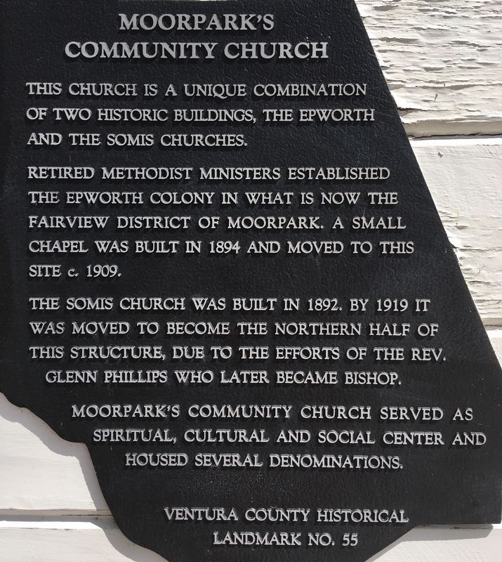
1. Moorpark’s Community Church Marker
This church is a unique combination of two historic buildings, the Epworth and the Somis churches.
Retired Methodist ministers established the Epworth Colony in what is now the Fairview district of Moorpark. A small chapel was built in 1894 and moved to this site c. 1909.
The Somis Church was built in 1892. By 1919 it was moved to become the northern half of this structure, due to the efforts of the rev. Glenn Phillips who later became bishop.
Moorpark’s Community Church served as spiritual, cultural and social center and housed several denominations.
Erected by Ventura County. (Marker Number 55.)
Topics and series. This historical marker is listed in these topic lists: Architecture • Religion & Religious Structures. In addition, it is included in the Ventura County Historical Landmarks series list. A significant historical year for this entry is 1894.
Location. 34° 17.194′ N, 118° 52.844′ W. Marker is in Moorpark, California, in Ventura County. It is at the intersection of Walnut Street and Charles Street, on the right when traveling north on Walnut Street. Touch for map. Marker is at or near this
this page online

Regionally, this marker is in Greater Los Angeles, on the Central Coast, and in the Transverse Ranges. It is also on the American Pacific Coast. Globally, it is in North America, on the Ring of Fire, on the Pacific Rim, in the Western Hemisphere, in the Western World, and in the Anglosphere. Historically, it finds itself in what was once New Spain and also Mexico’s Alta California.
Other nearby markers. At least 8 other markers are within 5 miles of this marker, measured as the crow flies: Tanner Corner (about 600 feet away, measured in a direct line); Santa Rosa School (approx. 2.9 miles away); Joel McCrea Ranch (approx. 3.1 miles away); Norwegian Grade (approx. 3.7 miles away); F-117A Nighthawk (approx. 3.9 miles away); Ronald Wilson Reagan (approx. 3.9 miles away); Pederson Ranch House (approx. 4½ miles away); Simi Library (approx. 4.6 miles away). Touch for a list and map of all markers in Moorpark.
Additional keywords. Pepper Trees
Photographed by Craig Baker, March 25, 2019
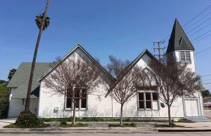
2. Church and Marker
View looking east. The Somis Church is the left half. The Epworth Church is the right half, with the marker visible to the right of the window.
Photographed by Craig Baker, March 25, 2019
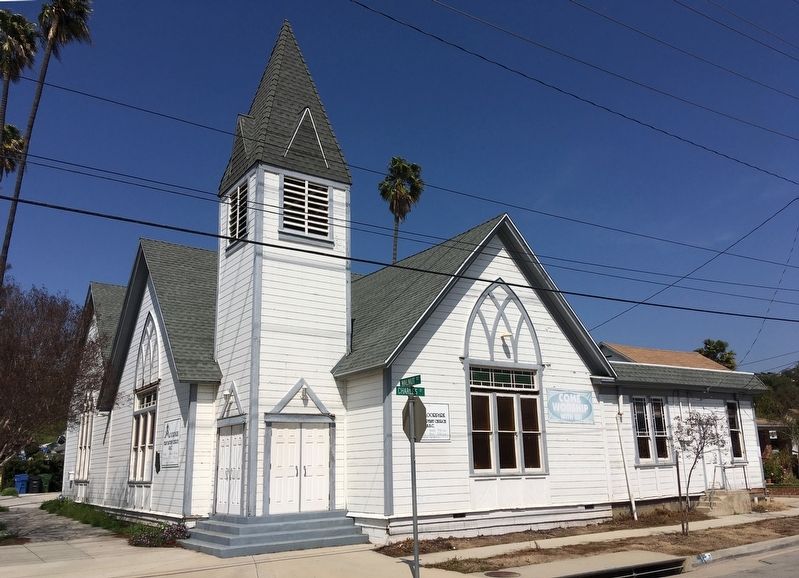
3. Moorpark’s Community Church
Photographed by Craig Baker, March 25, 2019
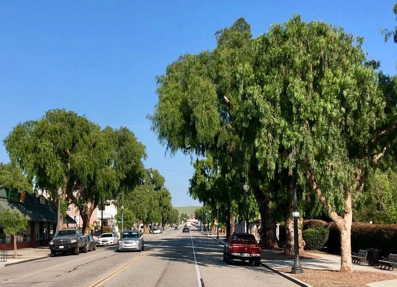
4. Moorpark’s Pepper Trees
Planted in 1900. Ventura County Landmark No. 72.
Photographed by Craig Baker, March 25, 2019
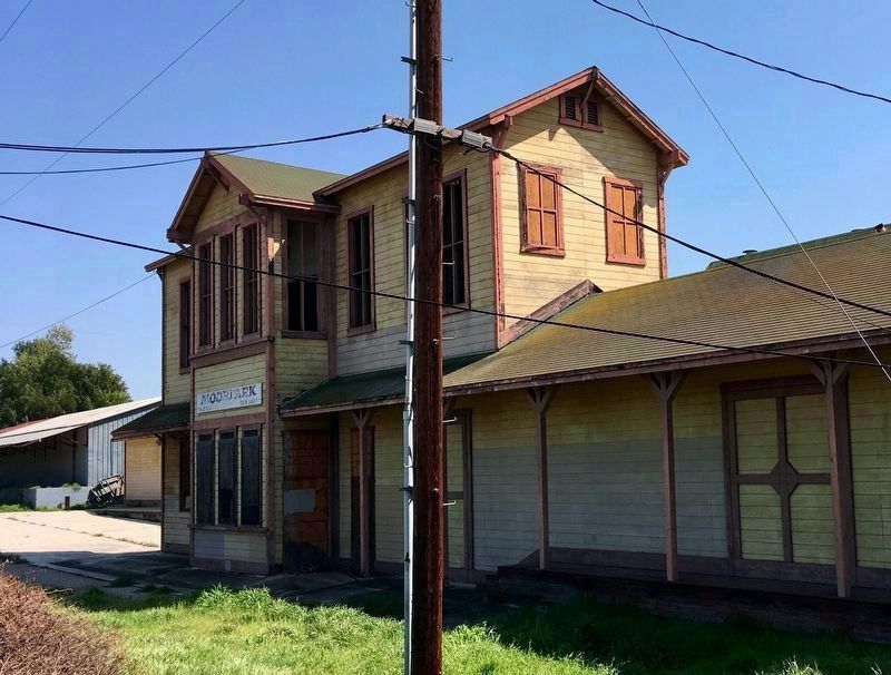
5. Moorpark’s Granary
Located next to the railroad tracks and designed to look like an old train station, it’s an abandoned granary built in the 1970s.
Credits. This page was last revised on February 22, 2026. It was originally submitted on April 1, 2019, by Craig Baker of Sylmar, California. This page has been viewed 957 times since then and 79 times this year. Photos: 1, 2, 3, 4. submitted on April 1, 2019, by Craig Baker of Sylmar, California. 5. submitted on April 2, 2019, by Craig Baker of Sylmar, California. • Andrew Ruppenstein was the editor who published this page.
