Near Polo in Ogle County, Illinois — The American Midwest (Great Lakes)
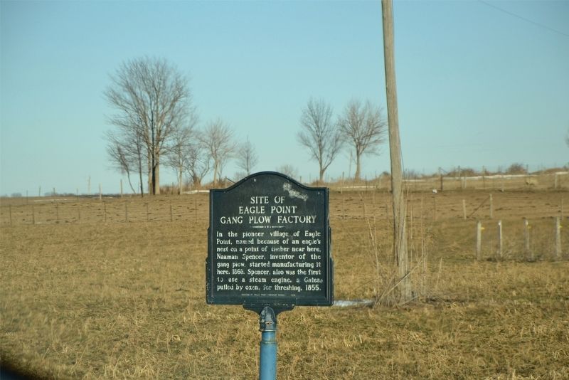
Site of Eagle Point Gang Plow Factory
Erected 1976 by Eagle Point Township Board.
Topics. This historical marker is listed in these topic lists: Industry & Commerce • Settlements & Settlers. A significant historical year for this entry is 1868.
Location. 41° 59.628′ N, 89° 40.798′ W. Marker is near Polo, Illinois, in Ogle County. Marker is on West Eagle Point Road, ¼ mile east of Brookville Road, on the left when traveling east. Touch for map. Marker is in this post office area: Polo IL 61064, United States of America. Touch for directions.
Other nearby markers. At least 8 other markers are within 6 miles of this marker, measured as the crow flies. Buffalo Grove Lime Kiln 1870-1915 (approx. 3.9 miles away); William Durley Killed By Indians (approx. 4 miles away); Indian Ambush (approx. 4 miles away); William Durley Killed Here (approx. 4 miles away); First Cabin in Ogle County (approx. 4.2 miles away); Buffalo Grove (approx. 4½ miles away); A Stone Arch Bridge on the Galena Road (approx. 5 miles away); Lincoln in Polo (approx. 5.3 miles away). Touch for a list and map of all markers in Polo.
Regarding Site of Eagle Point Gang Plow Factory. Illustration of the factory can be seen in Combination Atlas Map of Ogle County Illinois, by Everts, Baskins, and Stewart (1872).
http://www.historicmapworks.com/Map/US/224480/Eagle+Point+Township++Grant++Spencer++Anderson/Ogle+County+1872/Illinois/
Credits. This page was last revised on April 4, 2019. It was originally submitted on April 3, 2019. This page has been viewed 313 times since then and 21 times this year. Photo 1. submitted on April 3, 2019. • Bill Pfingsten was the editor who published this page.
