Fire and Brick & Stone
Upper Spring
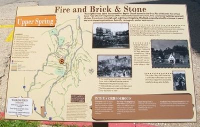
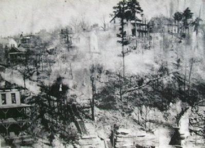
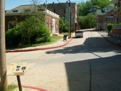
The neighborhood above the current First Baptist Church burned in the Great Fire of 1883, the first of four Great Fires which destroyed most of the town's early wooden structures. New commercial buildings were built of more fire-resistant materials such as brick and limestone. This block, originally called Rice Avenue, is one of the most interesting downtown. Beautiful spring parks anchor both corners.
[Inset photo captions read]
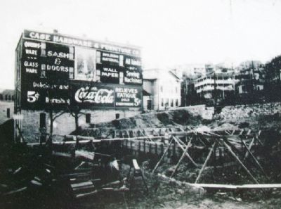
[1.] The Wadsworth Building was the first structure to rise from the ashes after the second Great Fire in 1888. This multi-story building was a popular home furnishings and hardward store whose ghost signs still give hint to the wide variety of merchandise offered by various owners. This view also shows the foundations of the "new" U.S. Post Office, completed in 1918.
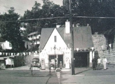
[2.] Originally the site of the Kentucky House, the Sharp's Continental Oil Filling Station was located here in 1928 to provide convenient service to the automobile tourist. It was enlarged and converted to law offices in 1964.
[3]. The Sweet Spring Hotel once stood here. It was built in 1887 and later became the Huntington Hospital. It burned in the 1940s and site was vacant until the current building was constructed to blend well into the corner in 1994.
The unique Palace Bath House sign is said to be the first
neon sign west of the Mississippi River, designed by colorful local sign artist By Golly.
In the Neighborhood
Limestone: Sweet Spring is a good place to see the many ways this rock forms the basic fabric of Eureka Springs; natural bluffs, cut stone stacked walls, sidewalks, benches and buildings!
The Sweet-Harding Spring Reservation: Public land set aside in the 1890s, it is above the entire block to protect the springs. A rustic trail leads to Harding Spring on the next corner.
Upper Spring Street: A lovely flat walk with beautiful spring parks and interesting buildings built into the mountainsides.
First Baptist Penn Memorial Church: Built 1916 and named in honor of Major William Penn, an evangelist and minister in Eureka Springs.
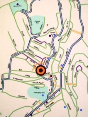
Landmarks [Map and Key]
This material is based upon work assisted by a grant from the U.S. Department of the Interior, National Park Service, a Preserve America grant. Any opinions, findings, and conclusions or recommendations expressed in this material are those of the author and do not necessarily reflect the views of the Department of the Interior. Photographs courtesy of the Cornerstone Bank of Eureka Springs, Eureka Springs Historical Museum and the Eureka Springs Carnegie Public Library.
Erected by Eureka Springs Downtown
Topics. This historical marker is listed in these topic lists: Architecture • Churches & Religion • Industry & Commerce • Settlements & Settlers. A significant historical year for this entry is 1883.
Location. 36° 24.264′ N, 93° 44.313′ W. Marker is in Eureka Springs, Arkansas, in Carroll County. Marker is at the intersection of Spring Street and Pine Street, on the right when traveling north on Spring Street. Marker is about 100 feet north of the Post Office. Touch for map. Marker is at or near this postal address: 101 Spring Street, Eureka Springs AR 72632, United States of America. Touch for directions.
Other nearby markers. At least 8 other markers are within walking distance of this marker. Sweet Spring Hotel - Huntington Infirmary - Sweet Spring Home (here, next to this marker); Elwood House (within shouting distance of this marker); Sweet Spring (within shouting distance of this marker); Kentucky House (within shouting distance of this marker); Eastview Cottage (about 500 feet away, measured in a direct line); Harding Spring (about 600 feet away); The Lay of the Land (about 600 feet away); Citizen's Bank Building (about 700 feet away). Touch for a list and map of all markers in Eureka Springs.
More about this marker.
3. Photo 2 on Fire and Brick & Stone Marker
Regarding Fire and Brick & Stone. Photo #2 on "Fire and Brick & Stone marker" is described as "by unknown, circa 1930's". The gas pumps in this photo of a Conoco (Continental Oil) gas station are Martin & Schwartz model 80 and they were first manufactured in 1946. In addition, a better version of this photo is available on the Jefferson Highway Facebook site and the better photo shows a Conoco pole sign on the left side of the photo. That specific kind of Conoco pole sign was first installed by Conoco beginning in 1949. Thus, I believe a better description of this photo is "circa 1950".
Also see . . . Eureka Springs History. (Submitted on January 4, 2015, by William Fischer, Jr. of Scranton, Pennsylvania.)
Credits. This page was last revised on August 16, 2020. It was originally submitted on January 4, 2015, by William Fischer, Jr. of Scranton, Pennsylvania. This page has been viewed 738 times since then and 87 times this year. Last updated on April 3, 2019, by Andrew Wagner of Fulshear, Texas, USA. Photos: 1, 2, 3, 4, 5, 6. submitted on January 4, 2015, by William Fischer, Jr. of Scranton, Pennsylvania. • Andrew Ruppenstein was the editor who published this page.
