Bay City in Bay County, Michigan — The American Midwest (Great Lakes)
Cross Country Connections
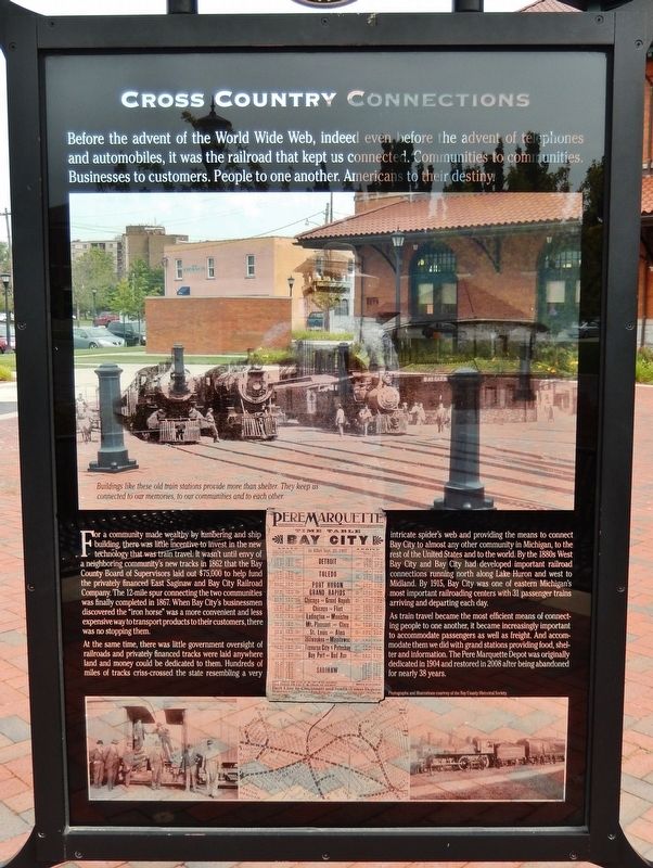
Before the advent of the World Wide Web, indeed even before the advent of telephones and automobiles, it was the railroad that kept us connected. Communities to communities. Businesses to customers. People to one another. Americans to their destiny.
For a community made wealthy by lumbering and ship building, there was little incentive to invest in the new technology that was train travel. It wasn't until envy of a neighboring community’s new tracks in 1862 that the Bay County Board of Supervisors laid out $75,000 to help fund the privately financed East Saginaw and Bay City Railroad Company. The 12-mile spur connecting the two communities was finally completed in 1867. When Bay City's businessmen discovered the "iron horse" was a more convenient and less expensive way to transport products to their customers, there was no stopping them.
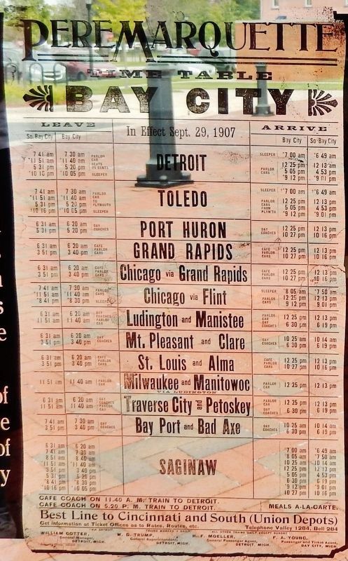
At the same time, there was little government oversight of railroads and privately financed tracks were laid anywhere land and money could be dedicated to them. Hundreds of miles of tracks criss-crossed the state resembling a very intricate spider's web and providing the means to connect Bay City to almost any other community in Michigan, to the rest of the United States and to the world. By the 1880s West Bay City and Bay City had developed important railroad connections running north along Lake Huron and west to Midland. By 1915, Bay City was one of eastern Michigan's most important railroading centers with 31 passenger trains arriving and departing each day.
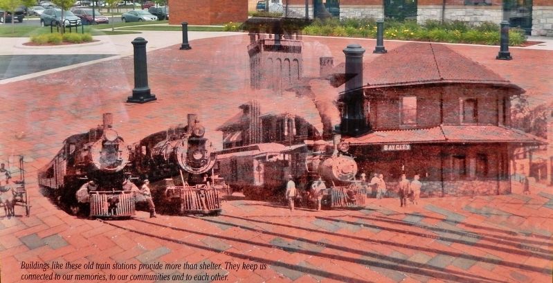
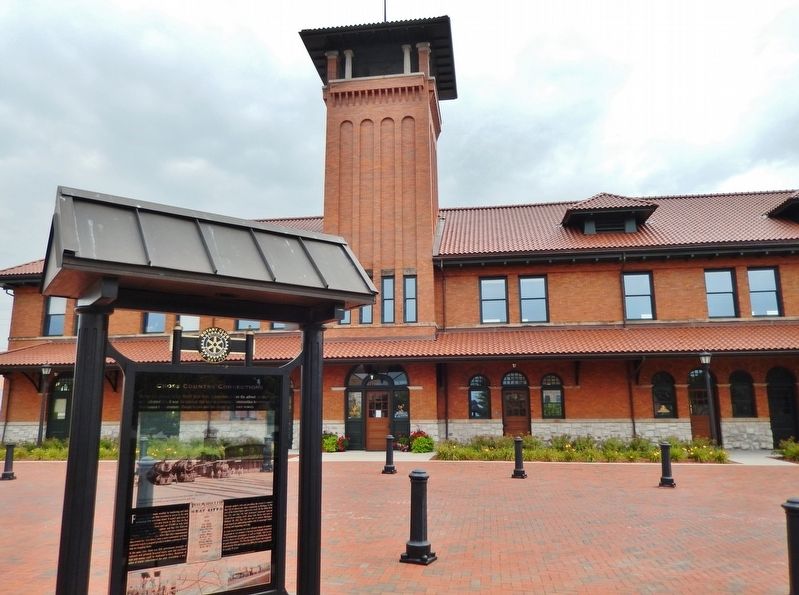
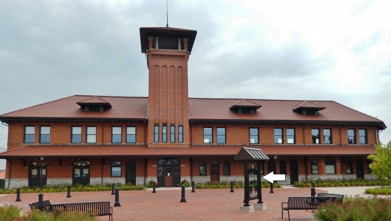
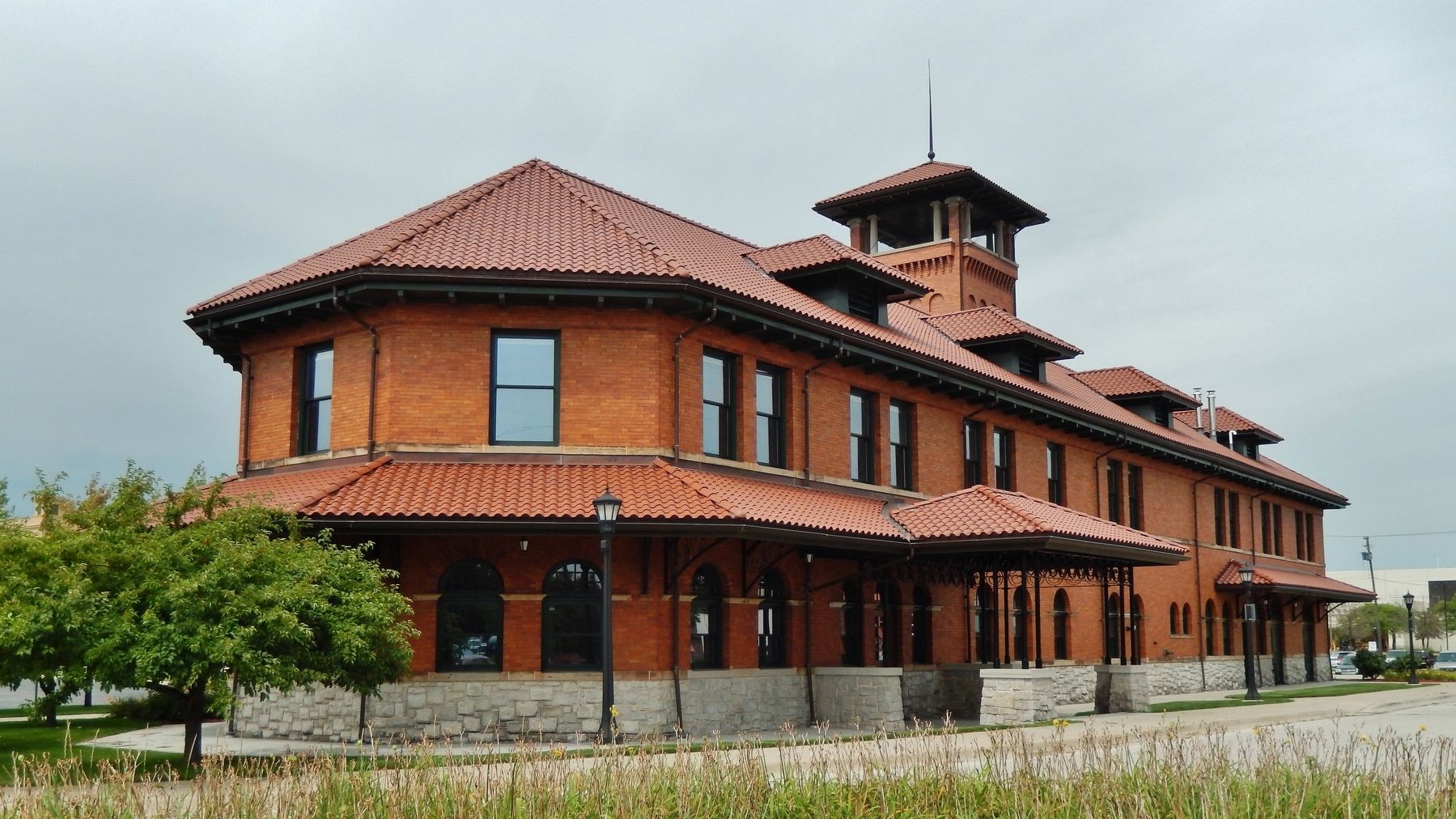
As train travel became the most efficient means of connecting people to one another, it became increasingly important to accommodate passengers as well as freight. And accommodate them we did with grand stations providing food, shelter and information. The Pere Marquette Depot was originally dedicated in 1904 and restored in 2008 after being abandoned for nearly 38 years.
Erected by Rotary Club of Bay City.
Topics and series. This historical marker is listed in this topic list: Railroads & Streetcars. In addition, it is included in the Rotary International series list. A significant historical year for this entry is 1862.
Location. 43° 35.993′ N, 83° 53.123′ W. Marker is in Bay City, Michigan, in Bay County. Marker can be reached from the intersection of Adams Street and 4th Street, on the right when traveling north. Marker is located in the plaza at the main front entrance to Bay City's Pere Marquette Depot. Touch for map. Marker is at or near this postal address: 1000 Adams Street, Bay City MI 48708, United States of America. Touch for directions.
Other nearby markers. At least 8 other markers are within walking distance of this marker. IX-inch Dahlgren SB Iron Shell Gun (about 700 feet away, measured in a direct line); Bay County Veterans Memorial
(about 700 feet away); George H. & Elva Shearer House (approx. 0.2 miles away); Train Traffic Control Shack Informational Kiosk (approx. 0.2 miles away); US 13-inch Sea-Coast Mortar (approx. 0.2 miles away); Center Avenue (approx. 0.2 miles away); Bay City Branch Library (approx. 0.2 miles away); First Presbyterian Church (approx. ¼ mile away). Touch for a list and map of all markers in Bay City.
Also see . . .
1. Pere Marquette Railroad Depot, Bay City Station. Wikipedia entry:
The first train pulled into Bay City on November 23, 1867. By 1899, the Pere Marquette had merged with other railways and was the largest in Michigan. They built several new passenger and freight depots over the next few years, including this depot, which opened in 1904. The building remained in use for both passenger and freight service until about 1951, after which it was abandoned. In 1953, the depot was renovated for use by the Greyhound Bus Company, which ultimately vacated the building in 1969, and it remained vacant until 2003. (Submitted on April 6, 2019, by Cosmos Mariner of Cape Canaveral, Florida.)
2. History of the Pere Marquette Depot. Website homepage:
Beginning in the early 1900s, the first generation of depots was gradually replaced with larger and more technologically advanced buildings. Depot construction became more standardized and certain characteristics, based on practical experience, became common. Depots were generally one story, with the longer side parallel to the tracks. A lack of stairs or raised entryways facilitated freight and baggage movement, and a trackside bay window gave the depot personnel a better view of incoming and outgoing traffic. Passengers were accommodated with large roof overhangs to protect them from the elements, and clock towers were added to help standardize times, as well as to demonstrate the efficiency of the railroad. (Submitted on April 6, 2019, by Cosmos Mariner of Cape Canaveral, Florida.)
Credits. This page was last revised on April 3, 2022. It was originally submitted on April 6, 2019, by Cosmos Mariner of Cape Canaveral, Florida. This page has been viewed 191 times since then and 10 times this year. Photos: 1, 2, 3, 4, 5, 6. submitted on April 6, 2019, by Cosmos Mariner of Cape Canaveral, Florida.
