San Luis Potosí, Mexico — The Northeast (and Central Highlands)
The Plan of San Luis
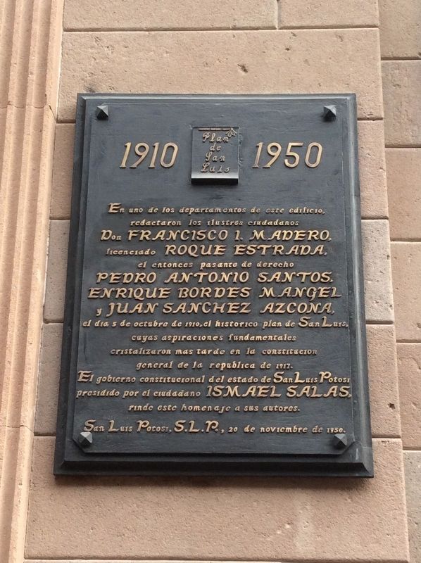
En uno de los departamentos de este edificio, redactaron los ilustres ciudadanos Don Francisco I. Madero, licenciado Roque Estrada, el entonces pasante de derecho Pedro Antonio Santos, Enrique Bordes Mangel y Juan Sanchez Azcona, el día 5 de octubre de 1910, el histórico plan de San Luis, cuyas aspiraciones fundamentales cristalizaron mas tarde en la constitución general de la republic de 1917.
El gobierno constitucional del estado de San Luis Potosí presidido por el ciudadano Ismael Salas, rinde este homenaje a sus autores.
San Luis Potosí, S.L.P., 20 de noviembre de 1950.
1910 The Plan of San Luis 1950
On October 5, 1910, in one of the apartments of this building, the illustrious citizens Francisco I. Madero, Roque Estrada, the then law intern Pedro Antonio Santos, Enrique Bordes Mangel and Juan Sánchez Azcona, wrote the historic Plan of San Luis, whose fundamental aspirations were later crystallized in the 1917 Constitution of the Republic.
The Constitutional Government of the State of San Luis Potosí, presided over by the citizen Ismael Salas, pays homage to its authors.
San Luis Potosí, S.L.P., November 20, 1950.
Erected 1950 by El Gobierno Constitucional del Estado de San Luis Potosí.
Topics. This historical marker is listed in these topic lists: Government & Politics • Patriots & Patriotism • Wars, Non-US. A significant historical date for this entry is October 5, 1910.
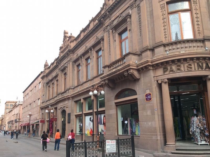
Location. 22° 9.068′ N, 100° 58.634′ W. Marker is in San Luis Potosí. Marker is on Francisco I. Madero just west of Calle 5 de Mayo, on the left when traveling west. Touch for map. Marker is at or near this postal address: 175 Francisco I Madero, San Luis Potosí 78000, Mexico. Touch for directions.
Other nearby markers. At least 8 other markers are within walking distance of this marker. Royal Treasury (within shouting distance of this marker); Mint of San Luis Potosí (within shouting distance of this marker); La Lonja Society of San Luis Potosí (within shouting distance of this marker); Government Palace (within shouting distance of this marker); Royal Treasure / Monumental Palace (within shouting distance of this marker); Former Othón Theater (about 90 meters away, measured in a direct line); Government Palace / Vicereine’s House (about 90 meters away); Metropolitan Cathedral / Vicereine's Balcony (about 120 meters away). Touch for a list and map of all markers in San Luis Potosí.
Also see . . . The Plan of San Luis Potosí
. "The Plan of San Luis de Potosí (Plan de San Luis, in Spanish) was a political document written by presidential candidate Francisco I. Madero, who was jailed prior to the elections, and escaped to write the Plan. It was published on October 5, 1910. It called for nullifying the 1910 election of Porfirio Díaz, claimed a provisional presidency for Madero, and called for Mexicans to revolt on November 20, 1910."
Mexicans did revolt on November 20, thereby starting the Mexican Revolution. (Submitted on April 10, 2019, by J. Makali Bruton of Accra, Ghana.)
Credits. This page was last revised on April 10, 2019. It was originally submitted on April 10, 2019, by J. Makali Bruton of Accra, Ghana. This page has been viewed 149 times since then and 14 times this year. Photos: 1, 2. submitted on April 10, 2019, by J. Makali Bruton of Accra, Ghana.

