Southwark in Greater London, England, United Kingdom — Northwestern Europe (the British Isles)
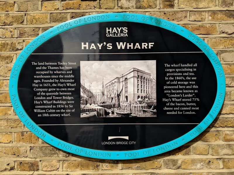
Hay's Wharf
Photographed by Mike Wintermantel, April 5, 2019
1. Hay's Wharf Marker
Wharf handled all cargos specialising in provisions and tea. In the 1860's, the use of cold storage was pioneered here and this are became known as "London Larder". Hay's Wharf stored 75% of the bacon, butter, cheese and canned meat needed for London.
Erected by Hay's Galleria, London Bridge City.
Topics. This historical marker is listed in this topic list: Notable Places. A significant historical year for this entry is 1651.
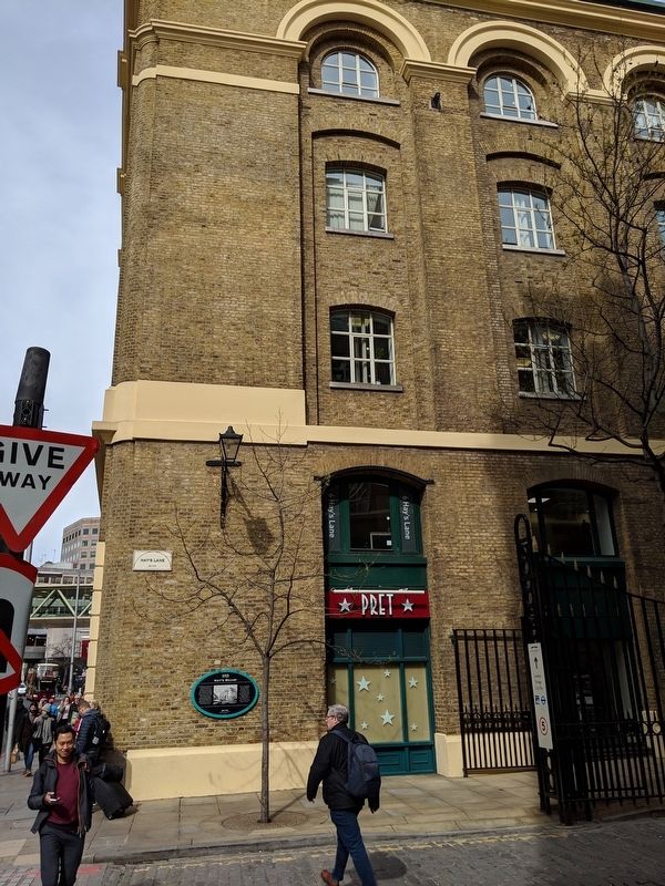
Location. 51° 30.327′ N, 0° 5.091′ W. Marker is in Southwark, England, in Greater London. It is at the intersection of Hay's Lane and Tooley Street (Route A200), on the right when traveling south on Hay's Lane. Touch for map. Marker is in this post office area: Southwark, England SE1 2HB, United Kingdom. Touch for directions.

Regionally, this marker
this page online
Other nearby markers. At least 8 other markers are within walking distance of this marker: The Great Fire of Tooley Street (within shouting distance of this marker); The Church of St. Olave (about 150 meters away, measured in a direct line); The Glaziers Hall (approx. 0.3 kilometers away); William Nicholson (approx. 0.3 kilometers away); St. Saviour’s & St. Olaves Girls’ School (approx. 0.3 kilometers away); Southwark Cathedral (approx. 0.4 kilometers away); The George Inn (approx. 0.4 kilometers away); St. Saviour’s Southwark Private Property (approx. 0.4 kilometers away). Touch for a list and map of all markers in Southwark.
Photographed by Mike Wintermantel, April 5, 2019
2. Hay's Wharf Marker
Credits. This page was last revised on September 12, 2024. It was originally submitted on April 11, 2019, by Mike Wintermantel of Pittsburgh, Pennsylvania. This page has been viewed 527 times since then and 19 times this year. Photos: 1, 2. submitted on April 11, 2019, by Mike Wintermantel of Pittsburgh, Pennsylvania.
