
Deadwood in Lawrence County, South Dakota — The American Midwest (Upper Plains)
Utility Building
Photographed by Cosmos Mariner, July 11, 2018
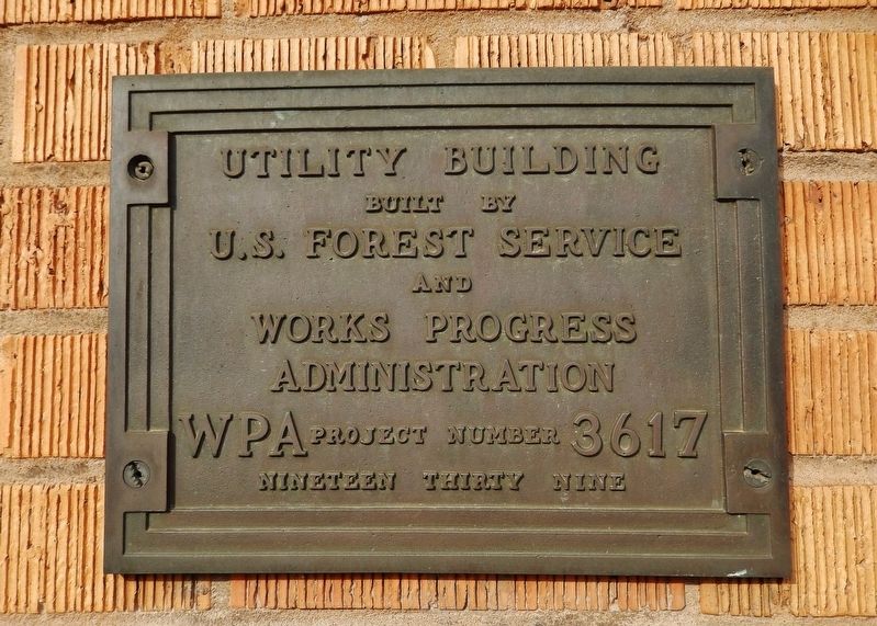
1. Utility Building Marker
built byU.S. Forest Serviceand
Works Progress
Administration
WPA Project Number 3617
Nineteen Thirty Nine
Topics and series. This historical marker is listed in this topic list: Notable Buildings. In addition, it is included in the Works Progress Administration (WPA) projects series list. A significant historical year for this entry is 1939.
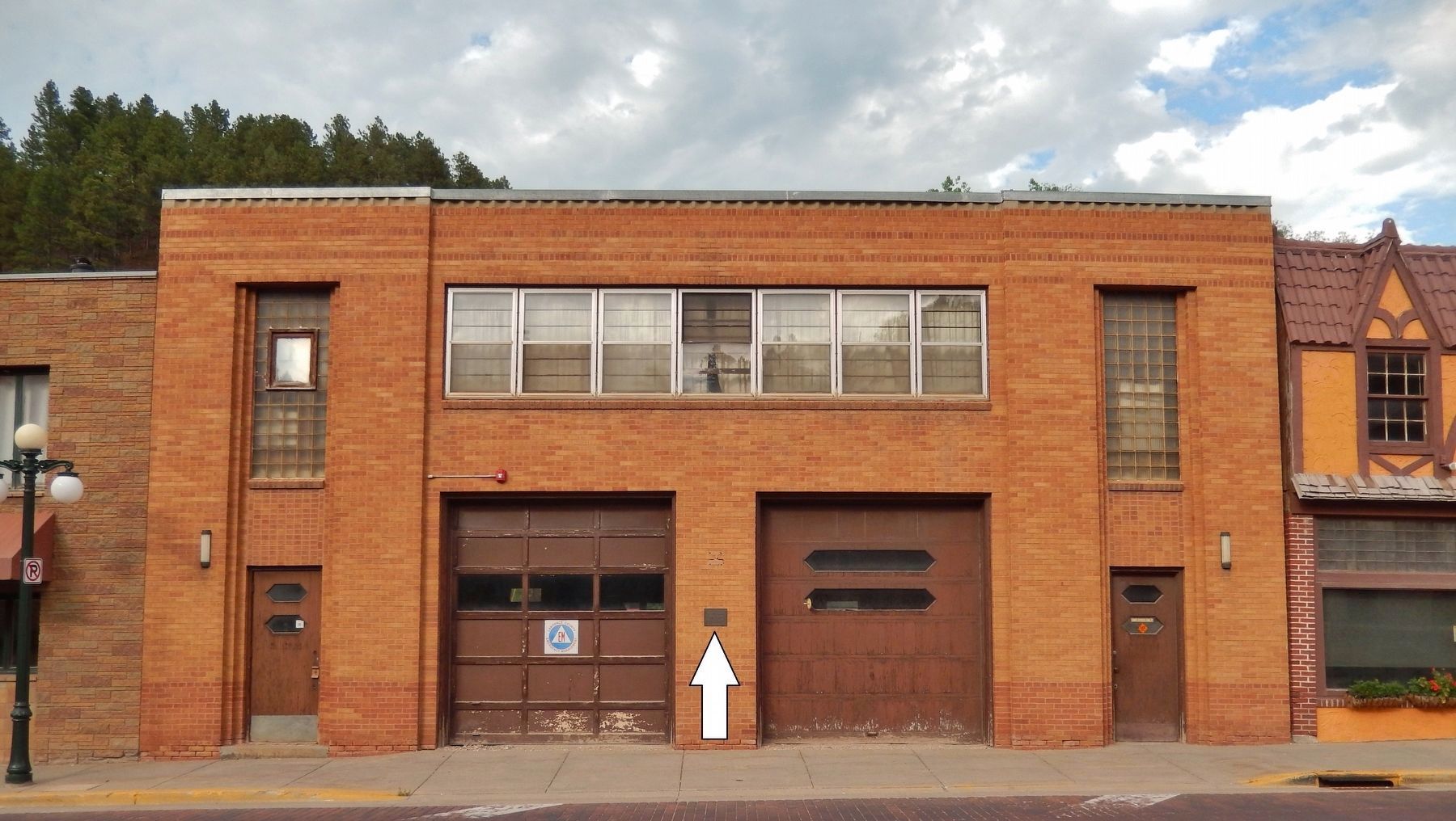
Location. 44° 22.469′ N, 103° 43.731′ W. Marker is in Deadwood, South Dakota, in Lawrence County. It is on Sherman Street (CanAm Highway) (U.S. 85) north of Center Street, on the right when traveling north. Marker is mounted at eye-level, directly on the subject building, between the two large service doorways, facing Sherman Street (west). Touch for map. Marker is at or near this postal address: 91 Sherman Street, Deadwood SD 57732, United States of America. Touch for directions.

Regionally, this marker is in West River. It is also in the American Black Hills, in the Lewis & Clark Corridor, on the prairies, and on the Northern Plains. Globally, it is in North America, the Western Hemisphere, the Western World, and the Anglosphere. Historically, it finds itself
this page online
Other nearby markers. At least 8 other markers are within walking distance of this marker: Lawrence County Jails & Capital Punishment (a few steps from this marker); Lest We Forget (within shouting distance of this marker); Lawrence County Great World War Memorial (within shouting distance of this marker); Fish & Hunter Company (within shouting distance of this marker); President Taft Comes to Deadwood (within shouting distance of this marker); Civic Stability (about 300 feet away, measured in a direct line); Job Corps Project (about 300 feet away); First Baptist Church (about 300 feet away). Touch for a list and map of all markers in Deadwood.
Also see . . . Works Progress Administration. The WPA – which in 1939 was renamed the Work Projects Administration – employed mostly unskilled men to carry out public works infrastructure projects. They built more than 4,000 new school buildings, erected 130 new hospitals, laid roughly 9,000 miles of storm drains and sanitary sewer lines, built 29,000 new bridges, constructed 150 new airfields, paved or
Photographed by Cosmos Mariner, July 11, 2018
2. Utility Building (marker visible front center, between the two service doorways)
Credits. This page was last revised on April 18, 2019. It was originally submitted on April 13, 2019, by Cosmos Mariner of Cape Canaveral, Florida. This page has been viewed 295 times since then and 10 times this year. Photos: 1, 2. submitted on April 18, 2019, by Cosmos Mariner of Cape Canaveral, Florida.
