Tres Pinos in San Benito County, California — The American West (Pacific Coastal)
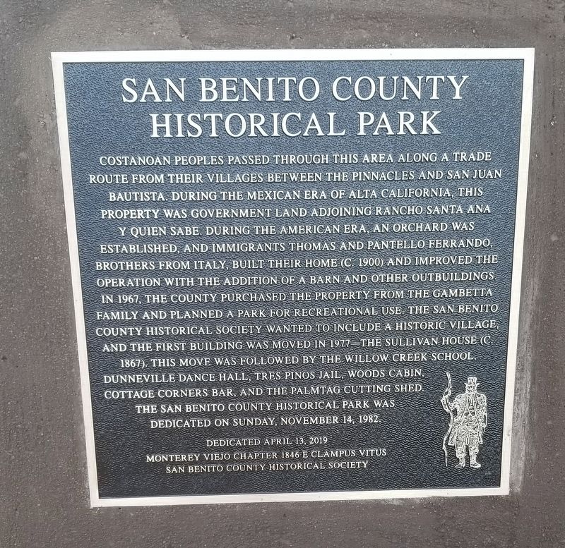
San Benito County Historical Park
Dedicated April 13, 2019
Monterey Viejo 1846 E Clampus Vitus
San Benito County Historical Society
Erected 2019 by Monterey Viejo 1846 E Clampus Vitus and the San Benito County Historical Society.
Topics and series. This historical marker is listed in these topic lists: Education
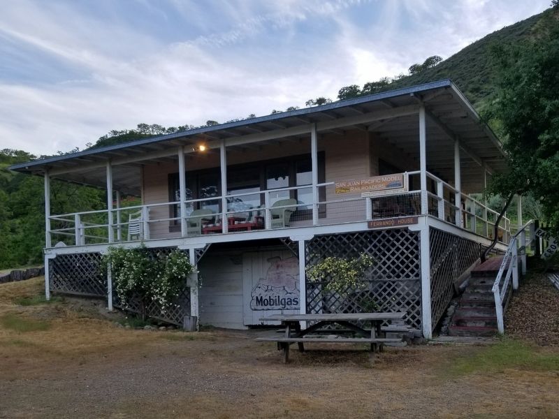
Location. 36° 46.362′ N, 121° 18.651′ W. Marker is in Tres Pinos, California, in San Benito County. Marker can be reached from Airline Highway. This marker is located at the San Benito County Historical Park grounds. As you enter the park, make a left then the first right. Marker can be seen on the right as you drive forward. Touch for map. Marker is at or near this postal address: 8300 Airline Highway, Tres Pinos CA 95075, United States of America. Touch for directions.
Other nearby markers. At least 8 other markers are within 5 miles of this marker, measured as the crow flies. Cottage Corners (about 400 feet away, measured in a direct line); Palmtag Cutting Shed (about 400 feet away); 19th Hole Rendezvous (approx. 1.2 miles away); Site of the Tres Pinos Hotel (approx. 1.4 miles away); New Idria Mine (approx. 3˝ miles away); Tres Pinos/Paicines (approx. 3˝ miles away); The Downfall of Tiburcio Vasquez (approx. 3˝ miles away); Vineyard School (approx. 4.9 miles away). Touch for a list and map of all markers in Tres Pinos.
Photographed By Frank Gunshow Sanchez, April 13, 2019
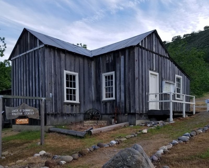
3. Wood's Cabin (C.1880s)
The cabin was originally located off Cienega Road in the canyon behind Vineyard School in what is now Hollister Hills SVRA. The house was last occupied in 1976. The "L" shaped single-wall construction, eleven-foot ceilings, are unique for this era. The 900 square foot building was dismantled by the San Benito County Contractors Association and moved to the park in September, 1992.

Photographed By Frank Gunshow Sanchez, April 13, 2019
4. Tres Pinos Jail C. 1905
The jail was located behind the 19th Hole Bar in Tres Pinos. Built in the early 1900's, it was used mainly for drunk and disorderly customers. They were held in the jail until the San Benito County Sheriff could come and get them. It was also used as a tack room for owner of the bar after the Sheriff had enough patrol cars to cover Tres Pinos.
Photographed By Frank Gunshow Sanchez, April 13, 2019
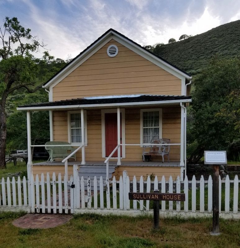
5. Sullivan House C.1867
The Sullivan House was built on the northern edge of Hollister, California by Michael Shea, one of Col. Hollister's carpenters. Built for Michael's widowed sister Mary Sullivan, and her four daughters. Mrs. Sullivan's husband, Patrick, had been killed in an accident while mining for gold. The house was the first structure moved to the park. After restoration the house was dedicated in August, 1990.
Photographed By Frank Gunshow Sanchez, April 13, 2019
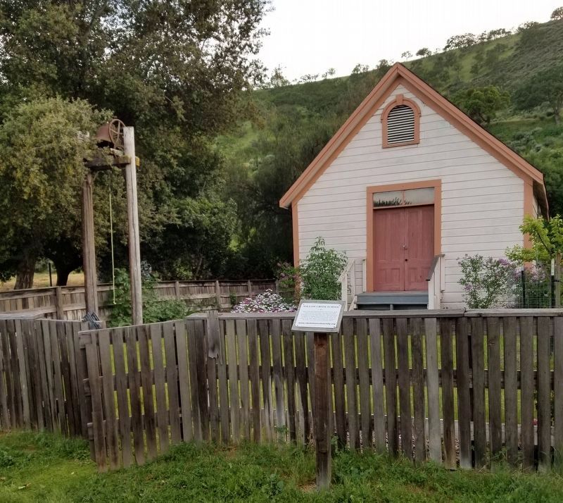
6. Willow Creek School C. 1874
Henry Melendy help build the school on his ranch 15 miles south of Tres Pinos with redwood timbers hauled by horse cart from Santa Cruz. There were up to 20 children in average daily attendance until the 1930's. On March 10, 1992 the SBC Historical Society moved the school to the park where it was restored by volunteers. The school was a gift by the Melendy Ranch.
Credits. This page was last revised on April 29, 2019. It was originally submitted on April 14, 2019, by Frank Gunshow Sanchez of Hollister, California. This page has been viewed 418 times since then and 49 times this year. Photos: 1, 2, 3. submitted on April 14, 2019, by Frank Gunshow Sanchez of Hollister, California. 4. submitted on April 29, 2019, by Frank Gunshow Sanchez of Hollister, California. 5, 6. submitted on April 14, 2019, by Frank Gunshow Sanchez of Hollister, California. • Andrew Ruppenstein was the editor who published this page.
