Kapelle St. Victor
⎯⎯⎯
St. Victor Chapel
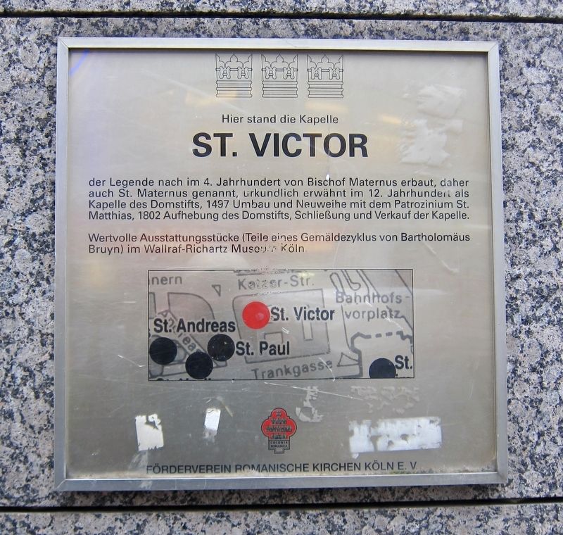

ST. VICTOR
der Legende nach im 4. Jahrhundert von Bischof Maternus erbaut, daher auch St. Maternus genannt, urkundlich erwähnt im 12. Jahrhundert als Kapelle des Domstifts, 1497 Umbau und Neuweihe mit dem Patrozinium St. Matthias, 1802 Aufhebung des Domstifts, Schließung und Verkauf der Kapelle.
Wertvolle Ausstattungsstücke (Teile eines Gemäldezyklus von Bartholomäus Bruyn) im Wallraf-Richartz Museum Köln.
Here stood the St. Victor Chapel, which according to legend was built in the Fourth Century by Bishop Maternus, thus also called St. Maternus, mentioned in the 12th century as a chapel of the cathedral, 1497 reconstruction and re-consecration with the Patrozinium St. Matthias, 1802 abolition of the cathedral, closing and sale of the chapel.
Noteworthy decorations included portions of a multi-part painting by Bartholmaeus Bruyn, which are now in the Wallraf-Richartz Museum Cologne.
Erected by Förderverein Romanische Kirchen Kolne. e.V.
Topics. This historical marker is listed in this topic list: Religion & Religious Structures. A significant historical year for this entry is 1497.
Location. 50° 56.538′ N,
this page online
Regionally, this marker is in the German Rhineland. Globally, it is in Europe, the European Union, Atlantic Europe, Central Europe, the Schengen Area, Western Europe, and the Western World. Historically, it finds itself in what was once the Roman Empire, the Holy Roman Empire, the Hanseatic League, and the former West Germany.
Other nearby markers. At least 8 other markers are within walking distance of this marker: Seitenportal des römischen Nordtores/ Side Portal of North Roman Gate (about 90 meters away, measured in a direct line); Georg Simon Ohm (about 90 meters away); Model of the Finial (about 120 meters away); Dr. Friedrich Joseph Haass (about 120 meters away); Matthias Joseph Scheeben (about 120 meters away); Dominican Monastery Site and Albertus Magnus (about 120 meters away); Friedrich von Spee S.J. (about 150 meters
Credits. This page was last revised on January 28, 2022. It was originally submitted on April 16, 2019, by Andrew Ruppenstein of Lamorinda, California. This page has been viewed 266 times since then and 11 times this year. Photos: 1, 2. submitted on April 16, 2019, by Andrew Ruppenstein of Lamorinda, California.
