Central City in Salt Lake City in Salt Lake County, Utah — The American Mountains (Southwest)
Salt Lake City & County Building
| — | 1891-1894, Monheim, Bird, & Proudfoot | — |
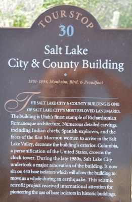
Photographed by Bryan R. Bauer, August 31, 2010
1. Salt Lake City & County Building Marker
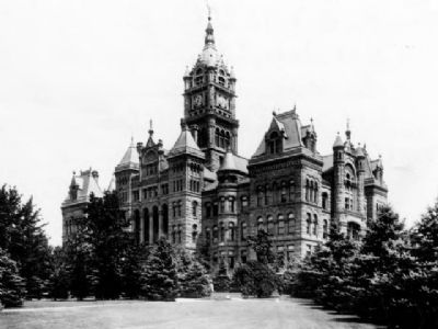
The building is Utah’s finest example of Richardsonian Romanesque architecture. Numerous detailed carvings, including Indian chiefs, Spanish explorers, and the faces of the first Mormon women to arrive in the Salt Lake Valley, decorate the building’s exterior. Columbia, a female personification of the United States, crowns the clock tower. During the late 1980s, Salt Lake City undertook a major renovation of the building. It now sits on 440 base isolators which will allow the building to move as a whole during an earthquake. This seismic retrofit project received international attention for pioneering the use of base isolators in historic buildings.
Erected by Utah Heritage Foundation. (Marker Number 30.)
Topics and series. This historical marker is listed in this topic list: Notable Buildings. In addition, it is included in the Utah, Salt Lake City Downtown Walking Tour series list.
Location. Marker has been reported missing. It was located near 40° 45.575′ N, 111° 53.16′ W. Marker was in Salt Lake City, Utah, in Salt Lake County. It was in Central City. It was on 200 East, on the right when traveling south. This marker is located on the east side of the building, close to the flagpoles. Touch for map. Marker was at or near this postal address: 451 Washington Square, Salt Lake City UT 84111, United States of America. Touch for directions.

Regionally, this marker was in the Wasatch Front and in Greater Salt Lake. It was also in the American Mountain West and on the Colorado Plateau. Globally, it was in North America, the Rocky Mountains, the Western Hemisphere, the Western World, and the Anglosphere. Historically, it found itself in what was once New
this page online
Other nearby markers. At least 8 other markers are within walking distance of this location: Salt Lake City and County Building (here, next to this marker); Pioneer Camping Grounds (about 600 feet away, measured in a direct line); a different marker also named Salt Lake City and County Building (about 600 feet away); Central Overland Trail - Washington Square (about 600 feet away); Salt Lake Stock and Mining Exchange (approx. ¼ mile away); Congregation Montefiore (approx. ¼ mile away); Trinity African Methodist Episcopal Church (approx. ¼ mile away); Modern Irrigation (approx. ¼ mile away). Touch for a list and map of all markers in Salt Lake City.
Another marker is no longer nearby. Salt Lake Stock & Mining Exchange Building (was approx. ¼ mile away but has been confirmed missing).
Regarding Salt Lake City & County Building. The building is situated in the middle of beautiful Washington Square. It is Tour Stop 30 on the Utah Heritage Foundation Downtown Walking Tour.
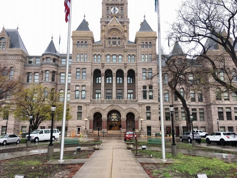
Photographed by Craig Baker, April 16, 2019
2. Marker is missing
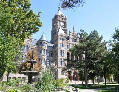
Photographed by Bryan R. Bauer, August 31, 2010
3. Salt Lake City & County Building Northwest Corner
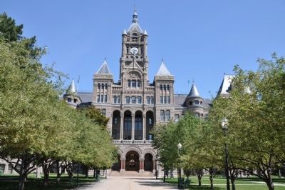
Photographed by Bryan R. Bauer, August 31, 2010
4. Salt Lake City & County Building West Face
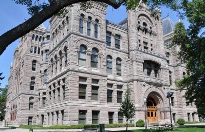
Photographed by Bryan R. Bauer, August 31, 2010
5. Salt Lake City & County Building Southwest Corner
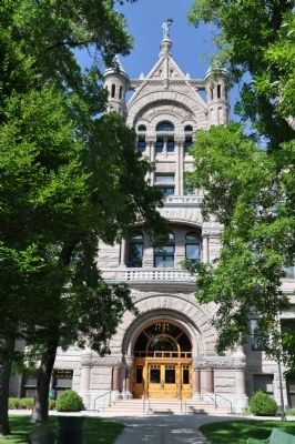
Photographed by Bryan R. Bauer, August 31, 2010
6. Salt Lake City & County Building South Face
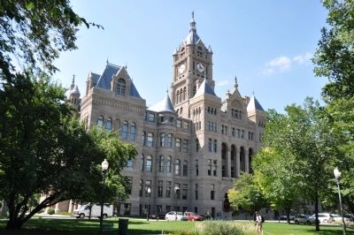
Photographed by Bryan R. Bauer, August 31, 2010
7. Salt Lake City & County Building Southeast Corner
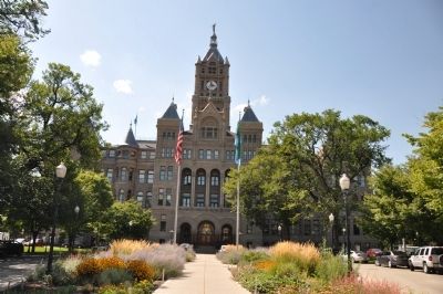
Photographed by Bryan R. Bauer, August 31, 2010
8. Salt Lake City & County Building East Face
National Register of Historic Places
9. Salt Lake City & County Building
This NRHP undated photo shows a full view of the building.
Credits. This page was last revised on February 16, 2023. It was originally submitted on September 12, 2010, by Bryan R. Bauer of Kearns, Ut 84118. This page has been viewed 2,108 times since then and 78 times this year. Last updated on April 16, 2019, by Craig Baker of Sylmar, California. Photos: 1. submitted on September 12, 2010, by Bryan R. Bauer of Kearns, Ut 84118. 2. submitted on April 16, 2019, by Craig Baker of Sylmar, California. 3, 4, 5, 6, 7, 8. submitted on September 12, 2010, by Bryan R. Bauer of Kearns, Ut 84118. 9. submitted on September 17, 2010. • Bill Pfingsten was the editor who published this page.
