Near Sperryville in Rappahannock County, Virginia — The American South (Mid-Atlantic)
Marys Rock Tunnel
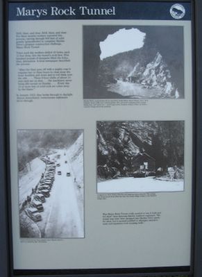
Twice each day workers drilled 40 holes, each 12 feet deep, into the tunnel's rock face. Five hundred pounds of dynamite filled the holes, then detonation. A local newspaper described the process:
"After the blast goes off with a mighty roar it requires two or three hours to clear away the loose boulders and stone and to roll them over the side.... Three 8-hour shifts of about 15 men each are on duty... the machinery never being idle except on Sunday.... Every day 15 or more feet of solid rock are eaten away by the blasts."
In January 1932, they broke through to daylight. Almost immediately venturesome sightseers drove through.
Was Marys Rock Tunnel really needed or was it built just for show? Area historian Darwin Lambert explained, "the tunnel may have been designed into Skyline Drive partly for show, but it seemed justified to eliminate extensive scars and expensive rock retaining walls."
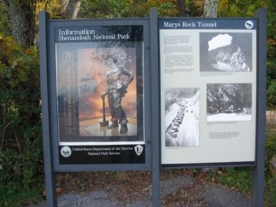
Erected by Shenandoah National Park.
Topics. This historical marker is listed in these topic lists: Disasters • Roads & Vehicles. A significant historical month for this entry is January 1932.
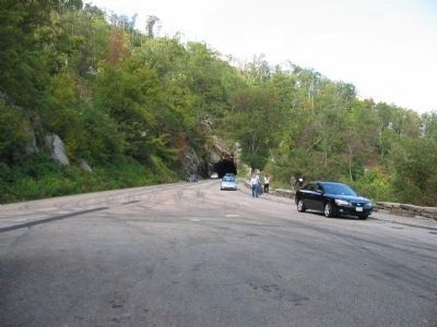
Location. 38° 39.092′ N, 78° 18.684′ W. Marker is near Sperryville, Virginia, in Rappahannock County. Marker is on Skyline Drive, on the left when traveling south. Located at the Tunnel Parking Overlook in Shenandoah National Park. Touch for map. Marker is in this post office area: Sperryville VA 22740, United States of America. Touch for directions.
Other nearby markers. At least 8 other markers are within 3 miles of this marker, measured as the crow flies. Rocks Older than Mankind (within shouting distance of this marker); The Greatest Single Feature (approx. ¾ mile away); Rappahannock County / Page County (approx. 0.8 miles away); Thornton Gap (approx. 0.8 miles away); William Randolph Barbee (approx. 0.8 miles away); Gaps in the Story (approx. 2.1 miles away); Old Rag (approx. 2.1 miles away); If These Walls Could Talk (approx. 2.3 miles away). Touch for a list and map of all markers in Sperryville.
More about this marker. On the upper right is a photo taken during the construction. Skyline Drive construction site as seen from inside Marys Rock Tunnel, circa 1934. Original tunnel walls were natural granite. But, persistent dripping water caused falling rock and winter ice - some huge icicles reached ceiling to floor. In 1958 a concrete lining solved the problem.
In the
right center is a photo of a cottage being moved through the tunnel. A tight fit in 1954. Notice that the roof peak has been removed. The cottage was being moved from what was then the Dicky Ridge Lodge to the Skyland Lodge area.
On the lower left is a photo of the overlook parking lot from the 1930's. Tunnel Overlook has been popular since Skyline Drive's birth, as shown by this 1935 photo.
Credits. This page was last revised on June 16, 2016. It was originally submitted on November 2, 2008, by Craig Swain of Leesburg, Virginia. This page has been viewed 2,347 times since then and 26 times this year. Photos: 1, 2, 3, 4. submitted on November 2, 2008, by Craig Swain of Leesburg, Virginia.


