Helena in Karnes County, Texas — The American South (West South Central)
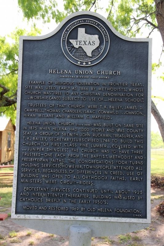
Helena Union Church
(Original Site 150 Feet South)
Photographed by Brian Anderson, April 5, 2019
1. Helena Union Church Marker
Example of religious toleration in frontier Texas. Site was used early as 1866 by Methodists, whose church was "free to any Christian denomination for...worship, (and) subject to use of...Helena School".
Trustees of that church were T. K. Bailey, James D. Campbell, Thomas Chandler, Isaac Conway, D. I. Johnson, Hiram McLane and William C. Mayfield.
Helena Union Church (seen here) was built on same site in 1875 when Helena had 1,000 people and was county seat. A group of 58 (with John Ruckman, Treasurer, and T. K. Bailey, Secretary) subscribed $746 to build this church "of first class pine lumber...covered with...juniper shingles". The church was to have three trustees - one each from the Baptist, Methodist and Presbyterian faiths. The congregations took turns holding services; however, townspeople attended all services, regardless of differences in creed. Use of building was open to all Orthodox faiths. Early ministers were circuit-riders.
Protestant services were continued until about 1925 and intermittently thereafter. Building was used by Catholics briefly in the early 1950s.
Moved and restored 1969 by Old Helena Foundation.
Erected 1969 by State Historical Survey Committee. (Marker Number 2429.)
Topics. This historical marker is listed in this topic list: Religion & Religious Structures. A significant historical year for this entry is 1875.
Location. 28° 57.02′ N, 97° 49.235′ W. Marker is in Helena, Texas, in Karnes County. It is on Farm to Market Road 81 south of County Road 302, on the left when traveling north. Touch for map. Marker is in this post office area: Karnes City TX 78118, United States of America. Touch for directions.

Regionally, this marker is in South Texas. It is also in the American South. Globally, it is in North America, a Gulf of Mexico state, the Western Hemisphere,
this page online
Other nearby markers. At least 8 other markers are within 5 miles of this marker, measured as the crow flies: Old Helena Courthouse (within shouting distance of this marker); Helena (within shouting distance of this marker); Ox-Cart Road (within shouting distance of this marker); Thomas Ruckman (within shouting distance of this marker); Home of John Ruckman (approx. 0.2 miles away); St. Joseph's School (approx. 4.7 miles away); Immaculate Conception Church (approx. 4.7 miles away); Father Leopold Moczygemba (approx. 4.7 miles away). Touch for a list and map of all markers in Helena.
Regarding Helena Union Church. The Helena Union Church is no longer located near this marker. The building was destroyed by a storm in 1973, a few years after this marker was placed.
Photographed by Brian Anderson, April 5, 2019
2. Helena Union Church Marker
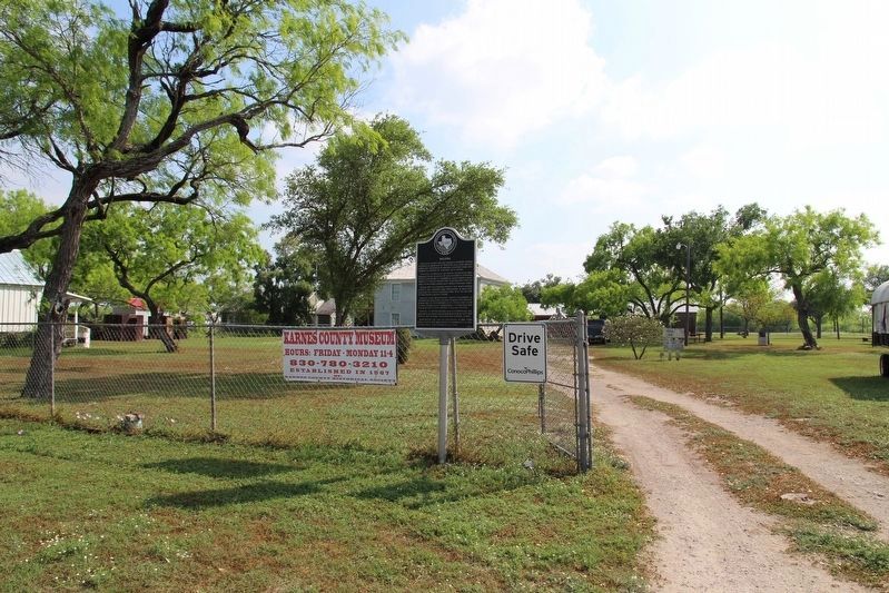
Marker is partially visible in the distance of the photo, just behind the parked truck.
Credits. This page was last revised on November 25, 2020. It was originally submitted on April 17, 2019, by Brian Anderson of New Albany, Ohio. This page has been viewed 362 times since then and 26 times this year. Photos: 1, 2. submitted on April 17, 2019, by Brian Anderson of New Albany, Ohio.
