Main Post in San Francisco City and County, California — The American West (Pacific Coastal)
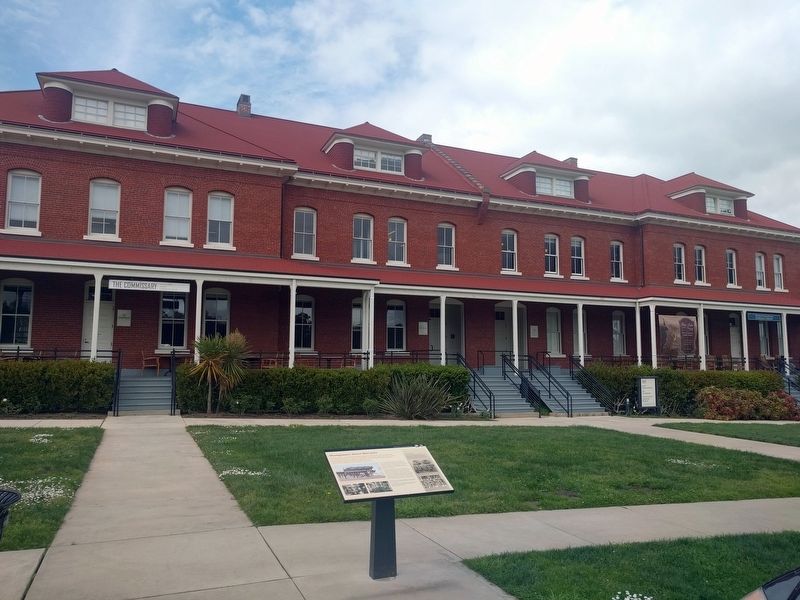
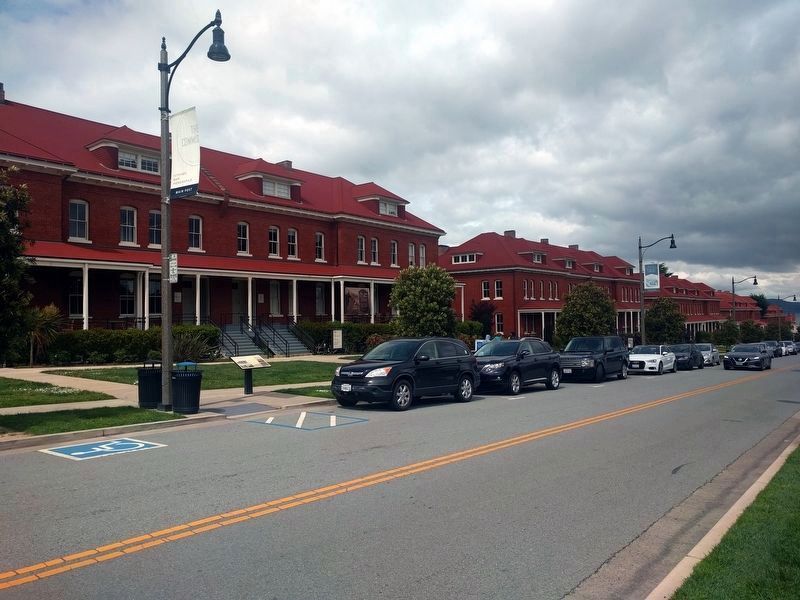
Montgomery Street Barracks
"In the years between the Civil War [1861-64] and the Spanish-American War [1898], the health of the army improved drastically. The new concern for soldiers’ well-being; the emphasis on sanitation, which became realizable in the new buildings at the larger posts; the new recreation and athletic facilities—all contributed to a healthier and more cheerful environment.
Edward M. Coffman, The Old Army: A Portrait of the American Army in Peacetime, 1784-1898
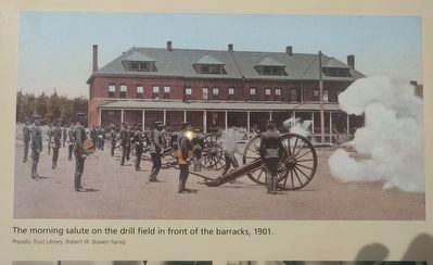
As the Indian Wars wound down by 1890, the Army closed frontier posts across the West and redeployed troops. The Presidio, with nearby rail and ship transport, was an ideal place to locate soldiers who could be quickly dispatched across the West or the Pacific.
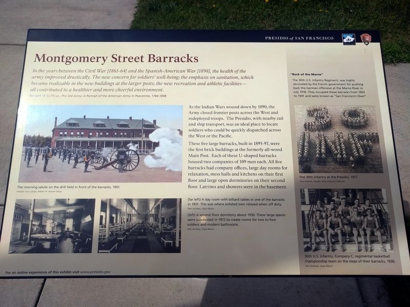
These five large barracks, built in 1895-97, were the first brick buildings at the formerly all-wood Main Post. Each of these U-shaped barracks housed two companies of 109 men each. All five barracks had company offices, large day rooms for relaxation, mess halls and kitchens on their first floor and large open dormitories on their second floor. Latrines and showers were in the basement.
"Rock of the Marne"
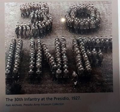
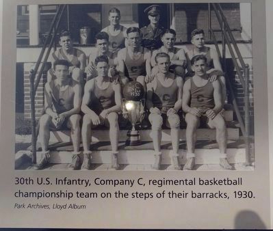
The 30th U.S. Infantry Regiment, was highly decorated by the French government for pushing back the German offensive at the Marne River in July 1918. They occupied these barracks from 1922 to 1941 and were known as “San Francisco’s Own”.
Erected by Presidio of San Francisco, National Park Service.
Topics. This historical marker is listed in this topic list: Forts and Castles. A significant historical month for this entry is July 1918.
Location. 37° 47.982′ N, 122° 27.572′ W. Marker is in San Francisco, California, in San Francisco City and County. It is in Main Post. Marker is at the intersection of Montgomery Street and Sheridan Avenue, on the right when traveling south on Montgomery Street. Touch for map. Marker is at or near this postal address: 101 Montgomery Street, San Francisco CA 94129, United States of America. Touch for directions.
Other nearby markers. At least 8 other markers are within walking distance of this marker. Laundresses' Row (within shouting distance of this marker); Sutler's Quarters (about 300 feet away, measured in a direct line); Ammunition Magazine (about 300 feet away); Infantry Row (about 400 feet away); Sergeants' Row (about 400 feet away); Pershing Square (about 500 feet away); The Ordońez Gun (about 500 feet away); War in the Philippines (about 500 feet away). Touch for a list and map of all markers in San Francisco.
More about this marker. An identical marker is at the north end of Montgomery Street.
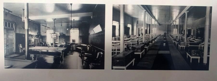
Park Archives, Lloyd Album
3. Lower left images
Left: A day room with billiard tables in one of the barracks in 1931. This was where enlisted men relaxed when off duty.
Right: A second floor dormitory about 1930. These large spaces were subdivided in 1972 to create rooms for two to four soldiers and modern bathrooms.
Right: A second floor dormitory about 1930. These large spaces were subdivided in 1972 to create rooms for two to four soldiers and modern bathrooms.
Credits. This page was last revised on February 7, 2023. It was originally submitted on April 19, 2019, by Joel Seewald of Madison Heights, Michigan. This page has been viewed 239 times since then and 22 times this year. Photos: 1, 2, 3, 4, 5, 6, 7. submitted on April 19, 2019, by Joel Seewald of Madison Heights, Michigan.
