Pomaria in Newberry County, South Carolina — The American South (South Atlantic)
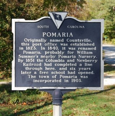
Pomaria
Erected 1981 by Pomaria Bicentennial Commission. (Marker Number 36-10.)
Topics and series. This historical marker is listed in these topic lists: Agriculture • Communications • Education • Railroads & Streetcars • Settlements & Settlers. In addition, it is included in the Postal Mail and Philately series list. A significant historical year for this entry is 1823.
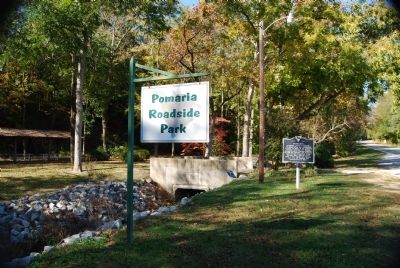
Location. 34° 15.75′ N, 81° 24.9′ W. Marker is in Pomaria, South Carolina, in Newberry County. Marker is on US Highway 176, on the right when traveling south. Marker is located near the intersection of Main and US Highway 176 on the grounds of the Pomaria Roadside Park. Touch for map. Marker is in this post office area: Pomaria SC 29126, United States of America. Touch for directions.
Other nearby markers. At least 10 other markers are within 7 miles of this marker, measured as the crow flies. Folk-Holloway House (approx. half a mile away); Lutheran Theological Southern Seminary (approx. 0.9 miles away); Bethlehem Lutheran Church (approx. 1.8 miles away); St. John's Church (approx. 2.6 miles away); Rev. Joachim Bulow. (approx. 2.6 miles away); St. Paul Lutheran Church (approx. 2.7 miles away); Hope Rosenwald School (approx. 2.9 miles away); Peak (approx. 5˝ miles away); Nuclear Power (approx. 6.4 miles away); Clayton Memorial Universalist Unitarian (approx. 6.6 miles away). Touch for a list and map of all markers in Pomaria.
Also see . . . Pomaria, South Carolina. Pomaria is a town in Newberry County, South Carolina, United States. (Submitted on November 2, 2008, by Brian Scott of Anderson, South Carolina.)
Additional commentary.
1. Marker Style
The marker shown reflects the second style of South Carolina Historical Markers. It was in use between 1955 and 1990. The original design was cast aluminum and crowned with a bas relief of the state flag surrounded by an inverted triangle. The markers were painted dark blue with silver lettering.
— Submitted November 2, 2008, by Brian Scott of Anderson, South Carolina.

Photographed By Brian Scott, November 1, 2008
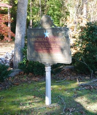
3. Blue Star Memorial Highway Marker
that have defended the
United States of America
Sponsored by
The Garden Club of South Carolina
in cooperation with
The South Carolina Highway Department
and
The Newberry Garden Club, Newberry, SC - 1962
Credits. This page was last revised on September 17, 2020. It was originally submitted on November 2, 2008, by Brian Scott of Anderson, South Carolina. This page has been viewed 1,577 times since then and 35 times this year. Photos: 1, 2, 3. submitted on November 2, 2008, by Brian Scott of Anderson, South Carolina.

