Dansville in Livingston County, New York — The American Northeast (Mid-Atlantic)
One Room School
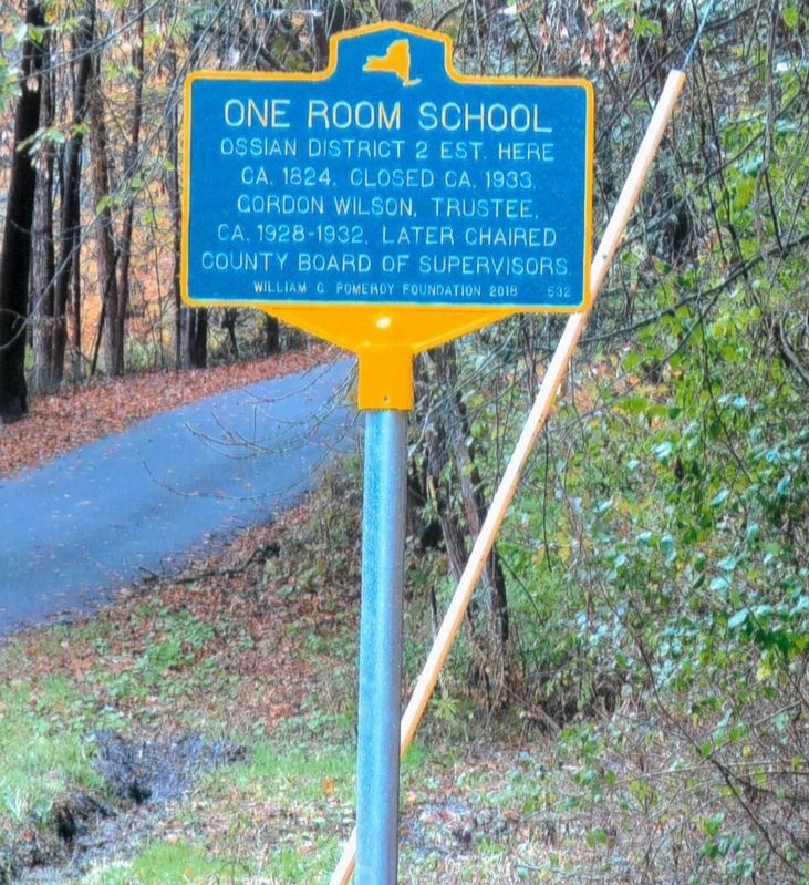
November 13, 2018
1. One Room School Marker
Erected 2018 by William G. Pomeroy Foundation. (Marker Number 532.)
Topics and series. This historical marker is listed in this topic list: Education. In addition, it is included in the William G. Pomeroy Foundation series list.
Location. 42° 29.376′ N, 77° 43.95′ W. Marker is in Dansville, New York, in Livingston County. It is on Poag’s Hole Road, on the left when traveling north. Touch for map. Marker is at or near this postal address: 11274 Poag’s Hole Road, Dansville NY 14437, United States of America. Touch for directions.

Regionally, this marker is in Upstate New York, specifically in Western New York, in the Finger Lakes, and in the Rochester Metropolitan Area. It is also in the American Northeast and in the Mid-Atlantic. Globally, it is in North America, the Western Hemisphere, the Western World, and the Anglosphere. Historically, it finds itself in what was once the Haudenosaunee (Iroquois) Confederacy,
this page online
Other nearby markers. At least 8 other markers are within 4 miles of this marker, measured as the crow flies: Elias H. Geiger (approx. 2.2 miles away); First House in Canaseraga (approx. 2.6 miles away); Canaseraga Four Corners Historic District (approx. 3 miles away); Ossian in WWI (approx. 3.2 miles away); Gambrel Roofed Barn (approx. 3.2 miles away); Ossian (approx. 3.2 miles away); Ossian Center (approx. 3.2 miles away); Isaac Hampton (approx. 3.2 miles away). Touch for a list and map of all markers in Dansville.
Regarding One Room School. Ossian school #2 was built near two sources of water, the Canaseraga Creek and Sugar Creek, on Poag’s Hole Rd. It was close to the families’ homes and source of income, farms and saw mills.
Credits. This page was last revised on April 26, 2019. It was originally submitted on April 25, 2019, by Deryn Pomeroy of Syracuse, New York. This page has been viewed 542 times since then and 38 times this year. Photo 1. submitted on April 25, 2019, by Deryn Pomeroy of Syracuse, New York. • Andrew Ruppenstein was the editor who published this page.
