Marker Logo
THE HISTORICAL
MARKER DATABASE
“Bite-Size Bits of Local, National, and Global History”
Near Spring Garden in Cherokee County, Alabama — The American South (East South Central)
 

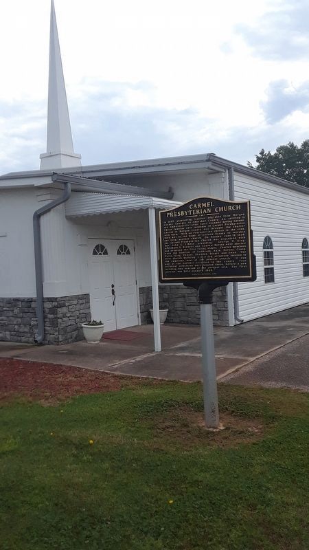
Carmel Presbyterian Church
 
 
Carmel Presbyterian Church Marker image. Click for full size.
Photographed by Angela Nichols, April 25, 2019
1. Carmel Presbyterian Church Marker
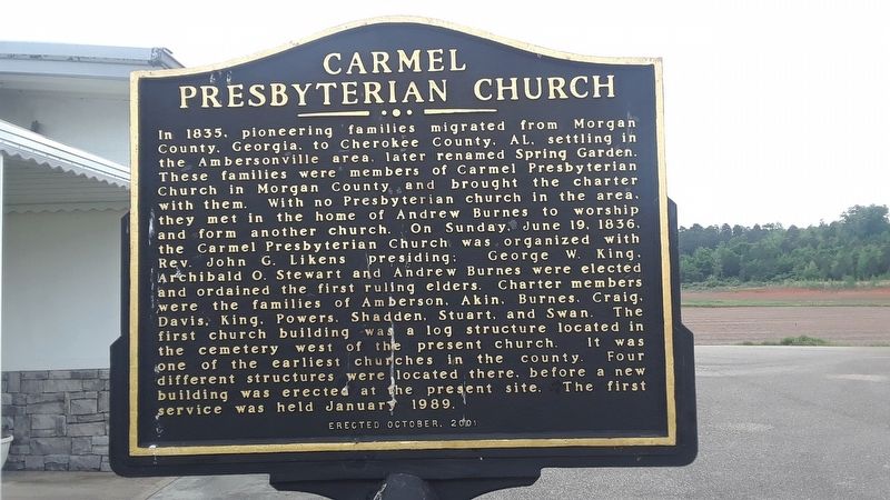
Inscription. In 1835, pioneering families migrated from Morgan County, Georgia to Cherokee County, AL, settling in the Ambersonville area, later renamed Spring Garden. These families were members of Carmel Presbyterian Church in Morgan County and brought their charter with them. With no Presbyterian church in the area, they met in the home of Andrew Burnes to worship and form another church. On Sunday, June 19, 1836, the Carmel Presbyterian Church was organized with Rev. John G. Likens presiding; George W. king, Archibald O. Stewart, and Andrew Burnes were elected and ordained the first ruling elders. Charter members were the families of Amberson, Akins, Burnes, Craig, Davis, King, Powers, Shadden, Stuart, and Swan. The first church building was a log structure located in the cemetery west of the present church. It was one of the earliest churches in the county. Four different structures were located there, before a new building was erected at the present site. The first service was held January 1989.
 
Erected 2001.
 
Topics. This historical marker is listed in these topic lists: Religion & Religious StructuresSettlements & Settlers. A significant historical date for this entry is June 19, 1836.
 
Location. 33° 57.65′ N,
Paid Advertisement
Click or scan to see
this page online
85° 34.345′ W. Marker is near Spring Garden, Alabama, in Cherokee County. It is at the intersection of County Route 33 and County Route 29, on the left when traveling south on County Route 33. Touch for map. Marker is in this post office area: Piedmont AL 36272, United States of America. Touch for directions.

Regionally, this marker is in East Alabama and specifically in North Alabama. It is also in the American South, specifically in the Deep South, in Appalachia, and specifically in Southern Appalachia. Globally, it is in North America, a Gulf of Mexico state, the Western Hemisphere, the Western World, and the Anglosphere. Historically, it finds itself in what was once the original Cherokee Nation, the territory of the Mississippian Culture, one of the Confederate States of America, and the Antebellum South.

Other nearby markers. At least 8 other markers are within 4 miles of this marker, measured as the crow flies: Ladiga Cavalry Skirmish (approx. 0.2 miles away); Spring Garden (approx. 1.4 miles away); Spring Garden School (approx. 2.4 miles away); Cherokee County's Paul Revere (approx. 2.9
Carmel Presbyterian Church Marker image. Click for full size.
Photographed by Angela Nichols, April 25, 2019
2. Carmel Presbyterian Church Marker
miles away); Dugger Mountain (approx. 3 miles away); The Alabama Tennessee River Railroad (approx. 3.4 miles away); Cross Plains / Piedmont (approx. 3.4 miles away); First Presbyterian Church (approx. 3.4 miles away). Touch for a list and map of all markers in Spring Garden.
 
Carmel Presbyterian Church Marker image. Click for full size.
Photographed by Angela Nichols, April 25, 2019
3. Carmel Presbyterian Church Marker
 
 
Credits. This page was last revised on January 11, 2022. It was originally submitted on April 26, 2019, by Angela Nichols of Centre, Alabama. This page has been viewed 1,032 times since then and 35 times this year. Photos:   1, 2, 3. submitted on April 26, 2019, by Angela Nichols of Centre, Alabama. • Bernard Fisher was the editor who published this page.

m=132792

CeraNet Cloud Computing sponsors the Historical Marker Database.
This website earns income from purchases you make after using our links to Amazon.com. We appreciate your support.
Paid Advertisement
Jul. 9, 2026
