St. Clair in Franklin County, Missouri — The American Midwest (Upper Plains)
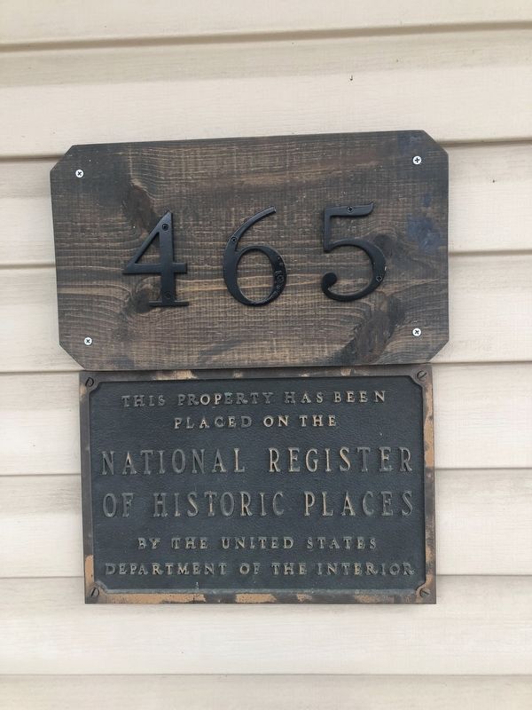
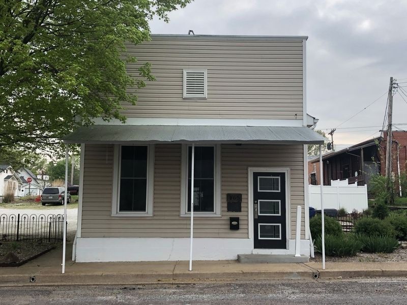
Panhorst Feed Store
465 St. Clair Street
has been placed on the
National Register
of Historic Places
by the United States
Department of the Interior
Topics. This historical marker is listed in these topic lists: Architecture • Industry & Commerce. A significant historical year for this entry is 1917.
Location. 38° 20.826′ N, 90° 58.894′ W. Marker is in St. Clair, Missouri, in Franklin County. Marker is on Saint Clair Street west of North Main Street (Missouri Highway 47), on the right when traveling west. Touch for map. Marker is at or near this postal address: 465 St Clair Street, Saint Clair MO 63077, United States of America. Touch for directions.
Other nearby markers. At least 15 other markers are within 10 miles of this marker, measured as the crow flies. International Shoe Company Building (about 700 feet away, measured in a direct line); Korean War Memorial (approx. 0.6 miles away); Veterans Memorial Benches (approx. 0.6 miles away); Franklin County Vietnam Memorial (approx. 0.6 miles away); Veterans Memorial (approx. 0.6 miles away); a different marker also named Veterans Memorial (approx. 2 miles away); POW & MIA Memorial (approx. 2 miles away); a different marker also named Veterans Memorial (approx. 2 miles away); This Rest Area is maintained through an Extended Employment Sheltered Workshop (approx. 4 miles away); Disabled Veterans Memorial (approx. 5˝ miles away); Lynching in America / Lynching of Erastus Brown (approx. 5.8 miles away); Vitt's Mill (approx. 6.9 miles away); Shawnee Town Ford (approx. 6.9 miles away); a different marker also named Veterans Memorial (approx. 6.9 miles away); Saltpeter Cave (approx. 9˝ miles away). Touch for a list and map of all markers in St. Clair.
Also see . . .
1. Panhorst Feed Store. Wikipedia article (Submitted on April 29, 2019, by Devry Becker Jones of Washington, District of Columbia.)
2. National Register of Historic Places Nomination Form for the Panhorst Feed Store.
Excerpt from the nomination form on page 5:
The Old Panhorst Feed Store is a simple, wood frame building of unpretentious design. This commercial vernacular building is emblematic of a type of construction common among small towns in the 19th and early 20th century. The building sits upon its original location and retains its setting as a single detached building. Original workmanship and materials were retained during a recent rehabilitation(Submitted on July 7, 2023, by Devry Becker Jones of Washington, District of Columbia.)under the auspices of the federal historic investment tax credit program. The building retains the ability to reflect its historic associations and represents a distinctive type and method of construction not commonly found in such a pristine condition.
Credits. This page was last revised on July 7, 2023. It was originally submitted on April 29, 2019, by Devry Becker Jones of Washington, District of Columbia. This page has been viewed 146 times since then and 8 times this year. Photos: 1, 2. submitted on April 29, 2019, by Devry Becker Jones of Washington, District of Columbia.

