Cumberland Township near Gettysburg in Adams County, Pennsylvania — The American Northeast (Mid-Atlantic)
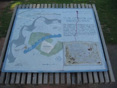
The Attack on Devil's Den
Inscription.
The Confederate infantry attack of July 2nd swept from Seminary Ridge and struck the left of Sickles line. For two terrible hours one reinforced Union Brigade and two batteries of artillery took the full shock of a three brigade attack. The survivors finally fell back to Cemetery Ridge.
Topics. This historical marker is listed in this topic list: War, US Civil. A significant historical date for this entry is July 2, 1851.
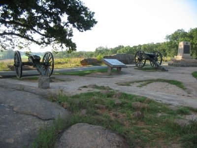
Location. 39° 47.517′ N, 77° 14.55′ W. Marker is near Gettysburg, Pennsylvania, in Adams County. It is in Cumberland Township. Marker is on Sickles Avenue, on the right when traveling north. Located in the Devils Den section of Gettysburg National Military Park. Touch for map. Marker is in this post office area: Gettysburg PA 17325, United States of America. Touch for directions.
Other nearby markers. At least 8 other markers are within walking distance of this marker. 4th New York Independent Battery (a few steps from this marker); Robertson's Brigade (within shouting distance of this marker); Holding Houck's Ridge (within shouting distance of this marker); Civil War Photography (within shouting distance of this marker); 99th Pennsylvania Infantry (within shouting distance of this marker); Buying Time (within shouting distance of this marker); Slaughter at Devil's Den (within shouting distance of this marker); Shaping the Battlefield (within shouting distance of this marker). Touch for a list and map of all markers in Gettysburg.
More about this marker. This weathered marker has a map of the attacks on the Devil's Den and a drawing in the lower right.
Credits. This page was last revised on February 7, 2023. It was originally submitted on November 4, 2008, by Craig Swain of Leesburg, Virginia. This page has been viewed 1,876 times since then and 25 times this year. Photos: 1, 2. submitted on November 4, 2008, by Craig Swain of Leesburg, Virginia.

