Matson in St. Charles County, Missouri — The American Midwest (Upper Plains)
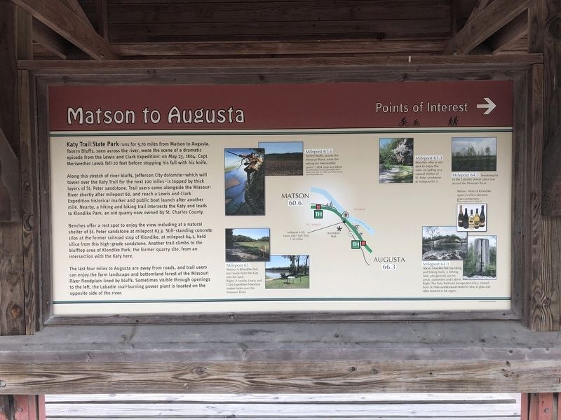
Matson to Augusta
Points of Interest
Along this stretch of river bluffs, Jefferson City dolomite—which will tower over the Katy Trail for the next 100 miles—is topped by thick layers of St. Peter sandstone. Trail users come alongside the Missouri River shortly after milepost 62, and reach a Lewis and Clark Expedition historical marker and public boat launch after another mile. Nearby, a hiking and biking trail intersects the Katy and leads to Klondike Park, an old quarry now owned by St. Charles County.
Benches offer a rest spot to enjoy the view including at a natural shelter of St. Peter sandstone at milepost 63.3. Still-standing concrete silos at the former railroad stop of Klondike, at milepost 64.1, held silica from this high-grade sandstone. Another trail climbs to the blufftop area of Klondike Park, the former quarry site, from an intersection with the Katy here.
The last four miles to Augusta are away from roads, and trail users can enjoy the farm landscape and bottomland forest of the Missouri River floodplain lined by bluffs. Sometimes visible through openings to the left, the Labadie coal-burning power plant is located on the opposite side of the river.
Topics and series. This historical marker is listed in these topic lists: Exploration • Waterways & Vessels. In addition, it is included in the Katy Trail State Park, and the Lewis & Clark Expedition series lists. A significant historical date for this entry is May 23, 1804.
Location. 38° 36.524′ N, 90° 47.687′ W. Marker is in Matson, Missouri, in St. Charles County. Marker is on Lucille Avenue west of Missouri Highway 94, on the right when traveling west. Touch for map. Marker is at or near this postal address: 3512 Alice Avenue, Defiance MO 63341, United States of America. Touch for directions.
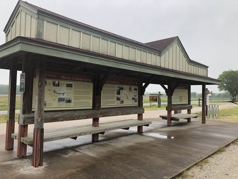
Other nearby markers. At least 8 other markers are within 3 miles of this marker, measured as the crow flies. Matson to Weldon Spring (here, next to this marker); Daniel Boone's Missouri Golden Years (here, next to this marker); Daniel Boone Judgment Tree Memorial (within shouting distance of this marker); The Boone Trace (about 300 feet away, measured in a direct line); A Defiant Tale (approx. 1.7 miles away); School Days In Defiance (approx. 1.7 miles away); Baseball in Defiance (approx. 2.1 miles away); Head's Store (approx. 2.3 miles away). Touch for a list and map of all markers in Matson.
Credits. This page was last revised on May 4, 2019. It was originally submitted on April 30, 2019, by Devry Becker Jones of Washington, District of Columbia. This page has been viewed 179 times since then and 16 times this year. Photos: 1, 2. submitted on April 30, 2019, by Devry Becker Jones of Washington, District of Columbia.

